Box Springs, California
| Box Springs, California | |
|---|---|
| Unincorporated community | |
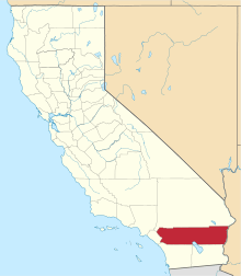
 Location of Box Springs in California | |
| Coordinates: 33°56′48″N 117°17′47″W / 33.94667°N 117.29639°WCoordinates: 33°56′48″N 117°17′47″W / 33.94667°N 117.29639°W | |
| Country |
|
| State |
|
| County | Riverside |
| Elevation[1] | 459 m (1,506 ft) |
| Time zone | PST (UTC-8) |
| • Summer (DST) | PDT (UTC-7) |
| ZIP code | 92507 |
| Area code(s) | 951 |
| FIPS code | 06-06065 |
| GNIS feature ID | 1660366 |
| [2] | |
Box Springs is an unincorporated community in Riverside County, California. Box Springs is located 5 miles (8.0 km) east-southeast of downtown Riverside on Interstate 215/State Route 60 (Moreno Valley Freeway).[3]
References
- ↑ U.S. Geological Survey Geographic Names Information System: Box Springs, California. Retrieved on 2008-07-10.
- ↑ "Box Springs CA". ZIP Code Lookup. Retrieved 2008-07-10.
- ↑ Durham, David L. (1998). California's Geographic Names: A Gazetteer of Historic and Modern Names of the State. Clovis, Calif.: Word Dancer Press. p. 1398. ISBN 1-884995-14-4.
This article is issued from Wikipedia - version of the 9/14/2016. The text is available under the Creative Commons Attribution/Share Alike but additional terms may apply for the media files.