Ripley, California
| Ripley | |
|---|---|
| census-designated place | |
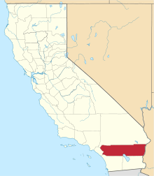
 Ripley Location within the state of California | |
| Coordinates: 33°31′26″N 114°39′11″W / 33.52389°N 114.65306°WCoordinates: 33°31′26″N 114°39′11″W / 33.52389°N 114.65306°W | |
| Country |
|
| State |
|
| County | Riverside |
| Area[1] | |
| • Total | 1.701 sq mi (4.405 km2) |
| • Land | 1.701 sq mi (4.405 km2) |
| • Water | 0 sq mi (0 km2) 0% |
| Elevation[2] | 249 ft (76 m) |
| Population (2010) | |
| • Total | 692 |
| • Density | 410/sq mi (160/km2) |
| Time zone | Pacific (PST) (UTC-8) |
| • Summer (DST) | PDT (UTC-7) |
| ZIP codes | 92272 |
| Area code(s) | 760 |
| GNIS feature ID | 2583122 |
Ripley is a census-designated place community in east Riverside County. It is located along State Route 78 (SR78) between Palo Verde and Blythe. The area is mostly agricultural lands irrigated by Colorado River water. The elevation is 249 feet (76 m).[2] The population was 692 at the 2010 census.
History
Ripley was established in 1920 when the California Southern Railroad (unrelated to the railroad linking Barstow and San Diego) was extended from Blythe. The townsite was named to dedicate former Santa Fe Railway president Edward Payson Ripley. [3] The town aimed to be a resort location until it was damaged by a flood that swept part of the valley in 1922. Today, a water tower remains as a landmark in town.[4]
Geography
According to the United States Census Bureau, the CDP covers an area of 1.7 square miles (4.4 km²), all of it land. Alongside Blythe and Palo Verde, Ripley is located in the Palo Verde Valley.
Official U.S. Geological Survey NAD27 coordinates for the community are 33°31′31″N 114°39′19″W / 33.52528°N 114.65528°W. It is within area code 760 and has its own ZIP Code: 92272.
Climate
This area has a large amount of sunshine year round due to its stable descending air and high pressure. According to the Köppen Climate Classification system, Ripley has a mild desert climate, abbreviated "Bwh" on climate maps.[5]
Situation
The area is largely irrigated agriculture. Farms in the area include operations owned by David Brown and Sons, Lawrence Chaffin Farms, and Red River Farms. The Metropolitan Water District has made an agreement with the United States Bureau of Reclamation to fallow land in the area in order to conserve water. Farmers will be paid not to grow crops so that the water can be used for other purposes. The area is served by Palo Verde Irrigation District and formerly the Arizona and California Railroad. The railroad's Blythe Division track ends just west of Ripley.
Demographics
The 2010 United States Census[6] reported that Ripley had a population of 692. The population density was 406.9 people per square mile (157.1/km²). The racial makeup of Ripley was 393 (56.8%) White, 103 (14.9%) African American, 2 (0.3%) Native American, 1 (0.1%) Asian, 4 (0.6%) Pacific Islander, 165 (23.8%) from other races, and 24 (3.5%) from two or more races. Hispanic or Latino of any race were 537 persons (77.6%).

The Census reported that 692 people (100% of the population) lived in households, 0 (0%) lived in non-institutionalized group quarters, and 0 (0%) were institutionalized.
There were 218 households, out of which 123 (56.4%) had children under the age of 18 living in them, 95 (43.6%) were opposite-sex married couples living together, 63 (28.9%) had a female householder with no husband present, 18 (8.3%) had a male householder with no wife present. There were 22 (10.1%) unmarried opposite-sex partnerships, and 1 (0.5%) same-sex married couples or partnerships. 33 households (15.1%) were made up of individuals and 9 (4.1%) had someone living alone who was 65 years of age or older. The average household size was 3.17. There were 176 families (80.7% of all households); the average family size was 3.49.
The population was spread out with 264 people (38.2%) under the age of 18, 85 people (12.3%) aged 18 to 24, 131 people (18.9%) aged 25 to 44, 148 people (21.4%) aged 45 to 64, and 64 people (9.2%) who were 65 years of age or older. The median age was 24.8 years. For every 100 females there were 98.3 males. For every 100 females age 18 and over, there were 82.9 males.
There were 295 housing units at an average density of 173.5 per square mile (67.0/km²), of which 78 (35.8%) were owner-occupied, and 140 (64.2%) were occupied by renters. The homeowner vacancy rate was 2.5%; the rental vacancy rate was 25.8%. 249 people (36.0% of the population) lived in owner-occupied housing units and 443 people (64.0%) lived in rental housing units.
References
- ↑ U.S. Census
- 1 2 U.S. Geological Survey Geographic Names Information System: Ripley, California
- ↑ Steve Glischinski (1997). Santa Fe Railway. MBI Publishing Company. p. 37. ISBN 978-0-7603-0380-1.
- ↑ Sahagun, Louis (29 September 1985). "Believe It or Not : Ripley Residents Trying to Bring Tiny Town 'Back From the Dead'". The Los Angeles Times. Retrieved 11 February 2015.
- ↑ Climate Summary for Ripley, California
- ↑ "2010 Census Interactive Population Search: CA - Ripley CDP". U.S. Census Bureau. Retrieved July 12, 2014.
- U.S. Geological Survey, National Geographic Names Database
- Map: "Ripley, California, 7.5-minute Quadrangle," U.S. Geological Survey, 1975.
- Map: "Road Map of California, 1958," (Sacramento, California: Department of Public Works, Division of Highways, 1958).
| Wikimedia Commons has media related to Ripley, California. |
External links
- Ripley weather records from University of California Agricultural Extension.
- Wind and other data from Ripley.
- Ripley Fire Station.