Black Creek (town), Wisconsin
| Black Creek, Wisconsin | |
|---|---|
| Town | |
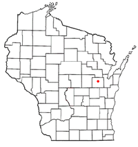 Location of Black Creek, Wisconsin | |
| Coordinates: 44°27′30″N 88°27′21″W / 44.45833°N 88.45583°WCoordinates: 44°27′30″N 88°27′21″W / 44.45833°N 88.45583°W | |
| Country | United States |
| State | Wisconsin |
| County | Outagamie |
| Established | March 1862 |
| Government | |
| • Type | Town Board - Chairperson & two Supervisors |
| • Chairperson | Dan Knutson |
| • Town Clerk | Karen Herman |
| Area | |
| • Total | 34.8 sq mi (90 km2) |
| • Land | 34.6 sq mi (90 km2) |
| • Water | 0.0 sq mi (0.0 km2) |
| Elevation[1] | 835 ft (254.5 m) |
| Population (2010) | |
| • Total | 1,259 |
| Time zone | Central (CST) (UTC-6) |
| • Summer (DST) | CDT (UTC-5) |
| ZIP Codes | 54106 & 54165 |
| Area code(s) | 920 |
| FIPS code | 55-07750[2] |
| GNIS feature ID | 1582819[1] |
| Website | www.BlackCreekWI.org |
Black Creek is a town in Outagamie County, Wisconsin, United States. The population was 1,259 at the 2010 census. The Village of Black Creek, and the unincorporated communities of Binghamton, and partially Five Corners are located in the town.[3]
History
In November 1861, petitioners requested a new town, Black Creek, be established and separated from the existing town of Center. The Outagamie county board approved and made this final in March 1862; officers were elected in April.[4][5]
Geography
The town of Black Creek is located at 44°27′32″N 88°26′23″W / 44.45889°N 88.43972°W(44.458889, -88.439722).[6] According to the United States Census Bureau, the town has a total area of 34.8 square miles (90 km²), all of it land.
Demographics
As of the census[2][7] of 2010, there were 1,259 people, 487 households, and 469 families residing in the town. The population density was 36.9 people per square mile (14.0/km²). There were 487 housing units at an average density of 14.10 per square mile (5.4/km²). The racial makeup of the town was 97.00% White, ???% Native American, 0.66% Asian, 0.2% African American, 0.6% from other races, and 2.04% from two or more races. 0.39% of the population were Hispanic or Latino of any race.
There were 469 occupied households out of which 11.59% had children under the age of 18 living with them.
In the town the population was spread out with 23.98% under the age of 18, 76% were over the age of 18, 4.28% from 20 to 24, 8.74% from 25 to 34, 24.78% from 35 to 49, 22.56% from 50 to 64, and 12.71% who were 65 years of age or older. For every 100 females there were 108.8 males.
The median income for a household in the town was $53,472, and the median income for a family was $59,196. Males had a median income of $37,188 versus $25,096 for females. The per capita income for the town was $20,481. About 5.9% of families and 6.1% of the population were below the poverty line, including 7.3% of those under age 18 and 4.5% of those age 65 or over.
Education
Students in the Town of Black Creek are served by the school in the Village of Black Creek, Black Creek Elementary & Middle School, which is part of the Seymour Community School District. Part of the town is also served by the Shiocton School District.
| Historical population | |||
|---|---|---|---|
| Census | Pop. | %± | |
| 1870 | 528 | — | |
| 1880 | 1,285 | 143.4% | |
| 1890 | 1,377 | 7.2% | |
| 1900 | 1,482 | 7.6% | |
| 1910 | 1,006 | −32.1% | |
| 1920 | 950 | −5.6% | |
| 1930 | 843 | −11.3% | |
| 1940 | 854 | 1.3% | |
| 1950 | 880 | 3.0% | |
| 1960 | 884 | 0.5% | |
| 1970 | 968 | 9.5% | |
| 1990 | 1,169 | — | |
| 2000 | 1,268 | 8.5% | |
| 2010 | 1,259 | −0.7% | |
| (1980 Census Data unavailable)[8] | |||
Transportation
| | WIS 47 Northbound, routes to Shawano. Southbound, WIS 47 routes to Appleton. |
| | WIS 54 Westward routes to Shiocton and New London. Eastward WIS 54 routes to Seymour and Green Bay. |
| | Going Westbound County Hwy A routes to WIS 76. Going Eastbound Hwy A routes to WIS 47 and turns Southbound to Appleton, WI. |
| | Hwy B's West Terminus is WIS 47 and its East Terminus is Hwy PP. |
| | Going Eastbound Hwy P routes to WIS 47. Going Westbound Hwy P routes to WIS 187. |
| | Hwy PP's Northern terminus is WIS 54 and is Southern terminus is WIS 47. |
| The Canadian National Railway, formerly known as the Soo Line Railroad, going Northbound routes to Shawano. Going Southbound it routes to Appleton. |
Recreation
- Fallen Timbers Environmental Center
- Newton Blackmour State Trail
- The Meadows Trails
- Town Hall Park
References
- 1 2 "US Board on Geographic Names". United States Geological Survey. 2007-10-25. Retrieved 2008-01-31.
- 1 2 "American FactFinder". United States Census Bureau. Archived from the original on 2013-09-11. Retrieved 2008-01-31.
- ↑ Binghamton
- ↑ United States Census Bureau, Census of Population and Housing (1870 Data) Archived 2015-05-12 at WebCite, retrieved December 27, 2013
- ↑ Outagamie County State Centennial Committee (1949). "Land of the Fox, Saga of Outagamie County" (PDF). Retrieved 2016-09-28.
- ↑ "US Gazetteer files: 2010, 2000, and 1990". United States Census Bureau. 2011-02-12. Retrieved 2011-04-23.
- ↑ 2010 Census, "Black Creek town data", Retrieved 18 August 2011.
- ↑ United States Census Bureau, Census of Population and Housing Archived 2015-05-12 at WebCite, retrieved December 27, 2013
Images
-

Black Creek Farm
-
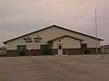
Black Creek Town Hall
External links
- Black Creek Elemmentary/Middle School website
- More info on Black Creek, WI
- Official Town Website
- Black Creek Village Library
- The Newton Blackmour State Trail
Municipalities and communities of Outagamie County, Wisconsin, United States | ||
|---|---|---|
| Cities | 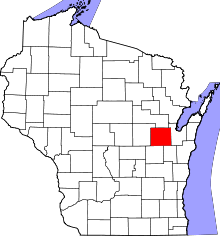 | |
| Villages | ||
| Towns | ||
| CDP | ||
| Unincorporated communities | ||
| Indian reservation | ||
| Ghost towns | ||
| Footnotes | ‡This populated place also has portions in an adjacent county or counties | |