Appleton, Wisconsin
| Appleton, Wisconsin | |
|---|---|
| City | |
|
Clockwise from top left: Downtown Appleton Skyline, Main Hall (Lawrence University), Fox Cities Performing Arts Center, History Museum at the Castle, Appleton War Memorial: Soldiers Square | |
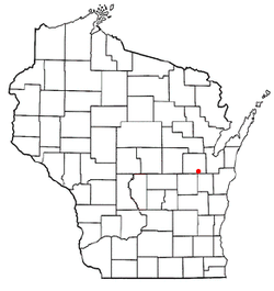 Location of Appleton within Wisconsin | |
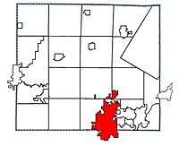 Location of Appleton in Outagamie County, Wisconsin | |
 Appleton, Wisconsin Location in the United States | |
| Coordinates: 44°16′N 88°24′W / 44.267°N 88.400°WCoordinates: 44°16′N 88°24′W / 44.267°N 88.400°W | |
| Country | United States |
| State | Wisconsin |
| Counties | Outagamie, Calumet, Winnebago |
| Surrounding Towns | Grand Chute, Little Chute, Menasha, Kimberly |
| Settled | 1835 |
| Incorporated | 2 May 1857 |
| Government | |
| • Type | Mayor-Council |
| • Mayor | Timothy M. Hanna (R)[1] |
| Area[2] | |
| • City | 24.82 sq mi (64.28 km2) |
| • Land | 24.33 sq mi (63.01 km2) |
| • Water | 0.49 sq mi (1.27 km2) 1.97% |
| Elevation | 790 ft (240 m) |
| Population (2010)[3] | |
| • City | 72,623 |
| • Estimate (2015[4]) | 74,139 |
| • Density | 2,984.9/sq mi (1,152.5/km2) |
| • Metro | 367,516 |
| • Metro density | 2,160/sq mi (834/km2) |
| Time zone | CST (UTC-6) |
| • Summer (DST) | CDT (UTC-5) |
| ZIP Code | 54911, 54912, 54913, 54914, 54915, 54919 |
| Area code(s) | 920 |
| FIPS code | 55-02375[5] |
| GNIS feature ID | 1560914[6] |
| Website |
www |

Appleton is a city in Outagamie (mostly), Calumet, and Winnebago counties in the U.S. state of Wisconsin. One of the Fox Cities, it is situated on the Fox River, 30 miles (48 km) southwest of Green Bay and 100 miles (160 km) north of Milwaukee. Appleton is the county seat of Outagamie County. The population was 72,623 at the 2010 census. Of this, 60,045 were in Outagamie County, 11,088 in Calumet County, and 1,490 in Winnebago County. Appleton is the principal city of the Appleton, Wisconsin Metropolitan Statistical Area, which is included in the Appleton-Oshkosh-Neenah, Wisconsin Combined Statistical Area. The city possesses the two tallest buildings in Outagamie County, the Zuelke Building and 222 Building, at 168 and 183 feet, respectively.
Appleton serves as the heart of the Fox River Valley, and is home to the Fox Cities Performing Arts Center, Fox River Mall, Neuroscience Group Field at Fox Cities Stadium, Appleton International Airport, and the Valley's two major hospitals: St. Elizabeth Hospital and ThedaCare Regional Medical Center-Appleton. It also hosts a large number of regional events such as its Flag Day parade, Christmas parade, and others.
History
Fur traders seeking to do business with Fox River Valley Native Americans were the first European settlers in Appleton. Hippolyte Grignon built the White Heron in 1835 to house his family and serve as an inn and trading post.[7]
Appleton was settled in 1847 and incorporated as a village in 1853. John F. Johnston was the first resident and village president. Home to Lawrence University, Appleton grew along with the school. With the financial backing of Amos A. Lawrence, the Lawrence Institute was chartered in 1847. Samuel Appleton, Lawrence's father-in-law from New England who never visited Wisconsin, donated $10,000 to the newly founded college library, and his name was given to the community in appreciation.[8][9][10]
The community was incorporated as a city on March 2, 1857,[11] with Amos Storey as its first mayor. Early in the 20th century, it adopted the commission form of government. In 1890, 11,869 people lived in Appleton; in 1900, there were 15,085; in 1910, 16,773; in 1920, 19,571; and in 1940, 28,436.
The paper industry, beginning with the building of the first paper mill in the city in 1853, has been at the forefront of the development of Appleton. In order to provide electricity to the paper industry, the nation's first hydro-electric central station, the Vulcan Street Plant on the Fox River, began operation on September 30, 1882. The power plant also powered the Hearthstone House, the first residence in the world powered by a centrally located hydroelectric station using the Edison system.[12]
Shortly thereafter, in August 1886, Appleton was the site for another national first, the operation of a commercially successful electric streetcar company. Electric lights replaced gas lamps on College Avenue in 1912. Appleton also had the first telephone in Wisconsin, and the first incandescent light in any city outside of the East Coast.[13]
Appleton's tallest building, the 222 Building was built in 1952. The Valley Fair Shopping Center, built in 1954, laid claim to being the first enclosed shopping mall in the United States, although this claim is disputed by other malls. In 2007 most of the structure was demolished, leaving only its east wing and a movie theater. A Pick 'n Save Food Center now stands in its place.
Sociologist James W. Loewen, in his book Sundown Towns: A Hidden Dimension of American Racism[14] labeled Appleton a sundown town -- a town that was intentionally all white. In these towns, black people were not allowed inside the town limits after dark.
In May 2016, a report by 24/7 Wall St. found that Appleton had the highest rate of self-reported binge and heavy drinking in the country.[15]
Geography
According to the United States Census Bureau, the city has a total area of 24.82 square miles (64.28 km2), of which, 24.33 square miles (63.01 km2) is land and 0.49 square miles (1.27 km2) is water.[2]
Climate
Appleton has a humid continental climate[16] typical of Wisconsin. Summers are warm to hot and winters are rather cold in comparison. Precipitation is relatively moderate compared to other areas close to the Great Lakes, which means lesser snowfall in winter than in many other cold areas.[17]
A dew point of 90 °F was observed at Appleton at 5 p.m. on July 13, 1995. This is tied for the second highest dew point ever observed in the United States.
| Climate data for Appleton | |||||||||||||
|---|---|---|---|---|---|---|---|---|---|---|---|---|---|
| Month | Jan | Feb | Mar | Apr | May | Jun | Jul | Aug | Sep | Oct | Nov | Dec | Year |
| Record high °F (°C) | 55 (13) |
59 (15) |
81 (27) |
89 (32) |
94 (34) |
101 (38) |
107 (42) |
103 (39) |
101 (38) |
89 (32) |
75 (24) |
61 (16) |
107 (42) |
| Average high °F (°C) | 24.7 (−4.1) |
28.1 (−2.2) |
39.1 (3.9) |
54.0 (12.2) |
67.0 (19.4) |
76.7 (24.8) |
81.9 (27.7) |
79.5 (26.4) |
70.9 (21.6) |
58.4 (14.7) |
42.6 (5.9) |
29.1 (−1.6) |
54.3 (12.4) |
| Average low °F (°C) | 8.7 (−12.9) |
11.0 (−11.7) |
22.2 (−5.4) |
34.6 (1.4) |
45.8 (7.7) |
55.9 (13.3) |
61.3 (16.3) |
59.3 (15.2) |
51.3 (10.7) |
40.3 (4.6) |
28.0 (−2.2) |
14.8 (−9.6) |
36.1 (2.3) |
| Record low °F (°C) | −30 (−34) |
−32 (−36) |
−21 (−29) |
7 (−14) |
23 (−5) |
34 (1) |
41 (5) |
35 (2) |
25 (−4) |
15 (−9) |
−7 (−22) |
−23 (−31) |
−32 (−36) |
| Average rainfall inches (mm) | 1.3 (33) |
1.1 (28) |
1.9 (48) |
2.7 (69) |
3.4 (86) |
3.8 (97) |
3.4 (86) |
3.2 (81) |
3.4 (86) |
2.2 (56) |
2.0 (51) |
1.4 (36) |
30 (760) |
| Source: [17] | |||||||||||||
Demographics
| Historical population | |||
|---|---|---|---|
| Census | Pop. | %± | |
| 1860 | 2,345 | — | |
| 1870 | 4,518 | 92.7% | |
| 1880 | 8,005 | 77.2% | |
| 1890 | 11,869 | 48.3% | |
| 1900 | 15,085 | 27.1% | |
| 1910 | 16,773 | 11.2% | |
| 1920 | 19,561 | 16.6% | |
| 1930 | 25,267 | 29.2% | |
| 1940 | 28,436 | 12.5% | |
| 1950 | 34,010 | 19.6% | |
| 1960 | 48,411 | 42.3% | |
| 1970 | 56,377 | 16.5% | |
| 1980 | 58,913 | 4.5% | |
| 1990 | 65,695 | 11.5% | |
| 2000 | 70,087 | 6.7% | |
| 2010 | 72,623 | 3.6% | |
| Est. 2015 | 74,139 | [18] | 2.1% |

Appleton is the principal city of the Appleton–Oshkosh–Neenah CSA, a Combined Statistical Area which includes the Appleton (Calumet and Outagamie counties) and Oshkosh–Neenah (Winnebago County) metropolitan areas, which had a combined population of 367,365 at the 2010 census.[5]
2010 census
As of the census[3] of 2010, there were 72,623 people, 28,874 households, and 18,271 families residing in the city. The population density was 2,984.9 inhabitants per square mile (1,152.5/km2). There were 30,348 housing units at an average density of 1,247.3 per square mile (481.6/km2). The racial makeup of the city was 87.5% White, 1.7% African American, 0.7% Native American, 5.9% Asian, 2.2% from other races, and 2.0% from two or more races. Hispanic or Latino of any race were 5.0% of the population.
There were 28,874 households of which 33.0% had children under the age of 18 living with them, 48.7% were married couples living together, 10.5% had a female householder with no husband present, 4.1% had a male householder with no wife present, and 36.7% were non-families. 29.5% of all households were made up of individuals and 9% had someone living alone who was 65 years of age or older. The average household size was 2.43 and the average family size was 3.04.
The median age in the city was 35.3 years. 25% of residents were under the age of 18; 10.1% were between the ages of 18 and 24; 27.7% were from 25 to 44; 26.1% were from 45 to 64; and 11.3% were 65 years of age or older. The gender makeup of the city was 49.5% male and 50.5% female.
2000 census
As of the census[5] of 2000, there were 70,087 people, 26,864 households, and 17,676 families residing in the city. The population density was 3,355.9 per square mile (1,295.7/km2). There were 27,736 housing units at an average density of 1,328.0 per square mile (512.7/km2). The racial makeup of the city was 91.48% White; 0.99% African American; 0.57% Native American; 4.61% Asian; 0.03% Pacific Islander; 1.05% from other races, and 1.27% from two or more races. Hispanic or Latino of any race were 2.53% of the population.
There were 26,864 households out of which 35.0% had children under the age of 18 living with them, 53.9% were married couples living together, 8.7% had a female householder with no husband present, and 34.2% were non-families. 27.6% of all households were made up of individuals and 9.1% had someone living alone who was 65 years of age or older. The average household size was 2.52 and the average family size was 3.13.
In the city the population was spread out with 27.4% under the age of 18; 9.7% from 18 to 24; 31.8% from 25 to 44; 19.7% from 45 to 64, and 11.3% who were 65 years of age or older. The median age was 34 years. For every 100 females there were 96.7 males. For every 100 females age 18 and over, there were 93.7 males.
The median income for a household in the city was $39,285, and the median income for a family was $44,097. Males had a median income of $36,459 versus $22,890 for females. The per capita income for the city was $17,478. About 7.3% of families and 9.5% of the population were below the poverty line, including 7.1% of those under age 18 and 4.8% of those age 65 or over.
Crime
FBI crime statistics for 2009 list the crime rate (per 100,000 population) for Appleton as follows:[20]
| Crime | Appleton | Wisconsin | United States |
|---|---|---|---|
| Violent crime | 234.7 | 257.0 | 429.4 |
| Murder | 1.4 | 2.5 | 5.0 |
| Forcible rape | 29.9 | 19.6 | 28.7 |
| Robbery | 25.6 | 85.8 | 133.0 |
| Aggravated assault | 177.8 | 149.1 | 262.8 |
| Property crime | 2,680.2 | 2,608.2 | 3,036.1 |
| Burglary | 465.2 | 472.9 | 716.3 |
| Larceny-theft | 2,163.8 | 1,977.4 | 2,060.9 |
| Motor vehicle theft | 51.2 | 157.8 | 258.8 |
Government
Appleton is governed via the mayor-council system. The mayor is elected every four years in a citywide vote. The council, known as the common council or city council, consists of 15 members, called alderpersons, all of whom are elected to two-year terms from individual districts. The current mayor, Timothy Hanna, was re-elected in 2016 to his sixth four-year term, having first been elected in 1996. The mayor appoints department heads, subject to council approval. The city attorney is elected every four years in a citywide vote.
Appleton is represented by Reid Ribble (R) in the United States House of Representatives, and by Ron Johnson (R) and Tammy Baldwin (D) in the United States Senate. Frank Lasee (R) and Mike Ellis (R) represent Appleton in the Wisconsin Senate, and Alvin Ott (R), Dean Kaufert (R), Dave Murphy (R), and Penny Bernard Schaber (D) represent Appleton in the Wisconsin State Assembly.
Transportation
The city is the owner of Valley Transit, a network of bus lines serving the Fox Valley. There are also several taxi operators in the city. Valley Transit operates routes that generally operate from as early as 5:45 AM until as late as 10:40 PM Monday through Saturday. Frequencies are usually every hour and every half-hour on certain routes during peak morning and afternoon times on weekdays. There is no service on Sunday. Greyhound and Lamers offer intercity buses serving such locations as Green Bay, Madison, Oshkosh, Fond du Lac, Milwaukee, and Chicago.
Roads
| | Interstate 41 Northbound routes to Green Bay. Southbound I-41 routes to Oshkosh, Fond du Lac, and Milwaukee. This is a full interstate grade freeway that runs on the west and north sides of Appleton. It has 8 exits serving the Appleton area (from South to North) with 2 being in Appleton (the other 5 are located in Grand Chute) at:
Hwy E Ballard Rd.(Exit 144) and Hwy 441 (Exit 145) |
| | US 10 Westbound goes to Waupaca and Stevens Point. US 10 Eastbound goes to Brillion and Manitowoc. This is mostly a freeway except along Oneida St. |
| | US 41 runs entirely concurrent with Interstate 41 through the city of Appleton. |
| | WIS 47 travels Northbound to Black Creek and Shawano, Wisconsin. Southbound, WIS 47 routes to Menasha. This is Richmond St., Memorial Dr., and Appleton Rd. |
| | WIS 96 travels west to Fremont and travels east to Little Chute and Kaukauna. This is Wisconsin Ave. |
| WIS 125 travels between US 41 and WIS 47 on College Ave. College Ave. west of US 41 is Hwy CA and heads to Appleton International Airport. | |
| | WIS 441 bypasses Appleton on the south and east sides as a freeway. Exits are at:
US 10 West/US 41, Racine St Menasha, Hwy AP Midway Rd., WIS 47 Appleton Rd., US 10 East Oneida St., Hwy KK Calumet St., Hwy CE College Ave., Hwy OO Northland Ave., US 41 |
Rail
Appleton is criss-crossed by the former main lines of the Chicago and North Western Railway (southwest-northeast) and the Milwaukee, Lake Shore and Western (roughly southeast-northwest, and now largely abandoned except for local service to area paper mills and other industries). A north-south branch of the former Wisconsin Central Railroad passes on the west side of the city. All rail service is now operated by Canadian National Railway. Appleton has no intercity passenger rail service, although studies are being undertaken on the feasibility of extending Amtrak service to the Fox Cities and Green Bay.
Airport
The Appleton International Airport (ATW) is located at the west end of College Avenue, 2 miles west of Interstate 41 and 6 miles west of downtown.
Education
Appleton is served by the Appleton Area School District, which has three high schools, four middle schools, seventeen elementary schools, and sixteen charter schools. The district's main public high schools are Appleton East, Appleton North, and Appleton West. The city also has two parochial high schools: Roman Catholic Xavier High School and Fox Valley Lutheran High School.
Appleton is home to Lawrence University, a private liberal arts college, and Fox Valley Technical College. Globe University, Concordia University Wisconsin,[21] and Rasmussen College have branch campuses in the city. The University of Wisconsin–Fox Valley, a two-year campus of the University of Wisconsin System, is located in nearby Menasha.
The city and surrounding area are served by the Appleton Public Library, which was chartered by the city in 1897 and as of 2010 has a collection of over 600,000 items.[7]
Economy
Largest employers
As of 2015, the largest employers in the city were:[22]
| #/Rank | Employer | # of Employees | Percentage of Total City Employment |
|---|---|---|---|
| 1 | St. Elizabeth Hospital/Affinity Health | 5,744 | 14.9% |
| 2 | Thrivent Financial | 1,800 | 4.7% |
| 3 | Appleton Area School District | 1,668 | 4.3% |
| 4 | Miller Electric | 1,575 | 4.1% |
| 5 | ThedaCare Regional Medical Center-Appleton/ThedaCare Health | 1,500 | 3.9% |
| 6 | The Boldt Company | 1,300 | 3.4% |
| 7 | Outagamie County | 1,200 | 3.1% |
| 8 | Appvion, Inc, | 1,000 | 2.6% |
| 8 | Valley Packaging Industries | 940 | 2.6% |
| 10 | Valley Packaging | 750 | 2% |
Companies headquartered in Appleton
- Armament Systems and Procedures, Inc.
- Miller Electric
- Pierce Manufacturing
- SECURA Insurance
- Thrivent Financial for Lutherans
- Air Wisconsin
Health care
The city is served by two hospitals:
- ThedaCare Regional Medical Center-Appleton
- St. Elizabeth Hospital
Tourism
Appleton tourist attractions include the Hearthstone House, the four-story mansion that was the first house in the world to be powered by hydroelectricity at its completion in 1881.[7] The History Museum at the Castle contains exhibits on Fox River Valley history, including a gallery showcasing Edna Ferber, a Harry Houdini exhibit, and other travelling exhibits. The Paper Discovery Center has historic paper-making machines on display and an exhibit on the history of paper. The Fox River Mall is the second-largest mall in Wisconsin. Other local malls include Northland Mall, City Centre Plaza and formerly Valley Fair Shopping Center, aka Valley Fair Mall, disputedly the first enclosed shopping mall in America, opening in 1954.
In 2013, Houdini Plaza, on the corner of College Avenue and Appleton Street, was renovated. The project cost around $1.5 million with most of that paid by the city itself. The plaza, known as the 'front yard' of downtown Appleton holds roughly 55 events each year, including summer concerts and part of the downtown farmers market.[23]
There are numerous performing ensembles in Appleton. Including the Appleton Boy Choir, Fox Valley Symphony Orchestra, Makaroff Youth Ballet, newVoices Choir, Vento Winds, and many more.
Parks
The city of Appleton has 24 neighborhood parks and four community parks in its park system. The neighborhood parks range in size from two acres to 16 acres, while the community parks range in size from 25 acres to 139 acres.
Memorial Park is the largest of the community parks, covering 139 acres. The park's facilities include: seven baseball/softball fields, playground equipment, an indoor ice skating rink, a sledding hill, a picnic pavilion, a catch and release fishing pond, grills, and a warming shelter.[24] The park provides the firework display for the Appleton community during the 4th of July holiday.
City Park, established in 1882, is the oldest park in the Appleton park system. The Trout Museum of Art uses the park for its Art in the Park showcase. The show features over 200 artists that draw over 25,000 art enthusiasts annually.[25] Pierce Park is the site of weekly Appleton City Band concerts held during the summer, and of the annual Appleton Old Car Show and Swap Meet. Pierce Park and Telulah Park each feature a disc golf course. Erb Park and Mead Park each feature a public aquatics facility. Jones Park is the site of the finish line for the Santa Scamper run held during the annual Appleton Christmas Parade, and features an outdoor hockey rink in the winter.[26]

Notable people
- Mary Agria, author
- Gary Arndt, travel photographer and writer
- George Baldwin, politician and businessman
- Clinton B. Ballard, Wisconsin politician
- Myrt Basing, NFL player
- Rocky Bleier, NFL player, 4-time Super Bowl Champion
- John Bradley, Iwo Jima Navy flag-raiser[27]
- Brian Butch, NBA player
- Mark Catlin, Jr., ex-speaker of the Wisconsin State Assembly
- Mark Catlin, Sr., football coach
- Bob Corbin, former member of the Ohio House of Representatives
- Clarence Currie, MLB player
- Willem Dafoe, actor[27]
- Lorenzo E. Darling, Wisconsin State Assemblyman
- Catherine Ebert-Gray, United States diplomat
- Helen J. Farabee, mental health activist
- Royal T. Farrand, physician and college football player
- Edna Ferber, author[27]
- Harold Froehlich, U.S. Representative and Outagamie County Circuit Judge
- Alfred Galpin, correspondent of H. P. Lovecraft
- Henry Golde, author and Holocaust survivor
- William Norman Grigg, author
- Charles J. Hagen, Wisconsin State Assemblyman
- Theodore Hardeen, magician
- Walter Havighurst, author
- J. P. Hayes, PGA golfer
- David Hammel, politician
- Leopold Hammel, politician
- George Hogriever, MLB player
- Harry Houdini, illusionist and stunt performer[27]
- Zuhdi Jasser, doctor, former lieutenant Commander in the United States Navy
- Roger Jenkins, hockey player
- Erik Jensen, NFL player
- Swede Johnston, NFL player
- Steve Kagen, U.S. Congressman
- David M. Kelly, Speaker of the Wisconsin State Assembly and a Wisconsin State Senator
- William Kennedy, Wisconsin State Senator[28]
- Ross Kenseth, America Stock car racing driver
- August Knuppel, mason and contractor
- Cole Konrad, first ever Bellator Heavyweight champion
- Ron Kostelnik, football player
- George Kreiss, Wisconsin politician
- Tony Kubek, World Series champion baseball player and Hall of Fame broadcaster
- August W. Laabs, Wisconsin politician
- John F. Lappen, Wisconsin State Senator
- Maury Laws, composer[27]
- James Lennon, Wisconsin State Assemblyman
- Jeff Loomis, guitarist
- Garrett Lowney, Olympic medalist
- James E. Lyons, Wisconsin State Assemblyman
- Sue R. Magnuson, Wisconsin State Assemblywoman
- David Martin, Wisconsin State Assemblyman
- Joseph McCarthy, U.S. senator, 1947-1957
- C. E. McIntosh, Wisconsin State Assemblyman
- Jack Mead, NFL player
- John S. Mills, U.S. Air Force Major General
- John Benjamin Murphy, surgeon
- William Beverly Murphy, ex-president of Campbell Soup Company
- Brenda Rae, operatic soprano
- Chester J. Roberts, head coach of the Miami RedHawks football and men's basketball teams
- William J. Rogers, Wisconsin State Assemblyman
- Sue Rohan, Wisconsin State Assemblywoman
- Larry Rosebaugh, Roman Catholic priest
- James Ryan, Wisconsin politician
- Samuel Ryan, Jr., Wisconsin State Assemblyman
- Oscar J. Schmiege, Wisconsin State Assemblyman and jurist
- George J. Schneider, U.S. Representative
- Henry Clay Sloan, Wisconsin State Assemblyman
- Perry H. Smith, businessman, legislator
- Gladys Taber, author
- John Tracy, Wisconsin State Assemblyman
- William J. Van Ryzin, U.S. Marine Corps Lieutenant General
- Greta Van Susteren, journalist, FoxNews television anchor[27]
- William Smith Warner, Wisconsin State Assemblyman
- Don Werner, MLB player
- Jerry L. Wing, businessman and politician
- Bernard C. Wolter, businessman and politician
- Walter B. Wriston, banker
- James Zwerg, civil rights activist
- Terry Zwigoff, filmmaker
Points of interest
- The Trout Museum of Art
- Fox Cities Performing Arts Center
- Fox River Mall
- Fox Valley Technical College
- Gardens of the Fox Cities
- Goodland Field
- Hearthstone Historic House Museum
- The History Museum at the Castle
- J. B. Courtney Woolen Mills
- John Hart Whorton House
- Lawrence University
- St. Paul Evangelical Lutheran Church
- Temple Zion and School
- Zion Lutheran Church
- Neuroscience Group Field at Fox Cities Stadium, home of the Wisconsin Timber Rattlers (Minor League-Class A Midwest League)
-

DOT sign on WIS 125
-

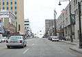
Looking east at Downtown Appleton
-
Looking east at Downtown Appleton
-

Looking west at Downtown Appleton
-

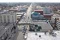
Looking east down on downtown Appleton
-
Looking west down on downtown Appleton
-

Inside Neuroscience Group Field


References
- ↑ "Republican mayors urge passage of LGBT nondiscrimination bill". Wisconsin Gazette. 30 July 2014. Retrieved 1 April 2016.
A group of Republican mayors — including Appleton Mayor Timothy Hanna
- 1 2 "US Gazetteer files 2010". United States Census Bureau. Archived from the original on 2012-01-24. Retrieved 2012-11-18.
- 1 2 "American FactFinder". United States Census Bureau. Retrieved 2012-11-18.
- ↑ "Population Estimates". United States Census Bureau. Retrieved 2016-05-22.
- 1 2 3 "American FactFinder". United States Census Bureau. Archived from the original on 2013-09-11. Retrieved 2008-01-31.
- ↑ "US Board on Geographic Names". United States Geological Survey. 2007-10-25. Retrieved 2008-01-31.
- 1 2 3 "History of Appleton". Appleton Public Library. 2011-06-01. Retrieved 2011-12-28.
- ↑ Wineries of Wisconsin and Minnesota By Patricia Monaghan page 126
- ↑ Appleton.org | City of Appleton, Wisconsin Archived March 24, 2010, at the Wayback Machine.
- ↑ "Profile for Appleton, Wisconsin". ePodunk. Retrieved 2010-06-20.
- ↑ Wisconsin (1857). Private and Local Laws Passed by the Legislature of Wisconsin in the Year 1857. Madison, Wisconsin: Calkins and Proudfit, Printers. pp. 243–283.
- ↑ "Victorian Christmas", Beloit Daily News, December 15, 2005
- ↑ "Appleton [brief history]". Wisconsinhistory.org. Retrieved 2014-01-18.
- ↑ Loewen, James (2006). Sundown Towns: A Hidden Dimension of American Racism. New York: Touchstone. ISBN 0743294483.
- ↑ Behr, Madeleine (2016-05-17). "Drunkest city in US? It's Appleton, report says". Post Crescent. Appleton WI. Retrieved 2016-05-25.
- ↑ "Appleton, Wisconsin Climate Summary". Weatherbase. Retrieved 6 February 2015.
- 1 2 "Appleton, Wisconsin Temperature Averages". Weatherbase. Retrieved 6 February 2015.
- ↑ "Annual Estimates of the Resident Population for Incorporated Places: April 1, 2010 to July 1, 2015". Retrieved July 2, 2016.
- ↑ "Census of Population and Housing". Census.gov. Archived from the original on May 11, 2015. Retrieved June 4, 2015.
- ↑ "2009 Crime in the United States: Offenses Known to Law Enforcement". U.S. Department of Justice, Federal Bureau of Investigation. August 2011. Archived from the original on 21 July 2011. Retrieved 2011-08-07.
- ↑ "Concordia's Locations". Visit Concordia. Concordia University. Retrieved 4 April 2016.
- ↑ "COMPREHENSIVE ANNUAL FINANCIAL REPORT". Appleton.org. p. 130. Retrieved June 14, 2016.
- ↑ http://whoonew.com/2013/07/houdini-plaza/
- ↑ dminteractive.com. "Official Site of the City of Appleton | Appleton, WI". Appleton.org. Retrieved 2014-01-18.
- ↑ "Appleton, Wisconsin Parks and Places - City Park". Triviaasylum.com. 1996-08-02. Retrieved 2014-01-18.
- ↑ "Appleton Parks & Recreation". Appletonparkandrec.org. Retrieved 2014-01-18.
- 1 2 3 4 5 6 "General Facts about Appleton, WI". Lawrence University. Archived from the original on 26 November 2010. Retrieved 24 November 2010.
- ↑ Wisconsin Blue Book 1893, p. 671.
Further reading
- Raney, William F. "Appleton". Wisconsin Magazine of History, vol. 33, no. 2 (December 1949):135-151.
External links
| Wikimedia Commons has media related to Appleton, Wisconsin. |
| Wikisource has the text of The New Student's Reference Work article Appleton, Wis.. |
-
 Appleton travel guide from Wikivoyage
 - City of Appleton
- Fox Cities Chamber
- VENTO Winds
- newVoices
-
 "Appleton". The American Cyclopædia. 1879.
| Core cities |  | |
|---|---|---|
| Largest municipalities over 10,000 in 2010 | ||
| Municipalities under 10,000 in 2010 |
| |
| Counties | ||
| ||
Municipalities and communities of Calumet County, Wisconsin, United States | ||
|---|---|---|
| Cities | 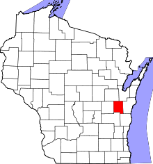 | |
| Villages | ||
| Towns | ||
| CDP | ||
| Unincorporated communities | ||
| Ghost town | ||
| Footnotes | ‡This populated place also has portions in an adjacent county or counties | |
Municipalities and communities of Outagamie County, Wisconsin, United States | ||
|---|---|---|
| Cities | 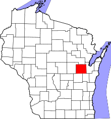 | |
| Villages | ||
| Towns | ||
| CDP | ||
| Unincorporated communities | ||
| Indian reservation | ||
| Ghost towns | ||
| Footnotes | ‡This populated place also has portions in an adjacent county or counties | |
Municipalities and communities of Winnebago County, Wisconsin, United States | ||
|---|---|---|
| Cities | 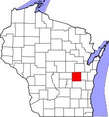 | |
| Villages | ||
| Towns | ||
| CDPs | ||
| Unincorporated communities |
| |
| Ghost towns | ||
| Footnotes | ‡This populated place also has portions in an adjacent county or counties | |