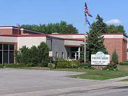
Howard, Wisconsin
| Howard, Wisconsin | |
|---|---|
| Village | |
 | |
| Nickname(s): Duck Creek | |
| Motto: Rising to New Heights | |
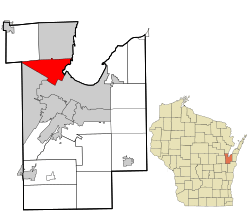 Location in Brown County and the state of Wisconsin. | |
| Coordinates: 44°33′47″N 88°4′55″W / 44.56306°N 88.08194°WCoordinates: 44°33′47″N 88°4′55″W / 44.56306°N 88.08194°W | |
| Country |
|
| State |
|
| Counties | Brown, Outagamie |
| Government | |
| • Type | Board/Administrator |
| • President | Burt R. McIntyre |
| • Administrator | Robert Bartelt |
| Area[1] | |
| • Total | 23.08 sq mi (59.78 km2) |
| • Land | 18.10 sq mi (46.88 km2) |
| • Water | 4.98 sq mi (12.90 km2) |
| Elevation[2] | 614 ft (187 m) |
| Population (2010)[3] | |
| • Total | 17,399 |
| • Estimate (2012[4]) | 18,500 |
| • Density | 961.3/sq mi (371.2/km2) |
| Time zone | Central (CST) (UTC-6) |
| • Summer (DST) | CDT (UTC-5) |
| Area code(s) | 920 |
| FIPS code | 55-35950[5] |
| GNIS feature ID | 1566765[2] |
| Website |
villageofhoward |
Howard is a village in Brown and Outagamie counties in the U.S. state of Wisconsin. The population was 17,399 at the 2010 census. All of this population resided in the Brown County portion of the village. It is part of the Green Bay Metropolitan Statistical Area.
The village is mostly within Brown County; a small portion extends west into Outagamie County. It is bordered to the east by Green Bay, a sub-basin of Lake Michigan. Prior to being incorporated as the Village of Howard, the Town of Howard was commonly referred to as "Duck Creek" because of the Duck Creek waterway winding its way through the village.
History
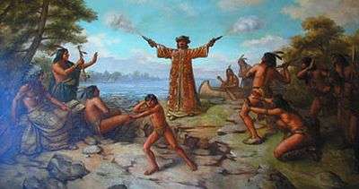
The Green Bay area was first explored by Europeans in 1634, when Jean Nicolet, a French voyager, arrived in the area. The Town of Howard was established in 1835 and slowly developed along the Duck Creek as a center for mail delivery, farming, quarrying and lumbering. It was named for Brigadier General Benjamin Howard, an officer in the War of 1812.[6] By 1856, a school was operating and the Town of Howard became known for its Duck Creek stone quarries. By 1959, the population had grown and the Town of Howard became incorporated as the Village of Howard. Residential, commercial and industrial growth has continued steadily since that time, creating a suburban community on Green Bay's northwest side.[7]
Geography
Howard is located at 44°33′47″N 88°4′55″W / 44.56306°N 88.08194°W (44.563091, -88.081856).[8]
According to the United States Census Bureau, the village has a total area of 23.08 square miles (59.78 km2), of which, 18.10 square miles (46.88 km2) of it is land and 4.98 square miles (12.90 km2) is water.[1]
Demographics
| Historical population | |||
|---|---|---|---|
| Census | Pop. | %± | |
| 1960 | 3,485 | — | |
| 1970 | 4,911 | 40.9% | |
| 1980 | 8,240 | 67.8% | |
| 1990 | 9,874 | 19.8% | |
| 2000 | 13,546 | 37.2% | |
| 2010 | 17,399 | 28.4% | |
| Est. 2015 | 19,250 | [9] | 10.6% |
2010 census
As of the census[3] of 2010, there were 17,399 people, 6,941 households, and 4,763 families residing in the village. The population density was 961.3 inhabitants per square mile (371.2/km2). There were 7,223 housing units at an average density of 399.1 per square mile (154.1/km2). The racial makeup of the village was 93.8% White, 1.5% African American, 1.2% Native American, 1.3% Asian, 0.6% from other races, and 1.6% from two or more races. Hispanic or Latino of any race were 2.4% of the population.
There were 6,941 households of which 37.0% had children under the age of 18 living with them, 52.9% were married couples living together, 10.9% had a female householder with no husband present, 4.8% had a male householder with no wife present, and 31.4% were non-families. 24.0% of all households were made up of individuals and 8.2% had someone living alone who was 65 years of age or older. The average household size was 2.50 and the average family size was 2.98.
The median age in the village was 36.3 years. 26.7% of residents were under the age of 18; 7.9% were between the ages of 18 and 24; 28.5% were from 25 to 44; 26.1% were from 45 to 64; and 10.7% were 65 years of age or older. The gender makeup of the village was 48.3% male and 51.7% female.
2000 census
As of the census[5] of 2000, there were 13,546 people, 5,236 households, and 3,691 families residing in the village. The population density was 753.7 people per square mile (291.0/km²). There were 5,350 housing units at an average density of 297.7 per square mile (114.9/km²). The racial makeup of the village was 96.16% White, 0.73% African American, 0.90% Native American, 0.78% Asian, 0.01% Pacific Islander, 0.32% from other races, and 1.10% from two or more races. Hispanic or Latino of any race were 1.09% of the population.
There were 5,236 households out of which 38.2% had children under the age of 18 living with them, 57.7% were married couples living together, 9.3% had a female householder with no husband present, and 29.5% were non-families. 21.7% of all households were made up of individuals and 6.0% had someone living alone who was 65 years of age or older. The average household size was 2.57 and the average family size was 3.04.
In the village the population was spread out with 27.8% under the age of 18, 8.6% from 18 to 24, 34.8% from 25 to 44, 21.3% from 45 to 64, and 7.5% who were 65 years of age or older. The median age was 34 years. For every 100 females there were 96.6 males. For every 100 females age 18 and over, there were 94.7 males.
The median income for a household in the village was $51,974, and the median income for a family was $56,579. Males had a median income of $40,081 versus $25,900 for females. The per capita income for the village was $21,688. About 3.2% of families and 4.3% of the population were below the poverty line, including 4.7% of those under age 18 and 3.7% of those age 65 or over.
Law and government
The Village of Howard has a Village President, a Board of Trustees, and a Village Administrator. The Village President and Board of Trustees establish policies for the Village, while the Village Administrator oversees the day-to-day operations of the government. The Village Board meets twice monthly (the second & fourth Monday of every month at 6:30 p.m. at Village Hall, located at 2456 Glendale Avenue).
The Village President is responsible for making appointments to boards and commissions and for chairing the Village Board meetings. The Village Board is responsible for establishing the tax rate, approving the budget, setting village policies, and establishing the strategic direction of the village.
Education
Public education
The village is served by the Howard-Suamico School District. There are also parochial Roman Catholic schools within the village.
Parks
The village of Howard has 21 parks, totaling several hundred acres. Howard’s Memorial Park is the trail head of the Mountain Bay Trail, an 83-mile (134 km)-long trail that runs through three counties in northeastern Wisconsin.
Akzo Nobel Park contains four softball diamonds, ten soccer fields and an 18-hole disc golf course.
Meadowbrook Park is a 92.25-acre (373,300 m2) outdoor recreation area consisting of gently sloping open areas, wooded lowlands, wetlands and hills, and a paved 1.25-mile (2.01 km) trail. The park also contains a lighted sledding hill, a fully fenced baseball diamond, an open-air shelter with grill, a full-size basketball court, and restrooms.
The Village of Howard also operates Village Green, a nine-hole, par 36 golf course that is fully irrigated.
Public safety
Police department
The Village of Howard does not have a police department of its own and contracts its law enforcement services from the Brown County Sheriff Department. The Village's main patrol station is located at Village Hall, in conjunction with the fire department.
Fire department
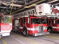
The Village of Howard has an award-winning paid on-call fire department, with a full-time public safety director (Ed Janke), and an assistant fire chief (Ann Watzka). The village contracts for Emergency Medical Services (EMS) with a private emergency medical services company, Eagle III.
Transportation
The village has seen substantial growth in recent years because of its location at the intersection of Interstate 43, U.S. Highway 41 & State Highway 29. Interstate 43, which provides direct access to Milwaukee, Wisconsin and Chicago, terminates in Howard. U.S. Highway 41 will be reclassified as an Interstate Highway as early as 2011. The Department of Transportation is considering reclassifying U.S. 41 to Interstate 55 (I-55), which would connect the area to Chicago, St. Louis, Memphis, and New Orleans.
The Wisconsin Department of Transportation is reconstructing U.S. Highway 41 from Oshkosh to Howard. In Howard, this $1 billion project begins in earnest in 2010. Howard's location (contiguous to Green Bay and in close proximity to the Fox Valley), in conjunction with the U.S. 41 reconstruction project, has attracted several national development companies.
Howard is the largest community in Brown County without transit service.
Notable people
- David Steffen - businessman and politician
- Carl Zoll - American Football player
- Martin Zoll - American Football player
Images
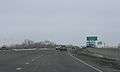 Sign on U.S. Route 41
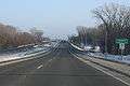 Entering Howard on Wisconsin Highway 29
References
- 1 2 "US Gazetteer files 2010". United States Census Bureau. Retrieved 2012-11-18.
- 1 2 "US Board on Geographic Names". United States Geological Survey. 2007-10-25. Retrieved 2008-01-31.
- 1 2 "American FactFinder". United States Census Bureau. Retrieved 2012-11-18.
- ↑ "Population Estimates". United States Census Bureau. Retrieved 2013-06-24.
- 1 2 "American FactFinder". United States Census Bureau. Retrieved 2008-01-31.
- ↑ "Profile for Howard, Wisconsin". ePodunk. Retrieved 2010-06-20.
- ↑ http://www.villageofhoward.com/history.cfm
- ↑ "US Gazetteer files: 2010, 2000, and 1990". United States Census Bureau. 2011-02-12. Retrieved 2011-04-23.
- ↑ "Annual Estimates of the Resident Population for Incorporated Places: April 1, 2010 to July 1, 2015". Retrieved July 2, 2016.
- ↑ "Census of Population and Housing". Census.gov. Retrieved June 4, 2015.
External links
| Wikimedia Commons has media related to Howard, Wisconsin. |
| Core city |  | |
|---|---|---|
| Largest municipalities over 10,000 in 2010 | ||
| Municipalities under 10,000 in 2010 | ||
| Counties | ||
Municipalities and communities of Brown County, Wisconsin, United States | ||
|---|---|---|
| Cities | 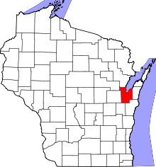 | |
| Villages | ||
| Towns | ||
| CDPs | ||
| Unincorporated communities |
| |
| Indian reservation | ||
| Ghost towns/ neighborhoods | ||
| Footnotes | ‡This populated place also has portions in an adjacent county or counties | |
Municipalities and communities of Outagamie County, Wisconsin, United States | ||
|---|---|---|
| Cities |  | |
| Villages | ||
| Towns | ||
| CDP | ||
| Unincorporated communities | ||
| Indian reservation | ||
| Ghost towns | ||
| Footnotes | ‡This populated place also has portions in an adjacent county or counties | |