Apollo, Pennsylvania
| Apollo, Pennsylvania | |
|---|---|
| Borough | |
|
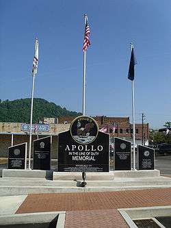
Apollo 11 Memorial | |
 Apollo | |
| Coordinates: 40°35′03″N 79°33′52″W / 40.58417°N 79.56444°WCoordinates: 40°35′03″N 79°33′52″W / 40.58417°N 79.56444°W | |
| Country | United States |
| State | Pennsylvania |
| County | Armstrong |
| Settled | 1816 |
| Incorporated | 1848 |
| Government | |
| • Mayor | Rich Dixon |
| Area | |
| • Total | 0.3 sq mi (0.9 km2) |
| • Land | 0.3 sq mi (0.8 km2) |
| • Water | 0.04 sq mi (0.1 km2) |
| Elevation | 820 ft (250 m) |
| Population (2010) | |
| • Total | 1,647 |
| • Density | 5,395/sq mi (2,083.0/km2) |
| Time zone | Eastern (EST) (UTC-5) |
| • Summer (DST) | EDT (UTC-4) |
| Zip code | 15613 |
| Area code(s) | 724 Exchange: 478 |
| Website |
apollopa |
Apollo is a borough in Armstrong County, Pennsylvania, United States, 35 miles (56 km) northeast of Pittsburgh in a former coal-mining region. Apollo was settled in 1790, laid out in 1816, and incorporated as a borough in 1848. The population was 1,647 at the 2010 census.[1]
History

The area was sectioned in 1769, following the Treaty of Fort Stanwix, as a farm known as "Warren's Sleeping Place", named after a Native American trader from the area named Edward Warren. It was soon surveyed and divided into lots, with the town of Warren officially being added to the Greensburg register on November 9, 1816.[2] The log cabin home of the Drake family still stands in the area, and is one of the oldest buildings in Armstrong County.
With the introduction of the post office, the area was officially renamed from Warren to Apollo in 1848 to avoid confusion with the post office of another town in Pennsylvania of the same name.[2]
By the late 19th century the Apollo Iron & Steel Company dominated the local economy. In 1895, the company's president, George Gibson McMurtry, hired famous landscape architect Frederick Law Olmsted to design a town for Apollo Iron & Steel's workers. The result was the neighboring town of Vandergrift. In 1911, Apollo became home to the first public library in Armstrong County.
The Roaring Run Recreation Area is located one mile upriver (southeast) of Apollo and can be accessed via the Apollo Kiski River Trail. Stone remnants of the Western Division of the Pennsylvania Mainline Canal, that passed through Apollo and operated between 1825-1850, can be found along the Roaring Run Trail. The canal made use of the Kiskiminetas River using a system of slackwater dams, and the boats floated on the river, entering a lock located at the mouth of Roaring Run. From there the canal ran along the path of the current Roaring Run Trail, through the entire length of the borough, entering the Kiskiminetas River again across the river from where the current borough of East Vandergrift is situated.
The Drake Log Cabin was listed on the National Register of Historic Places in 1983.[3]
Geography
Apollo is located on the Kiskiminetas River at 40°35′3″N 79°33′52″W / 40.58417°N 79.56444°W (40.584103, -79.564363).[4]
According to the United States Census Bureau, the borough has a total area of 0.35 square miles (0.9 km2), of which 0.31 square miles (0.8 km2) is land and 0.039 square miles (0.1 km2), or 12.43%, is water.[1]
Demographics
| Historical population | |||
|---|---|---|---|
| Census | Pop. | %± | |
| 1850 | 331 | — | |
| 1860 | 449 | 35.6% | |
| 1870 | 764 | 70.2% | |
| 1880 | 1,156 | 51.3% | |
| 1890 | 2,156 | 86.5% | |
| 1900 | 2,924 | 35.6% | |
| 1910 | 3,006 | 2.8% | |
| 1920 | 3,227 | 7.4% | |
| 1930 | 3,406 | 5.5% | |
| 1940 | 3,232 | −5.1% | |
| 1950 | 3,015 | −6.7% | |
| 1960 | 2,694 | −10.6% | |
| 1970 | 2,308 | −14.3% | |
| 1980 | 2,212 | −4.2% | |
| 1990 | 1,895 | −14.3% | |
| 2000 | 1,765 | −6.9% | |
| 2010 | 1,647 | −6.7% | |
| Est. 2015 | 1,588 | [5] | −3.6% |
| Sources:[6][7] | |||

As of the census[8] of 2000, there were 1,765 people, 762 households, and 467 families residing in the borough. The population density was 5,577.1 people per square mile (2,129.6/km²). There were 856 housing units at an average density of 2,704.8 per square mile (1,032.8/km²). The racial makeup of the borough was 95.52% White, 3.29% African American, 0.11% Native American, 0.11% Asian, 0.06% Pacific Islander, and 0.91% from two or more races. Hispanic or Latino of any race were 0.79% of the population.
There were 762 households, out of which 28.7% had children under the age of 18 living with them, 42.3% were married couples living together, 15.2% had a female householder with no husband present, and 38.6% were non-families. 34.5% of all households were made up of individuals, and 16.9% had someone living alone who was 65 years of age or older. The average household size was 2.29 and the average family size was 2.92.
In the borough the population was spread out, with 24.1% under the age of 18, 8.2% from 18 to 24, 30.0% from 25 to 44, 21.0% from 45 to 64, and 16.7% who were 65 years of age or older. The median age was 37 years. For every 100 females there were 87.4 males. For every 100 females age 18 and over, there were 81.8 males.
The median income for a household in the borough was $22,989, and the median income for a family was $29,952. Males had a median income of $26,750 versus $19,432 for females. The per capita income for the borough was $13,415. About 10.6% of families and 14.7% of the population were below the poverty line, including 14.7% of those under age 18 and 12.4% of those age 65 or over.
Economy
There are many small locally owned companies in Apollo.
Education
Apollo-Ridge School District, K-12
Notable people
- Nellie Bly, famous journalist and adventurer
- Ryan Hemphill, NASCAR driver
Trivia
- "Apollo, PA" is a palindrome.
References
- 1 2 "Geographic Identifiers: 2010 Demographic Profile Data (G001): Apollo borough, Pennsylvania". U.S. Census Bureau, American Factfinder. Retrieved July 29, 2013.
- 1 2 Henry, Thomas James (1916). 1816-1916; History of Apollo, Pennsylvania: The Year of a Hundred Years. Apollo, Pennsylvania: The News-Record Pub. Co. pp. 18–22, 25, 41, 54. Retrieved 6 August 2013.
- ↑ National Park Service (2009-03-13). "National Register Information System". National Register of Historic Places. National Park Service.
- ↑ "US Gazetteer files: 2010, 2000, and 1990". United States Census Bureau. 2011-02-12. Retrieved 2011-04-23.
- ↑ "Annual Estimates of the Resident Population for Incorporated Places: April 1, 2010 to July 1, 2015". Retrieved July 2, 2016.
- ↑ "Census of Population and Housing: Decennial Censuses". United States Census Bureau. Retrieved 2012-03-04.
- ↑ "Incorporated Places and Minor Civil Divisions Datasets: Subcounty Resident Population Estimates: April 1, 2010 to July 1, 2012". Population Estimates. U.S. Census Bureau. Archived from the original on 17 June 2013. Retrieved 11 December 2013.
- ↑ "American FactFinder". United States Census Bureau. Archived from the original on 2013-09-11. Retrieved 2008-01-31.
External links
| Wikimedia Commons has media related to Apollo, Pennsylvania. |
Municipalities and communities of Armstrong County, Pennsylvania, United States | ||
|---|---|---|
| City | 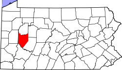 | |
| Boroughs | ||
| Townships | ||
| CDPs | ||
| Unincorporated communities | ||
| Counties |  Map of the Pittsburgh Tri-State with green counties in the metropolitan area and yellow counties in the combined area. | |
|---|---|---|
| Major cities | ||
| Cities and towns 15k-50k (in 2010) | ||
| Airports | ||
| Topics | ||
| ||