Truckhaven, California
Coordinates: 33°17′49″N 115°58′38″W / 33.29694°N 115.97722°W
| Truckhaven | |
|---|---|
| Unincorporated community | |
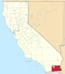
 Truckhaven  Truckhaven Location in California | |
| Coordinates: 33°17′49″N 115°58′38″W / 33.29694°N 115.97722°W | |
| Country | United States |
| State | California |
| County | Imperial County |
| Elevation[1] | -52 ft (-16 m) |
Truckhaven is an unincorporated community in Imperial County, California.[1] It is located 29 miles (47 km) west-northwest of Calipatria,[2] at an elevation of 52 feet (16 m) below sea level.[1]
Truckhaven is generally north of County Highway S-22, east of the Truckhaven rocks, and west of Salton City. It is bounded on the north by the Torres-Martinez Cahuilla Indian reservation lands. It derives its name from a famous old trade and commerce route pioneered through the area by Doc Beaty and the local ranchers from Borrego Springs out to the old highway running up to Palm Springs. USGS incorporated the road name into the Quad Map for the area. Ditto for the geologic place name and the name for any federal mining, mineral, or energy leases in the area. Currently the most active are geo-thermal leases looking for alternative energy.
Much of the old check-board ownership has been consolidated into and umbrella ownership within California State Parks. In the last legislative session, the current a future land use questions were largely answered as the legislature divided the area into two management units. The northern-most one is administered by Anza-Borrego Desert State Park and largely precludes the use of motorized vehicle except street legal and then only for basic access to the canyon floors. The southern portion is administered by Ocotillo Wells State Vehicular Recreation Area (also part of the Park System) which does allow use of motorized vehicles. The southern portion has been widely used a vehicle recreation site for many decades.
The area is the northern section of the Borrego Maneuver Area (BMA) administered by the US Navy during and after World War II. The Truckhaven area was only used as a far down range impact area for anti-aircraft gunnery and moderate artillery fire occurring much further south in the vicinity of Borrego Mountain and Military Wash. No evidence has come to light so far (as of 2011) that there are any unexploded ordnance (UXO) in the Truckhaven area.