Araz, California
Coordinates: 32°45′13″N 114°41′36″W / 32.75361°N 114.69333°W
| Araz | |
|---|---|
| Former settlement | |
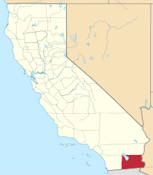
 Araz Location in California | |
| Coordinates: 32°45′13″N 114°41′36″W / 32.75361°N 114.69333°W | |
| Country | United States |
| State | California |
| County | Imperial County |
Araz (formerly, Pilot Knob) is a former settlement in Imperial County, California.[1] It was located on the Southern Pacific Railroad 8.5 miles (14 km) west-southwest of Bard.[1]
See also
References
This article is issued from Wikipedia - version of the 1/23/2014. The text is available under the Creative Commons Attribution/Share Alike but additional terms may apply for the media files.