Desert Shores, California
| Desert Shores | |
|---|---|
| Census designated place | |
|
View east through Desert Shores to the Salton Sea. | |
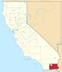
 Location in Imperial County and the state of California | |
 Desert Shores Location in the United States | |
| Coordinates: 33°24′15″N 116°02′23″W / 33.40417°N 116.03972°WCoordinates: 33°24′15″N 116°02′23″W / 33.40417°N 116.03972°W[1] | |
| Country |
|
| State |
|
| County | Imperial |
| Area[2] | |
| • Total | 0.682 sq mi (1.765 km2) |
| • Land | 0.682 sq mi (1.765 km2) |
| • Water | 0 sq mi (0 km2) 0% |
| Elevation[1] | −200 ft (−60 m) |
| Population (April 1, 2010) | |
| • Total | 1,104 |
| • Density | 1,600/sq mi (630/km2) |
| Time zone | Pacific (UTC-8) |
| • Summer (DST) | PDT (UTC-7) |
| ZIP code | 92274 |
| Area codes | 442/760 |
| FIPS code | 06-19024 |
| GNIS feature IDs | 1693254, 2408665 |
| [1] | |

Desert Shores (formerly Fish Springs)[1] is a census-designated place (CDP) in Imperial County, California, US. It is part of the El Centro Metropolitan Statistical Area.
Geography
The town is located at the western shore of the Salton Sea in the Imperial Valley, within the Colorado Desert ecoregion. It is 36 miles (58 km) west-northwest of Calipatria.[3] According to the United States Census Bureau, the CDP has a total area of 0.7 square miles (1.8 km2), all land.
Demographics
The population was 1,104 at the 2010 census, up from 792 in 2000.
2010
The 2010 United States Census[4] reported that Desert Shores had a population of 1,104. The population density was 1,619.9 people per square mile (625.5/km²). The racial makeup of Desert Shores was 709 (64.2%) White, 8 (0.7%) African American, 26 (2.4%) Native American, 4 (0.4%) Asian, 1 (0.1%) Pacific Islander, 307 (27.8%) from other races, and 49 (4.4%) from two or more races. Hispanic or Latino of any race were 848 persons (76.8%).
The Census reported that 1,104 people (100% of the population) lived in households, 0 (0%) lived in non-institutionalized group quarters, and 0 (0%) were institutionalized.
There were 344 households, out of which 167 (48.5%) had children under the age of 18 living in them, 181 (52.6%) were opposite-sex married couples living together, 37 (10.8%) had a female householder with no husband present, 27 (7.8%) had a male householder with no wife present. There were 29 (8.4%) unmarried opposite-sex partnerships, and 1 (0.3%) same-sex married couples or partnerships. 80 households (23.3%) were made up of individuals and 42 (12.2%) had someone living alone who was 65 years of age or older. The average household size was 3.21. There were 245 families (71.2% of all households); the average family size was 3.84.
The population was spread out with 352 people (31.9%) under the age of 18, 124 people (11.2%) aged 18 to 24, 263 people (23.8%) aged 25 to 44, 218 people (19.7%) aged 45 to 64, and 147 people (13.3%) who were 65 years of age or older. The median age was 29.9 years. For every 100 females there were 108.7 males. For every 100 females age 18 and over, there were 98.4 males.
There were 421 housing units at an average density of 617.7 per square mile (238.5/km²), of which 225 (65.4%) were owner-occupied, and 119 (34.6%) were occupied by renters. The homeowner vacancy rate was 4.2%; the rental vacancy rate was 2.4%. 704 people (63.8% of the population) lived in owner-occupied housing units and 400 people (36.2%) lived in rental housing units.
2000
As of the census[5] of 2000, there were 792 people, 279 households, and 181 families residing in the CDP. The population density was 1,208.4 people per square mile (463.3/km²). There were 406 housing units at an average density of 619.5 per square mile (237.5/km²). The racial makeup of the CDP was 73.5% White, 1.4% Black or African American, 0.9% Native American, 0.3% Asian, 21.1% from other races, and 2.9% from two or more races. 60.9% of the population were Hispanic or Latino of any race.
There were 279 households out of which 28.3% had children under the age of 18 living with them, 50.5% were married couples living together, 5.4% had a female householder with no husband present, and 35.1% were non-families. 29.0% of all households were made up of individuals and 18.3% had someone living alone who was 65 years of age or older. The average household size was 2.8 and the average family size was 3.6.
In the CDP the population was spread out with 26.9% under the age of 18, 8.5% from 18 to 24, 25.4% from 25 to 44, 18.8% from 45 to 64, and 20.5% who were 65 years of age or older. The median age was 37 years. For every 100 females there were 128.2 males. For every 100 females age 18 and over, there were 125.3 males.
The median income for a household in the CDP was $24,712, and the median income for a family was $29,550. Males had a median income of $26,176 versus $19,375 for females. The per capita income for the CDP was $8,352. About 12.0% of families and 7.9% of the population were below the poverty line, including none of those under age 18 and 14.9% of those age 65 or over.
Government
Local
Desert Shores and its neighboring community of Salton City are governed by the Salton Community Services District (SCSD), which is a special district per California Government Code. The legislative body of the SCSD is a five-member Board of Directors who are elected by the registered voters in the district every two years.
The SCSD has seven services that it is authorized to provide:
- Collect, treat, or dispose of sewage.
- Collect, transfer, and dispose of solid waste.
- Provide fire protection.
- Acquire, construct recreational facilities.
- Organize, promote community recreation.
- Acquire, construct, and improve street lighting and landscaping.
- Provide emergency medical services.
Aside from acting as the architectural committee for architectural compliance with the Covenants, Conditions, and Restrictions (CC&R) of the 80 plus tracts within the district, the SCSD has no land use authority under existing law; that responsibility falls on the Imperial County Board of Supervisors.
State and federal
In the state legislature, Desert Shores is in the 40th Senate District, represented by Democrat Ben Hueso,[6] and the 56th Assembly District, represented by Democrat Eduardo Garcia.[7]
Federally, Desert Shores is in California's 51st congressional district, represented by Democrat Juan Vargas.[8]
See also
References
- 1 2 3 4 "Desert Shores". Geographic Names Information System. United States Geological Survey.
- ↑ "2010 Census U.S. Gazetteer Files – Places – California". United States Census Bureau.
- ↑ Durham, David L. (1998). California's Geographic Names: A Gazetteer of Historic and Modern Names of the State. Clovis, Calif.: Word Dancer Press. p. 1413. ISBN 1-884995-14-4.
- ↑ "2010 Census Interactive Population Search: CA - Desert Shores CDP". U.S. Census Bureau. Retrieved July 12, 2014.
- ↑ "American FactFinder". United States Census Bureau. Retrieved 2008-01-31.
- ↑ "Senators". State of California. Retrieved April 8, 2013.
- ↑ "Members Assembly". State of California. Retrieved April 8, 2013.
- ↑ "California's 51st Congressional District - Representatives & District Map". Civic Impulse, LLC. Retrieved April 8, 2013.
| Wikimedia Commons has media related to Desert Shores, California. |
External links
- Salton Sea West.com: homepage — a non-commercial website with a large library of government documents pertaining to Desert Shores.