Paymaster Landing, California
Coordinates: 33°14′45″N 114°41′23″W / 33.24583°N 114.68972°W
| Paymaster Landing | |
|---|---|
| Unincorporated community | |
 Paymaster Landing  Paymaster Landing Location in California | |
| Coordinates: 33°14′45″N 114°41′23″W / 33.24583°N 114.68972°W | |
| Country | United States |
| State | California |
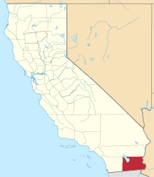
| County | Imperial County |
| Elevation[1] | 213 ft (65 m) |
Paymaster Landing is an unincorporated community in Imperial County, California.[1] It is located on the Colorado River 13 miles (21 km) south of Palo Verde,[2] at an elevation of 213 feet (65 m).[1]
References
This article is issued from Wikipedia - version of the 7/5/2016. The text is available under the Creative Commons Attribution/Share Alike but additional terms may apply for the media files.