Frink, California
Coordinates: 33°21′45″N 115°38′53″W / 33.36250°N 115.64806°W
| Frink | |
|---|---|
| Unincorporated community | |
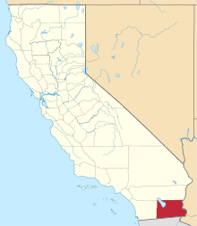
 Frink  Frink Location in California | |
| Coordinates: 33°21′45″N 115°38′53″W / 33.36250°N 115.64806°W | |
| Country | United States |
| State | California |
| County | Imperial County |
| Elevation[1] | -171 ft (-52 m) |
Frink is an unincorporated community in Imperial County, California.[1] It is located on the Southern Pacific Railroad 18 miles (29 km) north-northwest of Calipatria,[2] at an elevation of 171 feet (52 m) below sea level.[1]
References
This article is issued from Wikipedia - version of the 7/5/2016. The text is available under the Creative Commons Attribution/Share Alike but additional terms may apply for the media files.