Than Sadet–Ko Pha-ngan National Park
| Than Sadet–Ko Pha Ngan National Park | |
|---|---|
|
IUCN category II (national park) | |
|
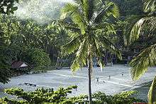
Than Sadet Beach | |
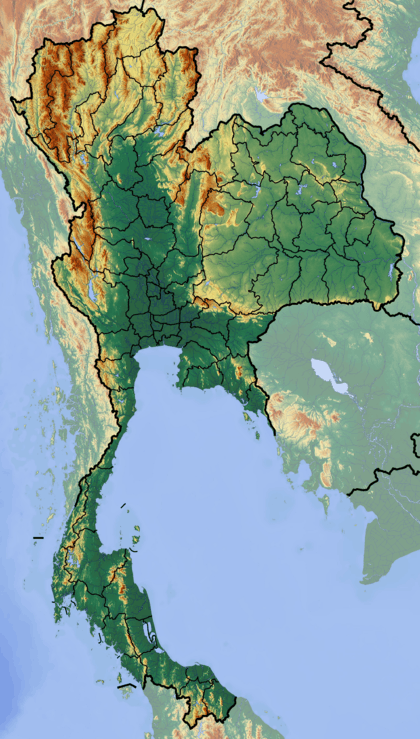 Location in Thailand | |
| Location | Surat Thani Province, Thailand |
| Nearest city | Surat Thani |
| Coordinates | 9°45′0″N 100°4′28″E / 9.75000°N 100.07444°ECoordinates: 9°45′0″N 100°4′28″E / 9.75000°N 100.07444°E |
| Area | 410.4 km² |
| Established | 1983 |

Than Sadet–Ko Pha Ngan (Thai: ธารเสด็จ-เกาะพะงัน) is a national park in southern Thailand, protecting 65.93 km2 (25.46 sq mi) mostly on the island Pha Ngan. The park was established on December 31, 1983. It covers an area of 39.12 km2 (15.10 sq mi), and was enlarged to its present size on February 10, 1999.
The park is named after the royal visit of Rama V, Than Sadet (lit. Royal River) who came to the island to visit the waterfall first in 1888, then returned as many as fourteen times over the next 21 years. Rama V's initials can still be seen carved in a commemorative rock near the estuary of the river where the waterfall empties into the sea at Than Sadet Bay. The river itself forms a series of waterfalls and rock pools along its 2.5 km length, providing excellent trekking possibilities for the experienced. Several other Thai monarchs have visited the site including the current King Rama IX.
Khao Ra is both the highest elevation of the park as well as of the whole island of Pha Ngan, peaking at 727 m above sea level.
In addition to the forest on Pha Ngan itself, the park also includes several small islands north of Pha Ngan, including Wao and Hin Bai archipelago.
References
External links
 Than Sadet-Ko Pha Ngan National Park travel guide from Wikivoyage
- National Park, Wildlife and Plant Conservation Department