Phu Kradueng National Park
| Phu Kradueng National Park | |
|---|---|
|
IUCN category II (national park) | |
|
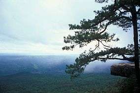
View from Lom Sak Cliff on Phu Kradueng Mountain | |
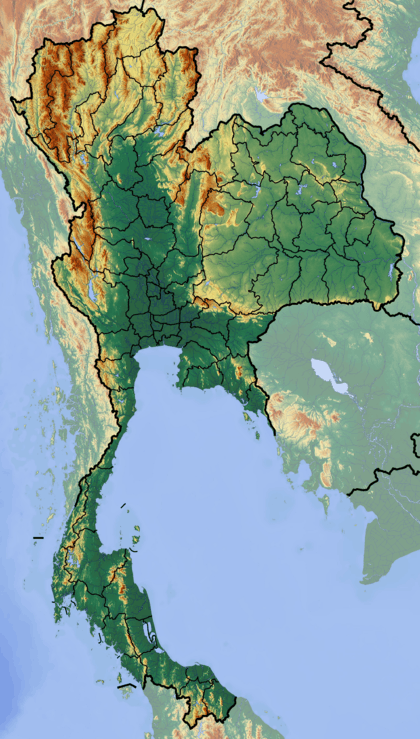 Location in Thailand | |
| Location | Loei Province, Thailand |
| Nearest city | Loei |
| Coordinates | 16°52′05″N 101°46′33″E / 16.86806°N 101.77583°ECoordinates: 16°52′05″N 101°46′33″E / 16.86806°N 101.77583°E |
| Area | 348 km² |
| Established | 1962 |
| Visitors | 69,613 (in 2009) |
| Governing body | Department of National Parks, Wildlife and Plant Conservation |
.jpg)
Phu Kradueng National Park (Thai: อุทยานแห่งชาติภูกระดึง), in the Si Than sub-district of Amphoe Phu Kradueng, Loei Province, is one of the best known national parks of Thailand, with a high point of 1,316 m (4318 ft) elevation at Khok Moei. It was proclaimed a national park on 23 November 1962, the second national park of Thailand after Khao Yai National Park.[1]
The park is closed to visitors during the rainy season (1 June - 30 September).[2]
Geography
Phu Kradueng mountain, made up of Jurassic and Cretaceous sandstone formations, takes the form of a mesa towering some 1,000 meters above the surrounding valleys. The summit plateau is roughly square-shaped and 60 km2 (37,500 rai) in size, with an average elevation of about 1,250 meters. Sloping slightly to the north, its western, southern, and eastern edges are fairly straight and formed by abrupt sandstone cliffs, while the northern part is deformed in a more irregular shape, containing a number of streams and (seasonal) waterfalls. The summit itself, in the southwestern part of the plateau, is inconspicuous. The park occupies an area of 348 km2 (217,575 rai)
History
"Phu" (ภู) comes from the Thai-Isan word "phukao" (ภูเขา), meaning mountain.[3] The name "kradueng" (กระดึง), or "krading" (กระดิ่ง) in the local dialect of Loei Province, can be translated as "rakhang yai" (ระฆังใหญ่), meaning "large bell". This name comes from a legend relating to a Buddhist holiday. During the holiday many of the townspeople heard the sound of a large bell. They believed it to be the bell of Indra.
Climate
Phu Kradung is a cool and comfortable all year round. The average temperature is 15°C. In the cool season, temperatures on the coldest nights reach freezing. In the rainy season, the weather can change quickly. Fog and low clouds tend to hang low over the landscape. Cliffs may collapse under their own weight after the soil which underlies the sandstone cap is eroded by heavy rain. Heavy rains can also cause flash floods in the streams which run down the mountain. Thus, the park is closed between June and September every year for visitor safety and forest rejuvenation.[1]
Flora and fauna
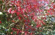
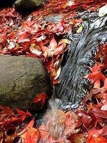
The mountain's steep sides are home to a succession of tropical forest tiers, namely (in ascending order): deciduous dipterocarp, mixed deciduous, dry evergreen, and hill evergreen forests, interspersed with bamboo. In contrast to that, the plateau at the mountain top consists of a sandy pine savanna landscape. Dominant tree species are Siamese sal (Shorea obtusa), Shorea siamensis, Diospyros spp., Lagerstroemia spp., Podocarpis nerriifolius, maple, Pinus murkusii, and Pinus kesiya. The grass fields support a variety of flowers, such as Hydrocera triflora, Torenia fournieri and marigolds. These flowers bloom at different times of the year. Some grow well in the rocky fields including Dendrobium sp. Close to the ground are ferns, mosses, and Serissa sp. Phu Kradung, with its variety of forest types and vegetation, provides abundant food for wildlife community, including elephants, bears, sambar deer, barking deer, serong, squirrel, fox. Birds include White-rumped Shama, black eagle, silver pheasant, red-wattled lapwing, Chinese francolin, and minivets. There is one rare species of turtle called "Tao Poo Loo" or "Tao Hang" which has a long tail and lives in high elevations along streams in the forests.[1]
References
- 1 2 3 "Phu Kradueng National Park". Department of National Parks (DNP) Thailand. Retrieved 2 November 2015.
- ↑ "Phu Kradueng National Park". Tourism Authority of Thailand (TAT). Retrieved 2 November 2015.
- ↑ "ภูเขา". thai-language.com. Retrieved 27 December 2015.
External links
 Media related to Phu Kradueng National Park at Wikimedia Commons
 Phu Kradueng National Park travel guide from Wikivoyage