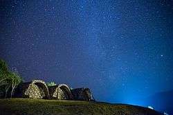
Si Nan National Park
| Si Nan National Park | |
|---|---|
| อุทยานแห่งชาติศรีน่าน | |
|
IUCN category II (national park) | |
 | |
 Park location in Thailand | |
| Location | Thailand |
| Nearest city | Nan |
| Coordinates | 18°22′4″N 100°50′15″E / 18.36778°N 100.83750°ECoordinates: 18°22′4″N 100°50′15″E / 18.36778°N 100.83750°E |
| Area | 1,024 km2 (395 sq mi) |
| Governing body | Department of National Parks, Wildlife and Plant Conservation |
Si Nan National Park (Thai: อุทยานแห่งชาติศรีน่าน) is a national park in Thailand's Nan Province. This mountainous park is home to steep cliffs and a long section of the Nan River.
Geography
Si Nan National Park is about 80 kilometres (50 mi) south of the town of Nan in the Wiang Sa, Na Noi, and Na Muen districts of Nan Province. The park's area is 1,024 square kilometres (395 sq mi). The park's highest point is the Khao Khun Huai Huek peak at 1,234 metres (4,049 ft). The Nan River flows for about 60 kilometres (40 mi) through the park.[1]
Attractions
Pha Chu, Pha Hua Sing, and Doi Samer Dao offer scenic views of the park's mountainous terrain. Kaeng Luang is a popular rafting spot along the Nan River.[2]
Flora and fauna
The park features forest types including deciduous and mixed. Tree species include Irvingia malayana, krabak, Malabar ironwood, makha, Xylia xylocarpa, Dalbergia oliveri and Vitex pinnata.[1]
The park serves as a sanctuary for animal species, some endangered, including tiger, leopard, fishing cat, wild boar, mouse deer, masked palm civet and treeshrew.[1]
References
- 1 2 3 "Si Nan National Park". Department of National Parks (Thailand). Archived from the original on 25 Dec 2015. Retrieved 13 Nov 2016.
- ↑ "Si Nan National Park". Tourism Authority of Thailand. Retrieved 24 Dec 2015.