Swan's Island, Maine
| Swans Island, Maine | |
|---|---|
| Town | |
 Swans Island, Maine Location within the state of Maine | |
| Coordinates: 44°9′8″N 68°26′36″W / 44.15222°N 68.44333°WCoordinates: 44°9′8″N 68°26′36″W / 44.15222°N 68.44333°W | |
| Country | United States |
| State | Maine |
| County | Hancock |
| Area[1] | |
| • Total | 80.81 sq mi (209.30 km2) |
| • Land | 12.41 sq mi (32.14 km2) |
| • Water | 68.40 sq mi (177.16 km2) |
| Elevation | 13 ft (4 m) |
| Population (2010)[2] | |
| • Total | 332 |
| • Estimate (2012[3]) | 331 |
| • Density | 26.8/sq mi (10.3/km2) |
| Time zone | Eastern (EST) (UTC-5) |
| • Summer (DST) | EDT (UTC-4) |
| ZIP code | 04685 |
| Area code(s) | 207 |
| FIPS code | 23-75455 |
| GNIS feature ID | 0582757 |
| Website | www.swansisland.org |
Swan's Island is an island town in Hancock County, Maine, United States. It is named after Colonel James Swan of Fife, Scotland, who purchased the island and some surrounding areas and organized their colonization in the eighteenth century.[4] The population was 332 at the 2010 census. The town is accessible by ferry[5] from Bass Harbor.
The island has a summertime population of approximately 1,000. There is a general store on the island, which opened in spring 2007, and at least one inn. There are also a number of small cottage-industry shops. The main industry is lobster fishing, which employs 40 people full-time and many others in part-time work.[6]
Swan's Island is also home to the Sweet Chariot Music Festival, an annual summertime show of folk music and sea shanties.[7]
History
Swan's Island was first charted in 1606 by Samuel de Champlain's expedition, and at the time was used by local Indians as a seasonal hunting ground.
James Swan purchased the island in 1786, but in 1791, David Smith, an American Revolutionary War veteran, became the first settler of European extraction on the island.[8]
The population grew slowly to more than 1,000 by 1900. Fish processing was the dominant industry into the 1930s, when it became no longer profitable in the area. The state-run ferry, which began service in 1960, helped make Swan's Island a popular summer tourism destination.[8][9] The ferry also is used to carry the mail to the island.[10]
Geography
According to the United States Census Bureau, the town has a total area of 80.81 square miles (209.30 km2), of which 12.41 square miles (32.14 km2) is land and 68.40 square miles (177.16 km2) is water.[1]
There are three villages in the town: Swan's Island, Atlantic, and Minturn.
Demographics
| Historical population | |||
|---|---|---|---|
| Census | Pop. | %± | |
| 1810 | 51 | — | |
| 1840 | 283 | — | |
| 1850 | 423 | 49.5% | |
| 1860 | 492 | 16.3% | |
| 1870 | 451 | −8.3% | |
| 1880 | 765 | 69.6% | |
| 1890 | 632 | −17.4% | |
| 1900 | 758 | 19.9% | |
| 1910 | 749 | −1.2% | |
| 1920 | 566 | −24.4% | |
| 1930 | 576 | 1.8% | |
| 1940 | 452 | −21.5% | |
| 1950 | 468 | 3.5% | |
| 1960 | 402 | −14.1% | |
| 1970 | 323 | −19.7% | |
| 1980 | 337 | 4.3% | |
| 1990 | 348 | 3.3% | |
| 2000 | 327 | −6.0% | |
| 2010 | 332 | 1.5% | |
| Est. 2014 | 331 | [11] | −0.3% |
2010 census
As of the census[2] of 2010, there were 332 people, 146 households, and 99 families residing in the town. The population density was 26.8 inhabitants per square mile (10.3/km2). There were 483 housing units at an average density of 38.9 per square mile (15.0/km2). The racial makeup of the town was 96.1% White, 0.9% African American, 0.9% Native American, and 2.1% from two or more races. Hispanic or Latino of any race were 0.3% of the population.
There were 146 households of which 26.0% had children under the age of 18 living with them, 56.8% were married couples living together, 6.2% had a female householder with no husband present, 4.8% had a male householder with no wife present, and 32.2% were non-families. 28.8% of all households were made up of individuals and 14.4% had someone living alone who was 65 years of age or older. The average household size was 2.27 and the average family size was 2.73.
The median age in the town was 46.3 years. 19.3% of residents were under the age of 18; 5% were between the ages of 18 and 24; 24.3% were from 25 to 44; 33.6% were from 45 to 64; and 17.5% were 65 years of age or older. The gender makeup of the town was 52.1% male and 47.9% female.
2000 census
As of the census[13] of 2000, there were 327 people, 142 households, and 90 families residing in the town. The population density was 23.4 people per square mile (9.1/km²). There were 421 housing units at an average density of 30.2 per square mile (11.7/km²). The racial makeup of the town was 98.17% White, 0.31% African American, and 1.53% from two or more races.
There were 142 households, out of which 26.8% had children under the age of 18 living in them; 59.2% were married couples living together; 2.1% had a female householder with no husband present, and 36.6% were non-families. 30.3% of all households were made up of individuals and 13.4% had someone living alone who was 65 years of age or older. The average household size was 2.30 and the average family size was 2.87.
In the town the population was spread out, with 23.9% under the age of 18; 8.3% from 18 to 24; 24.5% from 25 to 44; 24.8% from 45 to 64, and 18.7% who were 65 years of age or older. The median age was 41 years. For every 100 females, there were 105.7 males. For every 100 females age 18 and over, there were 112.8 males.
The median income for a household in the town was $28,438, and the median income for a family was $32,083. Males had a median income of $29,028 versus $18,750 for females. The per capita income for the town was $14,515. About 11.3% of families and 16.0% of the population were below the poverty line, including 15.1% of those under age 18 and 21.7% of those age 65 or over.
Activities
A travel agency specializing in trails, describes attractions for the island that include six historic homes dating to the 1700s, a listing on the National Register of Historic Places, a lighthouse, nature features that include nesting bald eagles, waterfowl, as well as deer, and trails, hiking, and camping.[14]
See also
References
- 1 2 "US Gazetteer files 2010". United States Census Bureau. Retrieved 2012-12-16.
- 1 2 "American FactFinder". United States Census Bureau. Retrieved 2012-12-16.
- ↑ "Population Estimates". United States Census Bureau. Retrieved 2013-07-06.
- ↑ Maine League of Historical Societies and Museums (1970). Doris A. Isaacson, ed. Maine: A Guide 'Down East'. Rockland, Me: Courier-Gazette, Inc. p. 431.
- ↑
- ↑ Bailey, Peg. "Welcome to Swan's Island". Retrieved 2007-10-21.
- ↑ "Sweet Chariot Music Festival". Retrieved 2013-12-31.
- 1 2 "Swan's Island history". Retrieved 2007-10-21.
- ↑ Small, Hermon. "A History of Swan's Island, Maine" (PDF).
- ↑ Shipler, David K., Dear Post Office: If It Ain't Broke, Don't Fix It, The Shipler Report, June 3, 2016
- ↑ "Annual Estimates of the Resident Population for Incorporated Places: April 1, 2010 to July 1, 2014". Retrieved June 4, 2015.
- ↑ "Census of Population and Housing". Census.gov. Retrieved June 4, 2015.
- ↑ "American FactFinder". United States Census Bureau. Retrieved 2008-01-31.
- ↑ "Swan Island". Retrieved 2015-08-21.
Further reading
- A History of Swan's Island, Maine. By Herman Wesley Small. Published 1898.
- Island Indicators, Status report on Maine’s year-round island communities A report by the Island Institute 2012
External links
- Town of Swan's Island
- Swan's Island Library
- Burnt Coat Harbor Light House
- Swan's Island Ferry
- Swan's Island Elementary School
- Island Map
- Hancock County Planning Commission Maps for Swan's Island
- Island Institute
- Memory Network - Swans Island
- Swan's Island Weather Station
- Tide Chart
- Banks Airport (ME5) Swan's Island
- Charter Flights to Swan's Island
Municipalities and communities of Hancock County, Maine, United States | ||
|---|---|---|
| City | 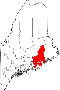 | |
| Towns |
| |
| Unorganized territories | ||
| CDPs | ||
| Other villages |
| |