Gouldsboro, Maine
| Gouldsboro, Maine | |
|---|---|
| Town | |
|
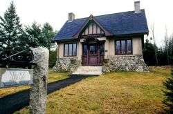
West Gouldsboro Village Library | |
 Gouldsboro, Maine Location within the state of Maine | |
| Coordinates: 44°25′47″N 68°2′38″W / 44.42972°N 68.04389°W | |
| Country | United States |
| State | Maine |
| County | Hancock |
| Government | |
| • Town Manager | Bryan Kaenrath |
| Area[1] | |
| • Total | 98.99 sq mi (256.38 km2) |
| • Land | 46.17 sq mi (119.58 km2) |
| • Water | 52.82 sq mi (136.80 km2) |
| Elevation | 33 ft (10 m) |
| Population (2010)[2] | |
| • Total | 1,737 |
| • Estimate (2012[3]) | 1,734 |
| • Density | 37.6/sq mi (14.5/km2) |
| Time zone | Eastern (EST) (UTC-5) |
| • Summer (DST) | EDT (UTC-4) |
| ZIP code | 04607 |
| Area code(s) | 207 |
| FIPS code | 23-28450 |
| GNIS feature ID | 0582494 |
Gouldsboro is a town in Hancock County, Maine, United States on the Schoodic Peninsula. The town was named for Robert Gould, a landholder in the town.[4] The town has many historically separate fishing and summer visitor villages, including Birch Harbor, Prospect Harbor, and Corea.[5] The population was 1,737 at the 2010 census.
Geography
According to the United States Census Bureau, the town has a total area of 98.99 square miles (256.38 km2), of which 46.17 square miles (119.58 km2) is land and 52.82 square miles (136.80 km2) is water.[1]
Demographics
| Historical population | |||
|---|---|---|---|
| Census | Pop. | %± | |
| 1790 | 267 | — | |
| 1800 | 379 | 41.9% | |
| 1810 | 471 | 24.3% | |
| 1820 | 560 | 18.9% | |
| 1830 | 880 | 57.1% | |
| 1840 | 1,198 | 36.1% | |
| 1850 | 1,400 | 16.9% | |
| 1860 | 1,717 | 22.6% | |
| 1870 | 1,709 | −0.5% | |
| 1880 | 1,825 | 6.8% | |
| 1890 | 1,709 | −6.4% | |
| 1900 | 1,259 | −26.3% | |
| 1910 | 1,349 | 7.1% | |
| 1920 | 1,282 | −5.0% | |
| 1930 | 1,115 | −13.0% | |
| 1940 | 1,068 | −4.2% | |
| 1950 | 1,168 | 9.4% | |
| 1960 | 1,100 | −5.8% | |
| 1970 | 1,310 | 19.1% | |
| 1980 | 1,574 | 20.2% | |
| 1990 | 1,986 | 26.2% | |
| 2000 | 1,941 | −2.3% | |
| 2010 | 1,737 | −10.5% | |
| Est. 2014 | 1,740 | [6] | 0.2% |
2010 census
As of the census[2] of 2010, there were 1,737 people, 773 households, and 528 families residing in the town. The population density was 37.6 inhabitants per square mile (14.5/km2). There were 1,442 housing units at an average density of 31.2 per square mile (12.0/km2). The racial makeup of the town was 97.8% White, 0.2% African American, 0.3% Native American, 0.2% Asian, 0.1% Pacific Islander, 0.8% from other races, and 0.6% from two or more races. Hispanic or Latino of any race were 2.4% of the population.
There were 773 households of which 21.6% had children under the age of 18 living with them, 56.0% were married couples living together, 7.8% had a female householder with no husband present, 4.5% had a male householder with no wife present, and 31.7% were non-families. 26.3% of all households were made up of individuals and 12.7% had someone living alone who was 65 years of age or older. The average household size was 2.25 and the average family size was 2.66.
The median age in the town was 50.3 years. 17.2% of residents were under the age of 18; 6.1% were between the ages of 18 and 24; 18.4% were from 25 to 44; 35.1% were from 45 to 64; and 23.1% were 65 years of age or older. The gender makeup of the town was 50.3% male and 49.7% female.
2000 census
As of the census[8] of 2000, there were 1,941 people, 801 households, and 539 families residing in the town. The population density was 42.1 people per square mile (16.3/km2). There were 1,328 housing units at an average density of 28.8 per square mile (11.1/km2). The racial makeup of the town was 96.39% White, 0.67% African American, 0.82% Native American, 0.21% Asian, 0.26% Pacific Islander, 0.52% from other races, and 1.13% from two or more races. Hispanic or Latino of any race were 1.85% of the population.
There were 801 households out of which 25.0% had children under the age of 18 living with them, 58.8% were married couples living together, 5.5% had a female householder with no husband present, and 32.7% were non-families. 27.5% of all households were made up of individuals and 13.4% had someone living alone who was 65 years of age or older. The average household size was 2.31 and the average family size was 2.78.
In the town the population was spread out with 19.8% under the age of 18, 7.5% from 18 to 24, 26.7% from 25 to 44, 28.6% from 45 to 64, and 17.3% who were 65 years of age or older. The median age was 42 years. For every 100 females there were 106.7 males. For every 100 females age 18 and over, there were 100.0 males.
The median income for a household in the town was $36,542, and the median income for a family was $43,864. Males had a median income of $25,076 versus $19,563 for females. The per capita income for the town was $18,203. About 7.0% of families and 10.4% of the population were below the poverty line, including 14.9% of those under age 18 and 8.5% of those age 65 or over.
Corea
Corea is one of four villages that comprise the town of Gouldsboro (the other three villages are Prospect Harbor, West Gouldsboro, and Birch Harbor). In the early 1800s, Corea was referred to as Indian Harbor, as it was occupied by the Native American Passamaquoddy. The name of the town changed from Indian Harbor to Corea in the year 1896 with the construction of the village's first post office.[9] The primary industry of Corea is lobster fishing.
Notable people
- Amy Clampitt, poet, author
- General David Cobb, congressman and Lieutenant Governor for Massachusetts[5]
- Luere B. Deasy, Maine Senate President and State Supreme Court Justice
- Kara DioGuardi, American Idol judge and singer-songwriter[10]
- Marsden Hartley, painter and poet[11]
- Louis A. Meyer, author, artist
- Louise Dickinson Rich, writer
References
- 1 2 "US Gazetteer files 2010". United States Census Bureau. Retrieved 2012-12-16.
- 1 2 "American FactFinder". United States Census Bureau. Retrieved 2012-12-16.
- ↑ "Population Estimates". United States Census Bureau. Retrieved 2013-07-06.
- ↑ "Profile for Gouldsboro, Maine". ePodunk. Retrieved 2010-04-18.
- 1 2 Maine League of Historical Societies and Museums (1970). Doris A. Isaacson, ed. Maine: A Guide 'Down East'. Rockland, Me: Courier-Gazette, Inc. pp. 276–277.
- ↑ "Annual Estimates of the Resident Population for Incorporated Places: April 1, 2010 to July 1, 2014". Retrieved June 4, 2015.
- ↑ "Census of Population and Housing". Census.gov. Retrieved June 4, 2015.
- ↑ "American FactFinder". United States Census Bureau. Retrieved 2008-01-31.
- ↑ The Daughters of Liberty, Gouldsboro, ME. Historical researches of Gouldsboro, Maine (1904). Daughters of Liberty, Gouldsboro, ME, 1904. p. 101
- ↑ "‘American Idol’ judge coming to Winter Harbor — Living — Bangor Daily News — BDN Maine". bangordailynews.com. Retrieved 2014-06-29.
- ↑ Ludington, Townsend. Marsden Hartley: The Biography of an American Artist. Cornell University, 1998.p. 278
Further reading
- Wright, Virginia M. "Schoodic: The Secret Side of Acadia". Down East: The Magazine of Maine (August 2009).
- Ludington, Townsend. Marsden Hartley: The Biography of an American Artist. Cornell University, 1998. p. 278
Municipalities and communities of Hancock County, Maine, United States | ||
|---|---|---|
| City | 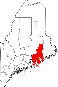 | |
| Towns |
| |
| Unorganized territories | ||
| CDPs | ||
| Other villages |
| |
Coordinates: 44°28′42″N 68°02′18″W / 44.47833°N 68.03833°W