Hancock County, Maine
| Hancock County, Maine | |
|---|---|
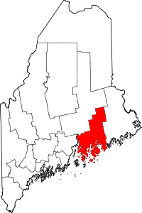 Location in the U.S. state of Maine | |
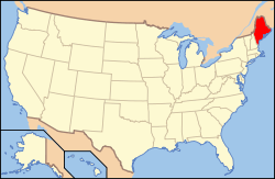 Maine's location in the U.S. | |
| Founded | June 25, 1789 |
| Named for | John Hancock |
| Seat | Ellsworth |
| Largest city | Ellsworth |
| Area | |
| • Total | 2,345 sq mi (6,074 km2) |
| • Land | 1,587 sq mi (4,110 km2) |
| • Water | 758 sq mi (1,963 km2), 32% |
| Population | |
| • (2010) | 54,418 |
| • Density | 32/sq mi (12/km²) |
| Congressional district | 2nd |
| Time zone | Eastern: UTC-5/-4 |
| Website |
www |


_IMG_2462.JPG)
Hancock County is a county located in the U.S. state of Maine. As of the 2010 census, the population was 54,418.[1] Its county seat is Ellsworth.[2] The county was incorporated on June 25, 1789 and named for John Hancock,[3] the first governor of the Commonwealth of Massachusetts. The Commissioners are Antonio Blasi, Steven Joy, Percy Brown.
Geography
According to the U.S. Census Bureau, the county has a total area of 2,345 square miles (6,070 km2), of which 1,587 square miles (4,110 km2) is land and 758 square miles (1,960 km2) (32%) is water.[4]
Adjacent counties
- Penobscot County, Maine — north
- Washington County, Maine — northeast
- Waldo County, Maine — west
Demographics
| Historical population | |||
|---|---|---|---|
| Census | Pop. | %± | |
| 1790 | 9,542 | — | |
| 1800 | 16,358 | 71.4% | |
| 1810 | 30,031 | 83.6% | |
| 1820 | 31,290 | 4.2% | |
| 1830 | 24,336 | −22.2% | |
| 1840 | 28,605 | 17.5% | |
| 1850 | 34,372 | 20.2% | |
| 1860 | 37,757 | 9.8% | |
| 1870 | 36,495 | −3.3% | |
| 1880 | 38,129 | 4.5% | |
| 1890 | 37,312 | −2.1% | |
| 1900 | 37,241 | −0.2% | |
| 1910 | 35,575 | −4.5% | |
| 1920 | 30,361 | −14.7% | |
| 1930 | 30,721 | 1.2% | |
| 1940 | 32,422 | 5.5% | |
| 1950 | 32,105 | −1.0% | |
| 1960 | 32,293 | 0.6% | |
| 1970 | 34,590 | 7.1% | |
| 1980 | 41,781 | 20.8% | |
| 1990 | 46,948 | 12.4% | |
| 2000 | 51,791 | 10.3% | |
| 2010 | 54,418 | 5.1% | |
| Est. 2015 | 54,659 | [5] | 0.4% |
| U.S. Decennial Census[6] 1790–1960[7] 1900–1990[8] 1990–2000[9] 2010–2013[1] | |||
2000 census
As of the census[10] of 2000, there were 51,791 people, 21,864 households, and 14,233 families residing in the county. The population density was 33 people per square mile (13/km²). There were 33,945 housing units at an average density of 21 per square mile (8/km²). The racial makeup of the county was 97.61% White, 0.25% Black or African American, 0.37% Native American, 0.38% Asian, 0.03% Pacific Islander, 0.20% from other races, and 1.15% from two or more races. 0.65% of the population were Hispanic or Latino of any race.
The largest ancestry groups in Hancock County, Maine according to Census 2000 are:
96.8% spoke English, 1.5% French and 1.0% Spanish as their first language.
There were 21,864 households out of which 28.20% had children under the age of 18 living with them, 53.50% were married couples living together, 8.10% had a female householder with no husband present, and 34.90% were non-families. 27.90% of all households were made up of individuals and 11.60% had someone living alone who was 65 years of age or older. The average household size was 2.31 and the average family size was 2.81.
In the county the population was spread out with 22.30% under the age of 18, 7.40% from 18 to 24, 27.50% from 25 to 44, 26.80% from 45 to 64, and 16.00% who were 65 years of age or older. The median age was 41 years. For every 100 females there were 95.70 males. For every 100 females age 18 and over, there were 92.10 males.
The median income for a household in the county was $35,811, and the median income for a family was $43,216. Males had a median income of $30,461 versus $22,647 for females. The per capita income for the county was $19,809. About 7.00% of families and 10.20% of the population were below the poverty line, including 11.90% of those under age 18 and 9.50% of those age 65 or over.
The 1990 Census counted 46,948, though the 1998 population estimate is 49,932.1 The gender division was 22,996 males, 23,952 females in 1989. Ninety-nine percent of the population was white (46,446), 121 American Indians, 249 Asians, 79 Blacks and 52 "other"
Sixty-six percent of the population of Hancock County are Mainers by birth, three percent were born outside the US.
Of the 31,475 persons over 25 years old, 83% (26,214) had a high school degree or higher. Twenty-one percent had a bachelor's degree or higher.
2010 census
As of the 2010 United States Census, there were 54,418 people, 24,221 households, and 14,834 families residing in the county.[11] The population density was 34.3 inhabitants per square mile (13.2/km2). There were 40,184 housing units at an average density of 25.3 per square mile (9.8/km2).[12] The racial makeup of the county was 96.9% white, 0.8% Asian, 0.4% American Indian, 0.4% black or African American, 0.3% from other races, and 1.2% from two or more races. Those of Hispanic or Latino origin made up 1.1% of the population.[11] In terms of ancestry, 24.0% were English, 19.8% were American, 15.2% were Irish, 9.0% were German, and 7.2% were Scottish.[13]
Of the 24,221 households, 24.4% had children under the age of 18 living with them, 48.9% were married couples living together, 8.2% had a female householder with no husband present, 38.8% were non-families, and 30.3% of all households were made up of individuals. The average household size was 2.20 and the average family size was 2.71. The median age was 46.3 years.[11]
The median income for a household in the county was $47,533 and the median income for a family was $60,092. Males had a median income of $41,046 versus $32,444 for females. The per capita income for the county was $26,876. About 6.8% of families and 11.5% of the population were below the poverty line, including 17.2% of those under age 18 and 7.3% of those age 65 or over.[14]
Economy
Of employed persons 16 years and over in 1990, 1,108 indicated involvement in the "agriculture, forestry and fisheries" industry, though 1,206 indicated "farming, forestry and fishing occupations." The U.S. Census data are not dependable for determining the numbers of individuals involved in the fishing industry. Only firms with 10 or more employees must report their numbers, as well as firms paying workmen’s compensation insurance. Because the majority of fishermen in Maine are considered self-employed, the statistics underreport fishing employment.
Cranberry Isles, Deer Isle, Frenchboro, Gouldsboro, Southwest Harbor, Stonington, Swans Island and Tremont (Bass Harbor) were identified by a key respondent as fisheries dependent. Bar Harbor, Brooklin, Brooksville, Hancock, Lamoine, Mount Desert, Penobscot, Sedgwick, Sorrento and Sullivan were also noted as having either significant fishing activity or a significant number of people who fish. Winter Harbor’s fishing activities were once dwarfed by the economic activity associated with a naval base, but now that the naval base has closed, fishing activity will most likely be the dominant economic activity in the community. Salmon farming is also popular in the area and Maine Salmon is an important export.
Hancock County has the longest coastline of any Maine county. Commercial fishing and tourism are the county’s most important industries. Hancock County is home to Acadia National Park (the only national park in Maine or the New England region, excluding the national sea shore on Cape Cod) and Cadillac Mountain (the highest point in Maine's coastal region). Jackson Laboratory, noted for cancer research, is located in Bar Harbor. Two institutions of higher education are located in Hancock County: Maine Maritime Academy at Castine and the College of the Atlantic at Bar Harbor.
Voter registration
| Year | Democrat | Republican |
|---|---|---|
| 2012 | 57.04% 17,569 | 40.01% 12,324 |
| 2008 | 58.74% 18,895 | 39.44% 12,686 |
| 2004 | 54.49% 18,048 | 43.49% 14,405 |
| 2000 | 45.44% 12,983 | 44.56% 12,732 |
| Voter Registration and Party Enrollment as of August 2011[16] | |||||
|---|---|---|---|---|---|
| Unenrolled | 15,237 | 35.64% | |||
| Republican | 13,202 | 30.88% | |||
| Democratic | 12,798 | 29.93% | |||
| Green Independent | 1,510 | 3.53% | |||
| Total | 42,747 | 100% | |||
Communities
City
- Ellsworth (county seat)
Towns
- Amherst
- Aurora
- Blue Hill
- Brooklin
- Brooksville
- Bucksport
- Castine
- Cranberry Isles
- Dedham
- Deer Isle
- Eastbrook
- Franklin
- Frenchboro
- Gouldsboro
- Great Pond
- Hancock
- Lamoine
- Mariaville
- Mount Desert
- Orland
- Osborn
- Otis
- Penobscot
- Sedgwick
- Sorrento
- Stonington
- Sullivan
- Surry
- Swan's Island
- Tremont
- Trenton
- Verona
- Waltham
Unorganized territories
Census-designated places
See also
- Maine Salmon
- Nicatous Lake, the second largest lake in Hancock County
- National Register of Historic Places listings in Hancock County, Maine
References
- 1 2 "State & County QuickFacts". United States Census Bureau. Retrieved August 19, 2013.
- ↑ "Find a County". National Association of Counties. Retrieved 2011-06-07.
- ↑ Gannett, Henry (1905). The Origin of Certain Place Names in the United States. Govt. Print. Off. p. 148.
- ↑ "2010 Census Gazetteer Files". United States Census Bureau. August 22, 2012. Retrieved September 7, 2014.
- ↑ "County Totals Dataset: Population, Population Change and Estimated Components of Population Change: April 1, 2010 to July 1, 2015". Retrieved July 2, 2016.
- ↑ "U.S. Decennial Census". United States Census Bureau. Retrieved September 7, 2014.
- ↑ "Historical Census Browser". University of Virginia Library. Retrieved September 7, 2014.
- ↑ "Population of Counties by Decennial Census: 1900 to 1990". United States Census Bureau. Retrieved September 7, 2014.
- ↑ "Census 2000 PHC-T-4. Ranking Tables for Counties: 1990 and 2000" (PDF). United States Census Bureau. Retrieved September 7, 2014.
- ↑ "American FactFinder". United States Census Bureau. Retrieved 2008-01-31.
- 1 2 3 "DP-1 Profile of General Population and Housing Characteristics: 2010 Demographic Profile Data". United States Census Bureau. Retrieved 2016-01-21.
- ↑ "Population, Housing Units, Area, and Density: 2010 - County". United States Census Bureau. Retrieved 2016-01-21.
- ↑ "DP02 SELECTED SOCIAL CHARACTERISTICS IN THE UNITED STATES – 2006-2010 American Community Survey 5-Year Estimates". United States Census Bureau. Retrieved 2016-01-21.
- ↑ "DP03 SELECTED ECONOMIC CHARACTERISTICS – 2006-2010 American Community Survey 5-Year Estimates". United States Census Bureau. Retrieved 2016-01-21.
- ↑ "Dave Leip's Atlas of U.S. Presidential Elections". Retrieved 2011-06-11.
- ↑ "Registration and Party Enrollment Statistics as of August, 2011" (PDF). Maine Bureau of Corporations.
External links
- Official Website of Hancock County
- Hancock County on Maine.gov
 |
Penobscot County | Washington County | | |
| Waldo County | |
|||
| ||||
| | ||||
| Atlantic Ocean |
Municipalities and communities of Hancock County, Maine, United States | ||
|---|---|---|
| City | | |
| Towns |
| |
| Unorganized territories | ||
| CDPs | ||
| Other villages |
| |
Augusta (capital) | |
| Topics |
|
| Society |
|
| Regions | |
| Counties | |
| Cities | |
| Largest towns | |
Coordinates: 44°34′N 68°22′W / 44.57°N 68.37°W