Winter Harbor, Maine
Not to be confused with Winter Harbor, Maine the former name of Biddeford Pool
| Winter Harbor, Maine | |
|---|---|
| Town | |
|
Aerial View Winter Harbor, Maine | |
 Winter Harbor, Maine Location within the state of Maine | |
| Coordinates: 44°23′5″N 68°5′41″W / 44.38472°N 68.09472°W | |
| Country | United States |
| State | Maine |
| County | Hancock |
| Area[1] | |
| • Total | 69.12 sq mi (179.02 km2) |
| • Land | 14.36 sq mi (37.19 km2) |
| • Water | 54.76 sq mi (141.83 km2) |
| Elevation | 23 ft (7 m) |
| Population (2010)[2] | |
| • Total | 516 |
| • Estimate (2012[3]) | 514 |
| • Density | 35.9/sq mi (13.9/km2) |
| Time zone | Eastern (EST) (UTC-5) |
| • Summer (DST) | EDT (UTC-4) |
| ZIP code | 04693 |
| Area code(s) | 207 |
| FIPS code | 23-86655 |
| GNIS feature ID | 0582821 |

Winter Harbor is a town in Hancock County, Maine, United States. The population was 516 at the 2010 census.
Geography
According to the United States Census Bureau, the town has a total area of 69.12 square miles (179.02 km2), of which 14.36 square miles (37.19 km2) is land and 54.76 square miles (141.83 km2) is water.[1]
History
Winter Harbor was raided various times by French and natives during Queen Anne's War. A United States Navy radio communications station operated here during World War II.[4]
Demographics
| Historical population | |||
|---|---|---|---|
| Census | Pop. | %± | |
| 1900 | 571 | — | |
| 1910 | 590 | 3.3% | |
| 1920 | 503 | −14.7% | |
| 1930 | 517 | 2.8% | |
| 1940 | 518 | 0.2% | |
| 1950 | 568 | 9.7% | |
| 1960 | 756 | 33.1% | |
| 1970 | 1,028 | 36.0% | |
| 1980 | 1,120 | 8.9% | |
| 1990 | 1,157 | 3.3% | |
| 2000 | 988 | −14.6% | |
| 2010 | 516 | −47.8% | |
| Est. 2014 | 516 | [5] | 0.0% |
2010 census
As of the census[2] of 2010, there were 516 people, 255 households, and 145 families residing in the town. The population density was 35.9 inhabitants per square mile (13.9/km2). There were 519 housing units at an average density of 36.1 per square mile (13.9/km2). The racial makeup of the town was 96.9% White, 0.4% African American, 0.2% Native American, 0.6% Asian, 1.4% from other races, and 0.6% from two or more races. Hispanic or Latino of any race were 1.7% of the population.
There were 255 households of which 21.2% had children under the age of 18 living with them, 45.1% were married couples living together, 6.3% had a female householder with no husband present, 5.5% had a male householder with no wife present, and 43.1% were non-families. 36.5% of all households were made up of individuals and 18.4% had someone living alone who was 65 years of age or older. The average household size was 2.02 and the average family size was 2.59.
The median age in the town was 51.1 years. 18% of residents were under the age of 18; 3% were between the ages of 18 and 24; 20% were from 25 to 44; 33.3% were from 45 to 64; and 25.8% were 65 years of age or older. The gender makeup of the town was 47.3% male and 52.7% female.
2000 census
As of the census[7] of 2000, there were 988 people, 402 households, and 278 families residing in the town. The population density was 68.8 people per square mile (26.5/km²). There were 558 housing units at an average density of 38.8 per square mile (15.0/km²). The racial makeup of the town was 89.98% White, 2.02% African American, 0.20% Native American, 0.71% Asian, and 7.09% from two or more races. Hispanic or Latino of any race were 3.64% of the population.
There were 402 households out of which 38.8% had children under the age of 18 living with them, 57.2% were married couples living together, 8.0% households had a female with no husband present, and 30.8% were non-families. 25.6% of all households were made up of individuals and 11.7% had someone living alone who was 65 years of age or older. The average household size was 2.46 and the average family size was 2.95.
In the town the population was spread out with 29.4% under the age of 18, 9.3% from 18 to 24, 30.8% from 25 to 44, 18.4% from 45 to 64, and 12.1% who were 65 years of age or older. The median age was 31 years. For every 100 females there were 93.3 males. For every 100 females age 18 and over, there were 92.3 males.
The median income for a household in the town was $28,571, and the median income for a family was $32,750. Males had a median income of $24,063 versus $17,448 for females. The per capita income for the town was $15,438. About 5.5% of families and 11.0% of the population were below the poverty line, including 10.3% of those under age 18 and 6.1% of those age 65 or over.
Grindstone Neck
The summer colony of Grindstone Neck lies on a peninsula southwest of the village. In 1889 a group formed “The Gouldsboro Land Improvement Company” with the idea of creating a summer colony much like that of Bar Harbor.[8] Residents of this community share in an association which includes a yacht club, nine-hole golf course,[9] tennis courts and footpaths.
The Winter Harbor Yacht Club purchased and renovated all nine original Winter Harbor 21 sailboats. Designed and launched in 1907, they are thought to be the oldest one-design sailboat fleet in the United States.
Many of the buildings on the neck were designed by Lindley Johnson, though the first few were designed by Wilson Eyre. The homes on Grindstone Neck are called "cottages" though many of them have upwards of 7–12 bedrooms.[10]
Notable people
- Fitz Eugene Dixon Jr., educator, philanthropist
References
- 1 2 "US Gazetteer files 2010". United States Census Bureau. Retrieved 2012-12-16.
- 1 2 "American FactFinder". United States Census Bureau. Retrieved 2012-12-16.
- ↑ "Population Estimates". United States Census Bureau. Retrieved 2013-07-06.
- ↑ "U.S.Navy Activities World War II by State". U.S. Naval Historical Center. Retrieved 2012-03-07.
- ↑ "Annual Estimates of the Resident Population for Incorporated Places: April 1, 2010 to July 1, 2014". Retrieved June 4, 2015.
- ↑ "Census of Population and Housing". Census.gov. Retrieved June 4, 2015.
- ↑ "American FactFinder". United States Census Bureau. Retrieved 2008-01-31.
- ↑ Gouldsboro land improvement co.'s Grindstone inn and lands, Grindstone Neck ... - Gouldsboro land improvement company - Google Books. Books.google.com. Retrieved 2012-03-04.
- ↑ "Grindstone Neck Golf Course / Course". Grindstonegolf.com. Retrieved 2012-03-04.
- ↑ "Raleigh, Ralph and Rags". Discovermainemagazine.com. Retrieved 2012-03-04.
Further reading
- Wright, Virginia M. "Schoodic: The Secret Side of Acadia". Down East: The Magazine of Maine (August 2009).
Coordinates: 44°23′43″N 68°04′59″W / 44.39528°N 68.08306°W
Municipalities and communities of Hancock County, Maine, United States | ||
|---|---|---|
| City | 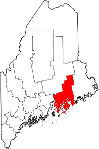 | |
| Towns |
| |
| Unorganized territories | ||
| CDPs | ||
| Other villages |
| |