Franklin, Maine
| Franklin, Maine | |
|---|---|
| Town | |
|
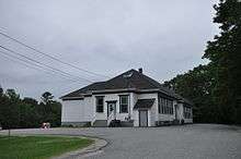
Schoodic Grange Hall | |
 Franklin, Maine Location within the state of Maine | |
| Coordinates: 44°35′15″N 68°13′48″W / 44.58750°N 68.23000°W | |
| Country | United States |
| State | Maine |
| County | Hancock |
| Area[1] | |
| • Total | 41.43 sq mi (107.30 km2) |
| • Land | 36.45 sq mi (94.41 km2) |
| • Water | 4.98 sq mi (12.90 km2) |
| Elevation | 200 ft (61 m) |
| Population (2010)[2] | |
| • Total | 1,483 |
| • Estimate (2012[3]) | 1,484 |
| • Density | 40.7/sq mi (15.7/km2) |
| Time zone | Eastern (EST) (UTC-5) |
| • Summer (DST) | EDT (UTC-4) |
| ZIP code | 04634 |
| Area code(s) | 207 |
| FIPS code | 23-26350 |
| GNIS feature ID | 0582479 |

Franklin is a town in Hancock County, Maine, United States. The population was 1,483 at the 2010 census. The town's namesake is Benjamin Franklin.[4] The first settler in 1764, was Moses Butler, for whom Butler's Point is named. Principal products (in chronological order) have been ship masts, railroad ties, granite, blueberries, and Christmas trees.[5]
Geography
According to the United States Census Bureau, the town has a total area of 41.43 square miles (107.30 km2), of which 36.45 square miles (94.41 km2) is land and 4.98 square miles (12.90 km2) is water.[1]
Demographics
| Historical population | |||
|---|---|---|---|
| Census | Pop. | %± | |
| 1830 | 382 | — | |
| 1840 | 502 | 31.4% | |
| 1850 | 736 | 46.6% | |
| 1860 | 1,004 | 36.4% | |
| 1870 | 1,042 | 3.8% | |
| 1880 | 1,102 | 5.8% | |
| 1890 | 1,264 | 14.7% | |
| 1900 | 1,201 | −5.0% | |
| 1910 | 1,161 | −3.3% | |
| 1920 | 925 | −20.3% | |
| 1930 | 820 | −11.4% | |
| 1940 | 742 | −9.5% | |
| 1950 | 709 | −4.4% | |
| 1960 | 627 | −11.6% | |
| 1970 | 708 | 12.9% | |
| 1980 | 979 | 38.3% | |
| 1990 | 1,141 | 16.5% | |
| 2000 | 1,370 | 20.1% | |
| 2010 | 1,483 | 8.2% | |
| Est. 2014 | 1,496 | [6] | 0.9% |
2010 census
As of the census[2] of 2010, there were 1,483 people, 652 households, and 411 families residing in the town. The population density was 40.7 inhabitants per square mile (15.7/km2). There were 1,043 housing units at an average density of 28.6 per square mile (11.0/km2). The racial makeup of the town was 97.3% White, 0.2% African American, 0.8% Native American, 0.7% Asian, and 1.0% from two or more races. Hispanic or Latino of any race were 0.6% of the population.
There were 652 households of which 26.5% had children under the age of 18 living with them, 48.9% were married couples living together, 9.7% had a female householder with no husband present, 4.4% had a male householder with no wife present, and 37.0% were non-families. 26.8% of all households were made up of individuals and 9.5% had someone living alone who was 65 years of age or older. The average household size was 2.26 and the average family size was 2.73.
The median age in the town was 44.6 years. 19.8% of residents were under the age of 18; 6.7% were between the ages of 18 and 24; 24% were from 25 to 44; 34.4% were from 45 to 64; and 15.1% were 65 years of age or older. The gender makeup of the town was 49.2% male and 50.8% female.
2000 census
As of the census[8] of 2000, there were 1,370 people, 579 households, and 389 families residing in the town. The population density was 37.3 people per square mile (14.4/km²). There were 902 housing units at an average density of 24.6 per square mile (9.5/km²). The racial makeup of the town was 95.84% White, 0.07% African American, 0.80% Native American, 0.51% Asian, 0.07% from other races, and 2.70% from two or more races. Hispanic or Latino of any race were 0.29% of the population.
There were 579 households out of which 28.7% had children under the age of 18 living with them, 56.1% were married couples living together, 8.3% had a female householder with no husband present, and 32.8% were non-families. 26.4% of all households were made up of individuals and 10.7% had someone living alone who was 65 years of age or older. The average household size was 2.35 and the average family size was 2.80.
In the town the population was spread out with 22.6% under the age of 18, 5.8% from 18 to 24, 29.6% from 25 to 44, 27.2% from 45 to 64, and 14.9% who were 65 years of age or older. The median age was 40 years. For every 100 females there were 98.6 males. For every 100 females age 18 and over, there were 91.7 males.
The median income for a household in the town was $32,070, and the median income for a family was $38,594. Males had a median income of $28,214 versus $19,900 for females. The per capita income for the town was $17,188. About 10.7% of families and 15.9% of the population were below the poverty line, including 15.8% of those under age 18 and 23.4% of those age 65 or over.
References
- 1 2 "US Gazetteer files 2010". United States Census Bureau. Retrieved 2012-12-16.
- 1 2 "American FactFinder". United States Census Bureau. Retrieved 2012-12-16.
- ↑ "Population Estimates". United States Census Bureau. Retrieved 2013-07-06.
- ↑ Gannett, Henry (1905). The Origin of Certain Place Names in the United States. Govt. Print. Off. p. 131.
- ↑ Maine League of Historical Societies and Museums (1970). Doris A. Isaacson, ed. Maine: A Guide 'Down East'. Rockland, Me: Courier-Gazette, Inc. p. 275.
- ↑ "Annual Estimates of the Resident Population for Incorporated Places: April 1, 2010 to July 1, 2014". Retrieved June 4, 2015.
- ↑ "Census of Population and Housing". Census.gov. Retrieved June 4, 2015.
- ↑ "American FactFinder". United States Census Bureau. Retrieved 2008-01-31.
Municipalities and communities of Hancock County, Maine, United States | ||
|---|---|---|
| City | 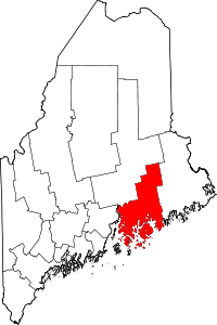 | |
| Towns |
| |
| Unorganized territories | ||
| CDPs | ||
| Other villages |
| |
Coordinates: 44°35′13″N 68°13′56″W / 44.58694°N 68.23222°W