Na Noi District
| Na Noi นาน้อย | |
|---|---|
| Amphoe | |
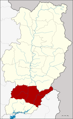 Amphoe location in Nan Province | |
| Coordinates: 18°19′30″N 100°42′54″E / 18.32500°N 100.71500°ECoordinates: 18°19′30″N 100°42′54″E / 18.32500°N 100.71500°E | |
| Country |
|
| Province | Nan |
| Government | |
| • Marshal | Samai Khamchomphu |
| Area | |
| • Total | 1,408.122 km2 (543.679 sq mi) |
| Population (2009) | |
| • Total | 32,560 |
| • Density | 23/km2 (60/sq mi) |
| Time zone | THA (UTC+7) |
| Postal code | 55150 |
| Geocode | 5504 |
Na Noi (Thai: นาน้อย, pronounced [nāː nɔ́ːj]) is a district (Amphoe) in Nan Province, northern Thailand.
History
Na Noi was originally named Wiang Si Sa Ket (เวียงศรีษะเกษ). In 1899 it became part of the province Nan. Though it was originally planned to merge Sisaket and Tha Pla into one district, in 1903 Tha Plan was integrated into Uttaradit Province. In 1917 the name of the district was changed, to avoid confusion with the Sisaket Province.[1]
Geography
Neighboring are from the north clockwise Wiang Sa, Laos, Ban Khok (Uttaradit Province), Na Muen and Rong Kwang (Phrae Province).
The main river is the Nan River in the eastern part of the district. The Nam Haeng river, which flows through the town Na Noi to flow into the Nan further east. Upriver of Na Noi town is the Nam Haeng Reservoir.
Also in the west of the district is the Si Nan National Park, protecting the forested Phi Pan Nam mountains which separate the valleys of the Nan and the Yom rivers.
Erosion formed the strange shapes named Hom Chom, found not far north of the town Na Noi. The mounds, some rather sharp, remained when rainwater and brooks cut into the sandstone.
The eastern part of the district is located in the Luang Prabang Range mountain area of the Thai highlands.[2]
Slogan
The slogan of the district is City of earth pillars, area of sweet tamarind, legendary Doi Phachu, praise the chedi Phra That Phlu Chae.
Administration
The district is subdivided into 7 subdistricts (tambon), which are further subdivided into 66 villages (muban). Na Noi is a township (thesaban tambon) and covers parts of tambon Na Noi. There are further 7 Tambon administrative organizations (TAO).
| No. | Name | Thai name | Villages | Inh. | |
|---|---|---|---|---|---|
| 1. | Na Noi | นาน้อย | 10 | 5,707 | |
| 2. | Chiang Khong | เชียงของ | 7 | 2,173 | |
| 3. | Si Sa Ket | ศรีษะเกษ | 14 | 7,439 | |
| 4. | Sathan | สถาน | 12 | 5,436 | |
| 5. | Santha | สันทะ | 8 | 5,723 | |
| 6. | Bua Yai | บัวใหญ่ | 8 | 4,021 | |
| 7. | Nam Tok | น้ำตก | 7 | 2,447 |
References
- ↑ ประกาศกระทรวงมหาดไทย เรื่อง เปลี่ยนชื่ออำเภอ (PDF). Royal Gazette (in Thai). 34 (0 ก): 40–68. April 29, 1917.
- ↑ ดร.กระมล ทองธรรมชาติ และคณะ, สังคมศึกษา ศาสนาและวัฒนธรรม ม.1, สำนักพิมพ์ อักษรเจริญทัศน์ อจท. จำกัด, 2548, หน้า 24-25