Sherwood, Wisconsin
| Sherwood, Wisconsin | |
|---|---|
| Village | |
 | |
 Location of Sherwood, Wisconsin | |
| Coordinates: 44°10′25″N 88°16′31″W / 44.17361°N 88.27528°WCoordinates: 44°10′25″N 88°16′31″W / 44.17361°N 88.27528°W | |
| Country | United States |
| State | Wisconsin |
| County | Calumet |
| Area[1] | |
| • Total | 3.52 sq mi (9.12 km2) |
| • Land | 3.46 sq mi (8.96 km2) |
| • Water | 0.06 sq mi (0.16 km2) |
| Elevation[2] | 892 ft (272 m) |
| Population (2010)[3] | |
| • Total | 2,713 |
| • Estimate (2012[4]) | 2,773 |
| • Density | 784.1/sq mi (302.7/km2) |
| Time zone | Central (CST) (UTC-6) |
| • Summer (DST) | CDT (UTC-5) |
| Area code(s) | 920 |
| FIPS code | 55-73525[5] |
| GNIS feature ID | 1574041[2] |
| Website |
villageofsherwood |
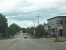
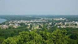
Sherwood is a village in Calumet County, Wisconsin, United States. The population was 2,713 at the 2010 census. The former historical unincorporated community of High Cliff is located within present-day Sherwood.[6][7]
Geography
According to the United States Census Bureau, the village has a total area of 3.52 square miles (9.12 km2), of which, 3.46 square miles (8.96 km2) of it is land and 0.06 square miles (0.16 km2) is water.[1]
Demographics
| Historical population | |||
|---|---|---|---|
| Census | Pop. | %± | |
| 1970 | 350 | — | |
| 1980 | 372 | 6.3% | |
| 1990 | 837 | 125.0% | |
| 2000 | 1,550 | 85.2% | |
| 2010 | 2,713 | 75.0% | |
| Est. 2015 | 2,865 | [8] | 5.6% |
Sherwood is located at 44°10′25″N 88°16′31″W / 44.17361°N 88.27528°W (44.173538, -88.275256).[10]
2010 census
As of the census[3] of 2010, there were 2,713 people, 986 households, and 830 families residing in the village. The population density was 784.1 inhabitants per square mile (302.7/km2). There were 1,027 housing units at an average density of 296.8 per square mile (114.6/km2). The racial makeup of the village was 96.8% White, 0.5% African American, 0.5% Native American, 0.8% Asian, 0.4% from other races, and 1.0% from two or more races. Hispanic or Latino of any race were 1.5% of the population.
There were 986 households of which 40.3% had children under the age of 18 living with them, 76.5% were married couples living together, 4.9% had a female householder with no husband present, 2.8% had a male householder with no wife present, and 15.8% were non-families. 12.2% of all households were made up of individuals and 4.4% had someone living alone who was 65 years of age or older. The average household size was 2.75 and the average family size was 3.00.
The median age in the village was 40 years. 28.1% of residents were under the age of 18; 3.7% were between the ages of 18 and 24; 28.1% were from 25 to 44; 29.9% were from 45 to 64; and 10.2% were 65 years of age or older. The gender makeup of the village was 49.9% male and 50.1% female.
2000 census
As of the census[5] of 2000, there were 1,550 people, 572 households, and 463 families residing in the village. The population density was 531.9 people per square mile (205.7/km²). There were 593 housing units at an average density of 203.5 per square mile (78.7/km²). The racial makeup of the village was 98.13% White, 0.19% African American, 0.32% Native American, 0.90% Asian, 0.13% from other races, and 0.32% from two or more races. Hispanic or Latino of any race were 0.97% of the population.
There were 572 households out of which 36.2% had children under the age of 18 living with them, 75.0% were married couples living together, 4.2% had a female householder with no husband present, and 18.9% were non-families. 13.8% of all households were made up of individuals and 5.2% had someone living alone who was 65 years of age or older. The average household size was 2.71 and the average family size was 3.02.
In the village the population was spread out with 27.3% under the age of 18, 5.5% from 18 to 24, 34.2% from 25 to 44, 24.5% from 45 to 64, and 8.6% who were 65 years of age or older. The median age was 36 years. For every 100 females there were 101.8 males. For every 100 females age 18 and over, there were 101.6 males.
The median income for a household in the village was $63,913, and the median income for a family was $67,303. Males had a median income of $46,384 versus $32,772 for females. The per capita income for the village was $27,035. About 3.9% of families and 4.9% of the population were below the poverty line, including 5.0% of those under age 18 and 16.0% of those age 65 or over.
Images
 Village hall
 Sherwood Community Center
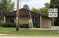 Post office
References
- 1 2 "US Gazetteer files 2010". United States Census Bureau. Retrieved 2012-11-18.
- 1 2 "US Board on Geographic Names". United States Geological Survey. 2007-10-25. Retrieved 2008-01-31.
- 1 2 "American FactFinder". United States Census Bureau. Retrieved 2012-11-18.
- ↑ "Population Estimates". United States Census Bureau. Retrieved 2013-06-24.
- 1 2 "American FactFinder". United States Census Bureau. Retrieved 2008-01-31.
- ↑ Map
- ↑ Dictionary of Wisconsin History, High Cliff (historical), Wisconsin
- ↑ "Annual Estimates of the Resident Population for Incorporated Places: April 1, 2010 to July 1, 2015". Retrieved July 2, 2016.
- ↑ "Census of Population and Housing". Census.gov. Retrieved June 4, 2015.
- ↑ "US Gazetteer files: 2010, 2000, and 1990". United States Census Bureau. 2011-02-12. Retrieved 2011-04-23.
External links
| Wikimedia Commons has media related to Sherwood, Wisconsin. |
| Core cities |  | |
|---|---|---|
| Largest municipalities over 10,000 in 2010 | ||
| Municipalities under 10,000 in 2010 |
| |
| Counties | ||
| ||
Municipalities and communities of Calumet County, Wisconsin, United States | ||
|---|---|---|
| Cities | 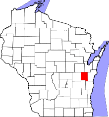 | |
| Villages | ||
| Towns | ||
| CDP | ||
| Unincorporated communities | ||
| Ghost town | ||
| Footnotes | ‡This populated place also has portions in an adjacent county or counties | |