Hayton, Wisconsin
| Hayton, Wisconsin | |
|---|---|
| Unincorporated community | |
|
Downtown Hayton | |
 Hayton  Hayton | |
| Coordinates: 44°01′21″N 88°06′58″W / 44.02250°N 88.11611°WCoordinates: 44°01′21″N 88°06′58″W / 44.02250°N 88.11611°W | |
| Country | United States |
| State | Wisconsin |
| County | Calumet |
| Town | Charlestown |
| Settled | 1840s |
| Elevation | 830 ft (250 m) |
| Time zone | Central (CST) (UTC-6) |
| • Summer (DST) | CDT (UTC-5) |
| Area code(s) | 920 |
| GNIS feature ID | 1566223[1] |

Hayton is an unincorporated community in the town of Charlestown, Calumet County, Wisconsin, United States.[1] It is located a few miles (kilometers) east of Chilton at the intersection of U.S. Route 151 and County T.[2]
Location

Sign for Hayton
The Killsnake River, a fork of the Manitowoc River, flows eastward through the community.[2] It is dammed by a mill and the sediments have been contaminated by PCBs.[3]
History
Hayton was the first settlement on the Killsnake River.[4] It was settled in the 1840s by William Urmston and it was originally named Wallersville after one of the landowners before it was renamed Hayton.[4]
Notable people
- Jeremiah Wallace Baldock, Wisconsin State Assemblyman and farmer, lived in Hayton.[5]
- William D. Carroll, Wisconsin State Senator, was born in Hayton.[6]
References
- 1 2 "Hayton, Wisconsin". Geographic Names Information System. United States Geological Survey.
- 1 2 Calumet County (PDF) (Map). Wisconsin Department of Transportation. 2011. Retrieved 2011-05-15.
- ↑ Steuer, et all, Jeffrey S. "Distribution and Transport of Polychlorinated Biphenyls and Associated Particulates in the Hayton Millpond, South Branch Manitowoc River, Wisconsin, 1993–95" (PDF). USGS. Retrieved May 15, 2011.
- 1 2 Edens, Mrs. Dale (January 18, 1973). "Historical Insight". Chilton Times-Journal.
- ↑ 'Veteran Is Called-Was A Pioneer of Chilton Town,' Chilton Times, December 13, 1919
- ↑ 'Wisconsin Blue Book 1933,' Biographical Sketch of William D. Carroll, pg. 220
Municipalities and communities of Calumet County, Wisconsin, United States | ||
|---|---|---|
| Cities | 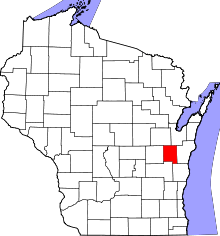 | |
| Villages | ||
| Towns | ||
| CDP | ||
| Unincorporated communities | ||
| Ghost town | ||
| Footnotes | ‡This populated place also has portions in an adjacent county or counties | |
This article is issued from Wikipedia - version of the 7/28/2016. The text is available under the Creative Commons Attribution/Share Alike but additional terms may apply for the media files.