Winneconne (town), Wisconsin
| Winneconne, Wisconsin | |
|---|---|
| Town | |
 Winneconne Location within the state of Wisconsin | |
| Coordinates: 44°6′40″N 88°42′54″W / 44.11111°N 88.71500°WCoordinates: 44°6′40″N 88°42′54″W / 44.11111°N 88.71500°W | |
| Country | United States |
| State | Wisconsin |
| County | Winnebago |
| Area | |
| • Total | 33.7 sq mi (87.2 km2) |
| • Land | 21.5 sq mi (55.8 km2) |
| • Water | 12.1 sq mi (31.4 km2) |
| Population (2010) | |
| • Total | 2,350 |
| • Density | 109/sq mi (42.1/km2) |
| Time zone | Central (CST) (UTC-6) |
| • Summer (DST) | CDT (UTC-5) |
| ZIP codes | 54986 |
| Area code(s) | 920 |
| FIPS code | 55-87925 |
| Website |
www |
Winneconne is a town in Winnebago County, Wisconsin, United States. The population was 2,350 at the 2010 census.[1] The Village of Winneconne is located within the town. The unincorporated community of Butte des Morts is also located in the town.
History
The name is an Indian word meaning "place of skulls", which came from a battle here in which the Sauks and Foxes fought against the French, Menominees and Chippewas.
Geography
According to the United States Census Bureau, the town has a total area of 33.7 square miles (87.2 km2), of which 21.5 square miles (55.8 km2) is land and 12.1 square miles (31.4 km2), or 36.02%, is water.[1]
Demographics
As of the census[2] of 2000, there were 2,145 people, 838 households, and 666 families residing in the town. The population density was 97.6 people per square mile (37.7/km²). There were 1,020 housing units at an average density of 46.4 per square mile (17.9/km²). The racial makeup of the town was 99.44% White, 0.23% Native American, 0.19% Asian, and 0.14% from two or more races. 0.19% of the population were Hispanic or Latino of any race.
There were 838 households out of which 30.4% had children under the age of 18 living with them, 71.5% were married couples living together, 4.3% had a female householder with no husband present, and 20.5% were non-families. 16.1% of all households were made up of individuals and 6.7% had someone living alone who was 65 years of age or older. The average household size was 2.56 and the average family size was 2.87.
In the town the population was spread out with 23.2% under the age of 18, 5.4% from 18 to 24, 27.1% from 25 to 44, 30.3% from 45 to 64, and 14.1% who were 65 years of age or older. The median age was 42 years. For every 100 females there were 103.1 males. For every 100 females age 18 and over, there were 102.6 males.
The median income for a household in the town was $60,385, and the median income for a family was $65,893. Males had a median income of $42,566 versus $27,692 for females. The per capita income for the town was $27,274. About 0.3% of families and 2.2% of the population were below the poverty line, including 1.3% of those under age 18 and 8.8% of those age 65 or over.
Secession
In 1967, as a result of the town name being inadvertently left off the official Wisconsin road map, a secret committee formulated a plan to secede from Wisconsin, set up toll gates on local roads and begin annexation of nearby communities (starting with the city of Oshkosh) to form a Sovereign State of Winneconne. As an alternative plan, annexation by another state, preferably one with better weather, was sought. The deadline for secession was 21 July 1967. A proclamation was issued, naming village president "James Coughlin to be president of the new state of Winneconne; Vera Kitchen to be prime minister and custodian of Vera's Kitchen Cabinet." Wisconsin Governor Warren Knowles entered into negotiations with the former village officials; as a result, Winneconne rejoined the State of Wisconsin at 12:01 AM on 22 July 1967. An annual Sovereign State Days celebration commemorates the event.[3]
References
- 1 2 "Geographic Identifiers: 2010 Demographic Profile Data (G001): Winneconne town, Winnebago County, Wisconsin". U.S. Census Bureau, American Factfinder. Retrieved January 31, 2013.
- ↑ "American FactFinder". United States Census Bureau. Retrieved 2008-01-31.
- ↑ History
External links
Municipalities and communities of Winnebago County, Wisconsin, United States | ||
|---|---|---|
| Cities | 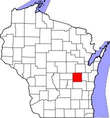 | |
| Villages | ||
| Towns | ||
| CDPs | ||
| Unincorporated communities |
| |
| Ghost towns | ||
| Footnotes | ‡This populated place also has portions in an adjacent county or counties | |