Stockbridge, Wisconsin
| Stockbridge, Wisconsin | |
|---|---|
| Village | |
|
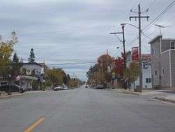
Along WIS 55 in downtown Stockbridge | |
| Motto: The Sturgeon Center of the World | |
 Location of Stockbridge, Wisconsin | |
| Coordinates: 44°3′36″N 88°16′58″W / 44.06000°N 88.28278°WCoordinates: 44°3′36″N 88°16′58″W / 44.06000°N 88.28278°W | |
| Country | United States |
| State | Wisconsin |
| County | Calumet |
| Area[1] | |
| • Total | 3.27 sq mi (8.47 km2) |
| • Land | 3.26 sq mi (8.44 km2) |
| • Water | 0.01 sq mi (0.03 km2) |
| Elevation[2] | 771 ft (235 m) |
| Population (2010)[3] | |
| • Total | 636 |
| • Estimate (2012[4]) | 637 |
| • Density | 195.1/sq mi (75.3/km2) |
| Time zone | Central (CST) (UTC-6) |
| • Summer (DST) | CDT (UTC-5) |
| ZIP code | 53088 |
| Area code(s) | 920 |
| FIPS code | 55-77425[5] |
| GNIS feature ID | 1584227[2] |
| Website | Village Website |


Stockbridge is a village in Calumet County, Wisconsin, United States. The population was 636 at the 2010 census. The village lies within the Town of Stockbridge.
History
Stockbridge is known as "The Sturgeon Center of the World,"[6] and was named after the Stockbridge Indians after they moved here from Stockbridge, New York, in the 1830s.[7]
Geography
Stockbridge is at 44°4′26″N 88°18′57″W / 44.07389°N 88.31583°W (44.074026, -88.316105).[8]
According to the United States Census Bureau, the village has a total area of 3.27 square miles (8.47 km2), of which, 3.26 square miles (8.44 km2) of it is land and 0.01 square miles (0.03 km2) is water.[1]
Demographics
| Historical population | |||
|---|---|---|---|
| Census | Pop. | %± | |
| 1910 | 328 | — | |
| 1920 | 387 | 18.0% | |
| 1930 | 377 | −2.6% | |
| 1940 | 386 | 2.4% | |
| 1950 | 409 | 6.0% | |
| 1960 | 476 | 16.4% | |
| 1970 | 582 | 22.3% | |
| 1980 | 567 | −2.6% | |
| 1990 | 579 | 2.1% | |
| 2000 | 649 | 12.1% | |
| 2010 | 636 | −2.0% | |
| Est. 2015 | 632 | [9] | −0.6% |
2010 census
As of the census[3] of 2010, there were 636 people, 292 households, and 185 families residing in the village. The population density was 195.1 inhabitants per square mile (75.3/km2). There were 348 housing units at an average density of 106.7 per square mile (41.2/km2). The racial makeup of the village was 98.7% White, 0.3% Native American, and 0.9% from two or more races. Hispanic or Latino of any race were 0.8% of the population.
There were 292 households of which 22.3% had children under the age of 18 living with them, 55.5% were married couples living together, 4.1% had a female householder with no husband present, 3.8% had a male householder with no wife present, and 36.6% were non-families. 30.5% of all households were made up of individuals and 9.6% had someone living alone who was 65 years of age or older. The average household size was 2.18 and the average family size was 2.67.
The median age in the village was 44.8 years. 17.3% of residents were under the age of 18; 7.2% were between the ages of 18 and 24; 25.7% were from 25 to 44; 31.4% were from 45 to 64; and 18.2% were 65 years of age or older. The gender makeup of the village was 51.9% male and 48.1% female.
2000 census
As of the census[5] of 2000, there were 649 people, 265 households, and 178 families residing in the village. The population density was 196.4 people per square mile (75.9/km²). There were 299 housing units at an average density of 90.5 per square mile (35.0/km²). The racial makeup of the village was 98.77% White, 0.62% Black or African American, 0.15% Native American, 0.15% from other races, and 0.31% from two or more races. 0.15% of the population were Hispanic or Latino of any race.
There were 265 households out of which 29.8% had children under the age of 18 living with them, 56.6% were married couples living together, 6.4% had a female householder with no husband present, and 32.8% were non-families. 25.7% of all households were made up of individuals and 9.4% had someone living alone who was 65 years of age or older. The average household size was 2.45 and the average family size was 2.98.
In the village the population was spread out with 23.7% under the age of 18, 9.1% from 18 to 24, 29.3% from 25 to 44, 25.7% from 45 to 64, and 12.2% who were 65 years of age or older. The median age was 37 years. For every 100 females there were 106.0 males. For every 100 females age 18 and over, there were 111.5 males.
The median income for a household in the village was $48,021, and the median income for a family was $56,094. Males had a median income of $38,359 versus $26,375 for females. The per capita income for the village was $21,129. About 1.1% of families and 2.5% of the population were below the poverty line, including none of those under the age of eighteen or sixty-five or over.
Education
Stockbridge High School had 83 students in the 2005-06 school year. As of 2008, 79 students attend the high school. On December 15, 2005, the school board approved a football program, a golf program, and other sports. The school's sports teams are known as the Stockbridge Indians. The school recently received a bronze medal when ranked by U.S. News & World Report magazine.
Historic places
Calumet County Park is located 4 miles northeast of the city. The park has effigy mounds.
There are two places in Stockbridge listed on the List of Registered Historic Places in Wisconsin: Stockbridge Harbor and Stockbridge Indian Cemetery.
Notable people
- Lemuel Goodell, Wisconsin legislator
- John Harsh, Wisconsin legislator
- Electa Quinney, educator
- John Wannuaucon Quinney, Stockbridge Indian diplomat, lived in Stockbridge.
- Glenn Turner, Wisconsin legislator
References
- 1 2 "US Gazetteer files 2010". United States Census Bureau. Archived from the original on January 24, 2012. Retrieved 2012-11-18.
- 1 2 "US Board on Geographic Names". United States Geological Survey. 2007-10-25. Retrieved 2008-01-31.
- 1 2 "American FactFinder". United States Census Bureau. Retrieved 2012-11-18.
- ↑ "Population Estimates". United States Census Bureau. Archived from the original on June 17, 2013. Retrieved 2013-06-24.
- 1 2 "American FactFinder". United States Census Bureau. Archived from the original on September 11, 2013. Retrieved 2008-01-31.
- ↑ "Stockbridge Area Business Association". Retrieved 2007-12-10.
- ↑ "Stockbridge-Munsee History". Retrieved 2007-12-10.
- ↑ "US Gazetteer files: 2010, 2000, and 1990". United States Census Bureau. 2011-02-12. Retrieved 2011-04-23.
- ↑ "Annual Estimates of the Resident Population for Incorporated Places: April 1, 2010 to July 1, 2015". Retrieved July 2, 2016.
- ↑ "Census of Population and Housing". Census.gov. Archived from the original on May 11, 2015. Retrieved June 4, 2015.
External links
Municipalities and communities of Calumet County, Wisconsin, United States | ||
|---|---|---|
| Cities | 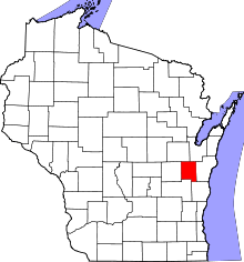 | |
| Villages | ||
| Towns | ||
| CDP | ||
| Unincorporated communities | ||
| Ghost town | ||
| Footnotes | ‡This populated place also has portions in an adjacent county or counties | |