San Antonio, Nueva Ecija
| San Antonio | |||
|---|---|---|---|
| Municipality | |||
 | |||
| |||
 Map of Nueva Ecija showing the location of San Antonio | |||
.svg.png) San Antonio Location within the Philippines | |||
| Coordinates: 15°23′N 120°48′E / 15.383°N 120.800°ECoordinates: 15°23′N 120°48′E / 15.383°N 120.800°E | |||
| Country | Philippines | ||
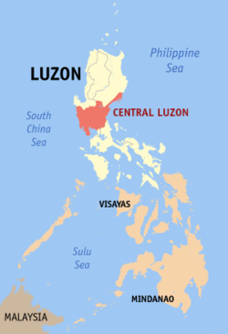
| Region | Central Luzon (Region III) | ||
| Province | Nueva Ecija | ||
| District | 4th District | ||
| Barangays | 16 | ||
| Government[1] | |||
| • Mayor | Arvin Cruz Salonga | ||
| • Vice Mayor | Julie E. Maxwell | ||
| Area[2] | |||
| • Total | 153.56 km2 (59.29 sq mi) | ||
| Population (2010)[3] | |||
| • Total | 73,074 | ||
| • Density | 480/km2 (1,200/sq mi) | ||
| Time zone | PST (UTC+8) | ||
| ZIP code | 3108 | ||
| Dialing code | 44 | ||
| Income class | 1st class; rural | ||


San Antonio is a first class municipality in the province of Nueva Ecija, Philippines. According to the 2010 Philippine census, it has a population of 73,074 people.[3]
History
The present name of the town was given in 1843 in honor of the patron saint, San Antonio Abad, by Father Leocadio Luis, the first priest of the town. Before its organization and recognition as a town by means of a decree promulgated during the Spanish regime, this was a barangay of Gapan and was known as Barrio Delinquente.
San Antonio was previously called as the barrio of Delinquente as old residents claimed that the name Delinquente originated by the sinking of a Casco (big boat / banca ) fully loaded with palay in Pampanga River.
It was partitioned from the town of Gapan in 1843 by the order of Governor General Marcelino Oraa, along with the town of San Isidro. The movement of the separation of Barrio Delinquente from the town of Gapan, and its organization as an independent municipality. was ignited in 1839.The petition of the residents of Barrio Delinquente was finally approved in November 1842 but the definite separation from the town of Gapan took place in 1843.
It is bounded by the towns of Jaen to its eastern side, Zaragosa is to the north, Cabiao and San Isidro, and Concepcion in the Province of Tarlac is at its western border. From Manila the popular route going to San Antonio is via the North Luzon Expressway (NLEX), exiting at San Simon and head on to Gapan-Olongapo Road turning right towards Arayat, Pampanga. Reaching the town of San Isidro, turn left to the road leading to San Antonio. The other route is to exit the NLEX at Santa Rita and traverse the Pan-Philippine Highway across the length of the Province of Bulacan up to Gapan City in Nueva ecija and turning left on the Gapan-Olongapo Road.
Local government
Municipal elected official (2016–present):
- Mayor
- Arvin "Gawa Hindi Salita" Cruz Salonga
- Vice Mayor
- Julie E. Maxwell
- Councilors:
- Renan "Besfriend" Morales
- Therese Fatima Javier
- Adonis Balagtas
- Carel Galang
- Polito "Pol" Pamintuan
- Renier Umali
- Maneng Balcos
- Cris Cunanan
Barangays
San Antonio is divided into 16 barangays.
- Buliran
- Cama Juan
- Julo
- Lawang Kupang
- Luyos
- Maugat
- Panabingan
- Papaya
- Poblacion
- San Francisco (KC1 or Kaisiwan)
- San José (Cabungan)
- San Mariano
- Santa Barbara
- Santa Cruz (Parang)
- Santo Cristo
- Tikiw
Demographics
| Population census of San Antonio | ||
|---|---|---|
| Year | Pop. | ±% p.a. |
| 1990 | 51,815 | — |
| 1995 | 56,130 | +1.51% |
| 2000 | 63,672 | +2.74% |
| 2007 | 67,446 | +0.80% |
| 2010 | 73,074 | +2.96% |
| Source: National Statistics Office[3] | ||
Economy
The people of San Antonio primarily depends on rice farming. The intercropping planting of vegetables, like ampalaya and beans, is common. In the past, watermelons and melons were part of the intercropping.
Tricycle operating and driving became a significant form of living, aside from those who are employed in the municipality, emergency hospitals, post office. health centers and the like. The town has also employed public school teachers in Central School and barangays.
Medium-sized entrepreneurs operate businesses as market stall owners and stores around the town and barangays are other source of living.
Available transports from the town to Manila are RL Transport owned by the Lamsons and Five Star Bus Co.. In the past, there were E. Jose Trans. and Baliwag Transit plying the same route.
There are few folks who engaged in fishing from nearby Along Along River or Chico River. There is a known tilapia raiser within the area of Palaisdaan ng Bayan.
Images
 Welcome arch
 Highway
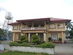 Town hall
 Facade of Saint Anthony Abbot Parish Church
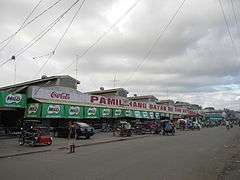 Public Market
References
- ↑ "Official City/Municipal 2013 Election Results". Intramuros, Manila, Philippines: Commission on Elections (COMELEC). 11 September 2013. Retrieved 22 October 2013.
- ↑ "Province: Nueva Ecija". PSGC Interactive. Makati City, Philippines: National Statistical Coordination Board. Retrieved 22 October 2013.
- 1 2 3 "Total Population by Province, City, Municipality and Barangay: as of May 1, 2010" (PDF). 2010 Census of Population and Housing. National Statistics Office. Retrieved 2012-10-22.
External links
| Wikimedia Commons has media related to San Antonio, Nueva Ecija. |
- Pasyalan Nueva Ecija
- Philippine Standard Geographic Code
- Philippine Census Information
- Local Governance Performance Management System
 |
La Paz, Tarlac | Zaragoza | | |
| Concepcion, Tarlac | |
Jaen | ||
| ||||
| | ||||
| Cabiao | San Isidro |