Mayantoc, Tarlac
| Mayantoc | ||
|---|---|---|
| Municipality | ||
|
Mayantoc Town Hall | ||
| ||
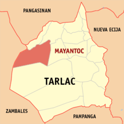 Map of Tarlac showing the location of Mayantoc | ||
.svg.png) Mayantoc Location within the Philippines | ||
| Coordinates: 15°37′N 120°23′E / 15.617°N 120.383°ECoordinates: 15°37′N 120°23′E / 15.617°N 120.383°E | ||
| Country | Philippines | |
| Region | Central Luzon (Region III) | |
| Province | Tarlac | |
| District | 1st District | |
| Founded | 1917 | |
| Barangays | 24 (see §Barangays) | |
| Government[1] | ||
| • Mayor | Iluminado E. Pobre Jr. | |
| Area[2] | ||
| • Total | 311.42 km2 (120.24 sq mi) | |
| Population (2010)[3] | ||
| • Total | 29,987 | |
| • Density | 96/km2 (250/sq mi) | |
| Time zone | PHT (UTC+8) | |
| ZIP code | 2304 | |
| IDD‑Area code | 45 | |
| Income class | 3rd class[4] | |
| Website |
www | |


Mayantoc is a third class municipality in the province of Tarlac, Philippines. According to the 2010 census, it has a population of 29,987 people.[3] It is nestled on the foothills of the Zambales Mountains where the Camiling River originates and provides many scenic picnic and swimming sites, making it known as the summer capital of the province. The most common road to Mayantoc starts at "Crossing Mayantoc", at the national highway to Camiling, Tarlac just after the Tarlac College of Agriculture campus.
Barangays
Mayantoc is administratively divided into 24 barangays:
| Name | PSGC code[2] | pop. (2010)[3] |
|---|---|---|
| Ambalingit | 036908001 | 636 |
| Baybayaoas | 036908002 | 419 |
| Bigbiga | 036908003 | 1,350 |
| Binbinaca | 036908004 | 563 |
| Calabtangan | 036908005 | 574 |
| Caocaoayan | 036908006 | 643 |
| Carabaoan | 036908007 | 820 |
| Cubcub | 036908008 | 486 |
| Gayonggayong | 036908009 | 414 |
| GoSo0D | 036908010 | 767 |
| Labney | 036908011 | 922 |
| Mamonit | 036908012 | 2,305 |
| Maniniog | 036908013 | 755 |
| Mapandan | 036908014 | 1,406 |
| Nambalan | 036908015 | 1,443 |
| Pedro L. Quines | 036908016 | 1,794 |
| Pitombayog | 036908017 | 2,089 |
| Poblacion Norte | 036908018 | 3,367 |
| Poblacion Sur | 036908019 | 3,077 |
| Rotrottooc | 036908020 | 1,172 |
| San Bartolome | 036908021 | 1,576 |
| San Jose | 036908022 | 1,547 |
| Taldiapan | 036908023 | 700 |
| Tangcarang (Melecio Manganaan) | 036908024 | 1,162 |
History
The first settlers of Mayantoc before the coming of Christian migrants were the negritos of the Abiling tribe. As they arrived in great numbers, so the natives were soon forced to move deeper into the forest areas of the Zambales mountain range.
The Christian settlers, mostly came from the Ilocos region, notably the towns of Cabugao, Tagudin, Sarrat, Paoay, Sinait and Bacarra settled in villages in the southern portion of the thriving town of Camiling, acknowledged as the mother town of Mayantoc. These villages later formed the barangay of Mayantoc under the township of Camiling. The place was still a forested area where rattan was abundant, a palm known by visitor traders as “Yantoc”, so that in time the barangay became known as Na Maraming Yantoc – the place of yantoc – later just Ma-Yantoc. As the barangay progressed and grew in the size and population, its inhabitants retained "Mayantoc" as its official name.
In an effort to convert the barangay of Mayantoc into a town, a petition signed by the inhabitants was sent to the proper authorities on 23 December 1916, with title deeds of several parcels of lands attached for the proposed school, market, plaza and town hall sites.
There were many others who helped in the birth of the new town, including Governor Gardner and Representative Luis Morales. Don Sergio Osmena, the speaker of House of Representative also helped in the granting of the people's petition. Then the American Governor General Francisco Burton Harrison promulgated Executive Order No. 96 declaring Mayantoc a separate town from Camiling and the new town was inaugurated in 17 January 1917. Don Manuel de Leon, then Governor of Tarlac province appointed Castillan Antonio Sanz, as the town first Municipal President. However Sanz was autocratic in Spanish customs and was in office for only six months, before a petition seeking his ousting, signed by several municipal councillors.
When the provincial board of Tarlac received the petition, Antonio Sanz was unseated, to be succeeded by the Vice President, Don Francisco Pascual Santos. That same year, an election was held in which Don Francisco P. Santos became the first elected Municipal President of Mayantoc.
The question of leadership having been popularly decided, the townspeople then took up the task of building the physical facilities of the community. The problem of a presentable Presidencia came up. But the municipal government was very poor. Bridges and roads were urgently needed. Canals along the roads of the town, especially around the plaza, needed digging. There were plenty of problems but few resources. The principal resource was the people themselves, imbued with pioneering spirit, cooperative and loyal to the leadership. The people donated whatever material they could afford, and freely gave their time and labor on the different projects of the new town.
Demographics
| Population census of Mayantoc | ||
|---|---|---|
| Year | Pop. | ±% p.a. |
| 1990 | 21,170 | — |
| 1995 | 22,952 | +1.53% |
| 2000 | 24,693 | +1.58% |
| 2007 | 27,274 | +1.38% |
| 2010 | 29,987 | +3.51% |
| Source: National Statistics Office[3][5] | ||
Points of interest
- Saint Joseph The Worker Parish Church of Mayantoc (F-1842): Feast day, March 19; Parish Priests - Rev. Fr.Melchor S. Fernando and Father Jimmy Campo; Vicariate of St. Michael the Archangel, Vicar Forane: Father Macario Ramos under the Roman Catholic Diocese of Tarlac.
The forested area of Mayantoc includes the
1.Kitti Callao Waterfalls 2.Nambalan Rapids 3.Restless River of San Barlolome 4.Chamber of the Bueno Clan 5.Ambalingit Goldfish Track and Field 6.Garma Paradise 7.Galera Pornhouse
8.Hidden Paradise of Mapandan
The municipality also features the Hidden Paradise in Barangay Pedro Quines.
Images
 Welcome arch
 Saint Joseph The Worker Parish Church of Mayantoc
 Crusaders Church
 Park arcade, entrance
 Covered court
 Public market
References
- ↑ "Municipalities". Quezon City, Philippines: Department of the Interior and Local Government. Retrieved 28 November 2012.
- 1 2 "Province: Tarlac". PSGC Interactive. Makati City, Philippines: National Statistical Coordination Board. Retrieved 28 November 2012.
- 1 2 3 4 "Total Population by Province, City, Municipality and Barangay: as of May 1, 2010" (PDF). 2010 Census of Population and Housing. National Statistics Office. Retrieved 28 November 2012.
- ↑ "NSCB - ActiveStats - PSGC Interactive - Concepts and Definitions - Income Classification". nscb.gov.ph.
- ↑ "Province of Tarlac". Municipality Population Data. LWUA Research Division. Retrieved 12 September 2013.
External links
| Wikimedia Commons has media related to Mayantoc, Tarlac. |
 |
Candelaria, Zambales | San Clemente | Camiling | |
| Masinloc, Zambales | |
Santa Ignacia | ||
| ||||
| | ||||
| Palauig, Zambales | San Jose |
Tarlac City (capital) | |
| Municipalities | |
| Component city | |
| Barangays | |