San Isidro, Nueva Ecija
| San Isidro Balen ning San Isidru | ||
|---|---|---|
| Municipality | ||
|
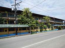
Town hall | ||
| ||
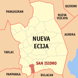 Map of Nueva Ecija showing the location of San Isidro | ||
.svg.png) San Isidro Location within the Philippines | ||
| Coordinates: 15°16′N 120°54′E / 15.267°N 120.900°ECoordinates: 15°16′N 120°54′E / 15.267°N 120.900°E | ||
| Country | Philippines | |
| Region | Central Luzon (Region III) | |
| Province | Nueva Ecija | |
| District | 4th District | |
| Barangays | 9 | |
| Government[1] | ||
| • Mayor | Cesario Lopez Jr. | |
| Area[2] | ||
| • Total | 56.49 km2 (21.81 sq mi) | |
| Population (2010)[3] | ||
| • Total | 47,800 | |
| • Density | 850/km2 (2,200/sq mi) | |
| Time zone | PST (UTC+8) | |
| ZIP code | 3106 | |
| Dialing code | +63 (0)44 | |
| Income class | 2nd class; partially urban | |


San Isidro is a second class municipality in the province of Nueva Ecija, Philippines. According to the 2010 Philippine census, it has a population of 47,800 people.[3]
The town is bounded by Gapan City to the east, the municipalities of San Leonardo and Jaen to the north, San Antonio to the west, Cabiao to the south-west, San Miguel, Bulacan, to the southeast and Candaba, Pampanga, to the south.
San Isidro became the capital of the Philippines while Emilio Aguinaldo was trying to escape from the Americans.
Barangays
San Isidro is divided into 9 barangays.[2]
- Alua
- Calaba
- Malapit
Mangga
- Poblacion
- Pulo
- San Roque
- Sto. Cristo
- Tabon
- Barangka
History
San Isidro was the capital of Nueva Ecija from 1852 to 1912.[4] In 1896, the first cry against the Spanish colonial government was made. 2,000 revolutionaries under General Mariano Llanera sieged San Isidro.[5]
In March 29, 1899, General Emilio Aguinaldo declared San Isidro as the capital of the Philippines[4] after the revolutionary capital Malolos, Bulacan was captured by the Americans; this, however, was short-lived. It was also in San Isidro that General Frederick Funston planned the capture of Aguinaldo to end the Philippine-American War. San Isidro Central School
The Wright Institute, established in 1903 in San Isidro, was the first high school established outside Manila during the American period.[5]
The town was occupied by Japanese troops in 1942, during the second world war. The combined U.S. and Philippine Commonwealth ground forces liberated San Isidro and defeated the Japanese forces in 1945 during the end of the war.
Demographics
| Population census of San Isidro | ||
|---|---|---|
| Year | Pop. | ±% p.a. |
| 1990 | 34,349 | — |
| 1995 | 36,283 | +1.03% |
| 2000 | 40,984 | +2.65% |
| 2007 | 44,687 | +1.20% |
| 2010 | 47,800 | +2.48% |
| Source: National Statistics Office[3] | ||
Images
|


References
- ↑ "Official City/Municipal 2013 Election Results". Intramuros, Manila, Philippines: Commission on Elections (COMELEC). 11 September 2013. Retrieved 21 October 2013.
- 1 2 "Province: Nueva Ecija". PSGC Interactive. Makati City, Philippines: National Statistical Coordination Board. Retrieved 21 October 2013.
- 1 2 3 "Total Population by Province, City, Municipality and Barangay: as of May 1, 2010" (PDF). 2010 Census of Population and Housing. National Statistics Office. Retrieved 2012-10-19.
- 1 2 Navasero, Mandy (29 September 2001). "Mayor Sonia Lorenzo and historic San Isidro". Philippine Daily Inquirer. Retrieved 20 January 2016.
- 1 2 "San Isidro History". Official Website of Municipal Government of San Isidro, Nueva Ecija. San Isidro, Nueva Ecija Municipal Government. Retrieved 20 January 2016.
External links
| Wikimedia Commons has media related to San Isidro, Nueva Ecija. |
| Wikisource has the text of the 1905 New International Encyclopedia article San Isidro. |
- San Isidro Ofiicial Website
- Pasyalan Nueva Ecija*
- Philippine Standard Geographic Code
- Philippine Census Information
- Local Governance Performance Management System
 |
San Antonio | Jaen | San Leonardo | |
| Cabiao | |
Gapan | ||
| ||||
| | ||||
| Candaba, Pampanga | San Miguel, Bulacan |
Palayan (capital) | |
| Municipalities | |
| Component cities | |
| Misc. | |