Morong, Bataan
| Morong | ||
|---|---|---|
| Municipality | ||
 | ||
| ||
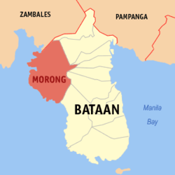 Location within Bataan province | ||
.svg.png) Morong Location within the Philippines | ||
| Coordinates: 14°41′N 120°16′E / 14.68°N 120.27°ECoordinates: 14°41′N 120°16′E / 14.68°N 120.27°E | ||
| Country | Philippines | |
| Region | Central Luzon (Region III) | |
| Province | Bataan | |
| District | 1st District of Bataan | |
| Barangays | 5 (see Barangays) | |
| Government [1] | ||
| • Type | Sangguniang Bayan | |
| • Mayor | Cynthia L. Estanislao (Liberal) | |
| • Vice Mayor | Bienvenido V. Vicedo Jr. (Liberal) | |
| Area[2] | ||
| • Total | 219.2 km2 (84.6 sq mi) | |
| Population (2015 census)[3] | ||
| • Total | 29,901 | |
| • Density | 140/km2 (350/sq mi) | |
| • Voter (2016)[4] | 18,795 | |
| Time zone | PST (UTC+8) | |
| ZIP code | 2105 | |
| IDD : area code | +63 (0)47 | |
| Income class | 3rd class | |
| PSGC | 030808000 | |

Morong, officially the Municipality of Morong (Filipino: Bayan ng Morong), is a municipality in the province of Bataan in the Central Luzon (Region III) of the Philippines. The population was 29,901 at the 2015 census.[3] In the 2016 election, it had 18,795 registered voters.[4]
The municipality is home to the Subic Bay International Airport, the Bataan Nuclear Power Plant, and the former Philippine Refugee Processing Center. Morong was formerly known as Moron.[5] It is accessible via the Bataan Provincial Expressway, off Exit 65.
History
Morong, originally called Bayandati, was a small settlement located in Barrio Nagbalayong. Due to the scarcity of land available for cultivation, the early inhabitants migrated to adjacent areas where wider lands can be discovered. They found Poblacion, the present site where the Spaniards met the natives of Moron.

The name Moron was given during the 16th century. A group of Spaniards arrived and inquired from the natives the name of their place. The natives thought that the Spaniards were asking about the Moros who retreated after a severe fighting, so they replied, Mga Moro umuurong hence the place was called Moron. Moros was a reference to the first inhabitants who bartered their products in the 16th century. In 1578, it became part of Corrigimento de Mariveles together with Bagac and Maragondon, Cavite. But it was only in 1607 that Moron was officially founded as an ecclesiastical parish and as a pueblo including the Coral Stone Church by the Recollects and was officially founded by Fr. Rodrigo de San Miguel who placed it under the protection of the Our Lady of the Pillar. The Our Lady of the Pillar Parish of Morong, erected in 1607 (one of the oldest seats of Catholic faith in the Philippines) originally orchestrated from the elements of the Gothic, Renaissance, and Baroque sources. It culminated its 400th Year foundation anniversary on October 12, 2007.[6]
On 16 January 1942, Imperial Japanese Army and an Allied coalition of Filipino-American forces both raced to capture Morong. They reached the town around the same time, but the Allies had detected the Japanese first. Taking the opportunity for a surprise attack, Lieutenant Edwin P. Ramsey of the 26th Cavalry Regiment ordered his troops to charge; the 27 heavily outnumbered Filipino and American cavalrymen charged and scattered the surprised Japanese. It was the last charge of American cavalry.[7]
Geography
Morong is located at 14°41′N 120°16′E / 14.68°N 120.27°E.
According to the Philippine Statistics Authority, the municipality has a land area of 219.2 square kilometres (84.6 sq mi)[2] constituting 15.97% of the 1,372.98-square-kilometre- (530.11 sq mi) total area of Bataan.
Barangays
Morong is politically subdivided into 5 barangays.[8]
| PSGC | Barangay | Population | ±% p.a. | ||
|---|---|---|---|---|---|
| 2015[3] | 2010[9] | ||||
| 030808001 | Binaritan | 20.0% | 5,966 | 5,273 | +2.38% |
| 030808002 | Mabayo | 16.0% | 4,771 | 4,275 | +2.11% |
| 030808003 | Nagbalayong | 20.8% | 6,207 | 5,680 | +1.70% |
| 030808004 | Poblacion | 18.4% | 5,511 | 5,105 | +1.47% |
| 030808005 | Sabang | 24.9% | 7,446 | 5,838 | +4.74% |
| Total | 29,901 | 26,171 | +2.57% | ||
Demographics
| Population census of Morong | |||||||||||||||||||||||||
|---|---|---|---|---|---|---|---|---|---|---|---|---|---|---|---|---|---|---|---|---|---|---|---|---|---|
|
| ||||||||||||||||||||||||
| Source: PSA[3][9][10] | |||||||||||||||||||||||||
In the 2015 census, Morong had a population of 29,901.[3] The population density was 140 inhabitants per square kilometre (360/sq mi).
In the 2016 election, it had 18,795 registered voters.[4]
Gallery
-

Municipal hall
-

Public market
-

Morong landscape
-

Seascape
-

Park and covered court
References
- ↑ "Municipality". Quezon City, Philippines: Department of the Interior and Local Government. Retrieved 31 May 2013.
- 1 2 "Province: Bataan". PSGC Interactive. Makati City, Philippines: Philippine Statistics Authority. Retrieved 21 November 2016.
- 1 2 3 4 5 "Region III (CENTRAL LUZON)". Census of Population (2015): Total Population by Province, City, Municipality and Barangay (Report). PSA. Retrieved 20 June 2016.
- 1 2 3 "2016 National and Local Elections Statistics". Commission on Elections. 2016.
- ↑ "Republic Act No. 1249; An Act Changing the Name of the Municipality of Moron, Province of Bataan, to Morong". LawPH.com. Archived from the original on 3 May 2012. Retrieved 6 December 2016.
- ↑ "History of Morong, Bataan". visitmorong.com. Retrieved 10 December 2014.
- ↑ Steve Shaw (4 September 2008). "The Last U.S. Cavalry Charge". Parting Shot. Western Shooting Horse Magazine. Retrieved 22 October 2009.
- ↑ "Municipal: Morong, Bataan". PSA. Philippines: National Statistical Coordination Board. Retrieved 8 January 2016.
- 1 2 "Region III (CENTRAL LUZON)". Census of Population and Housing (2010): Total Population by Province, City, Municipality and Barangay (Report). NSO. Retrieved 29 June 2016.
- ↑ "Region III (CENTRAL LUZON)". Census of Population (1995, 2000 and 2007): Total Population by Province, City and Municipality (Report). NSO. Archived from the original on 24 June 2011.
External links
| Wikimedia Commons has media related to Morong, Bataan. |
 |
Subic Bay | Olongapo (Zambales) | Dinalupihan | |
| South China Sea | |
Hermosa Orani Samal Abucay Balanga | ||
| ||||
| | ||||
| Bagac Bay | Bagac |
Balanga (capital) | |
| Municipalities | |
| Component city | |