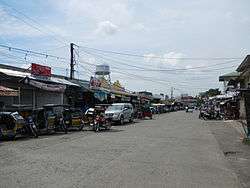
Peñaranda, Nueva Ecija
| Peñaranda | ||
|---|---|---|
| Municipality | ||
 | ||
| ||
 Map of Nueva Ecija showing the location of Peñaranda | ||
.svg.png) Peñaranda Location within the Philippines | ||
| Coordinates: 15°21′N 121°00′E / 15.350°N 121.000°ECoordinates: 15°21′N 121°00′E / 15.350°N 121.000°E | ||
| Country | Philippines | |
| Region | Central Luzon (Region III) | |
| Province | Nueva Ecija | |
| District | 4th District | |
| Barangays | 10 | |
| Government[1] | ||
| • Mayor | Ferdinand R. Abesamis | |
| Area[2] | ||
| • Total | 95.00 km2 (36.68 sq mi) | |
| Population (2010)[3] | ||
| • Total | 27,410 | |
| • Density | 290/km2 (750/sq mi) | |
| Time zone | PST (UTC+8) | |
| ZIP code | 3103 | |
| Dialing code | 44 | |
| Income class | 4th class; rural | |

Peñaranda is a fourth class municipality in the province of Nueva Ecija, Philippines. According to the 2010 census, it has a population of 27,410 people.[3]
It is bordered by municipalities of General Tinio and San Leonardo and the city of Gapan.
The area was originally called Mapisong, and it was a part of the municipality of Gapan. The area was organized into a municipality by José Maria Peñaranda, a Spanish engineer, and subsequently named after him.
Peñaranda was once known for its high quality crop called ikmo, a plant used by older Filipinos as a chewing substance. Recently however, the crop is on the brink of extinction. Rice remains a flourishing farm produce.
Barangays
Peñaranda is politically subdivided into 10 barangays.[2]
- Callos
- Las Piñas
- Poblacion I
- Poblacion II
- Poblacion III
- Poblacion IV
- Santo Tomas
- Sinasajan
- San Josef
- San Mariano (Maugat)
History
World War II
In December 1941, Japanese fighter and bomber planes were found invading the town municipalities of Peñaranda during the Japanese Invasion. In 1942, the Japanese Occupation forces entered Peñaranda, Nueva Ecija. Military general headquarters, garrisons and concentration camps of the Imperial Japanese Armed Forces were built and established in the town municipality.
In 1942 to 1945, the Hukbalahap Communist group and local guerrilla groups ambushed the municipal town in Peñaranda and attacked the Japanese. However, the guerrillas and Hukbalahap Communists groups were unsuccessful and they retreated from the Japanese. Upon the arrival of the local Filipino troops and officers of the Philippine Commonwealth Army units, the municipal town was liberated from the Japanese forces.
In 1945, entering to the Philippine Commonwealth Army troops of the 2nd, 21st, 22nd, 23rd, 25th and 26th Infantry Division of the Philippine Army took in Peñaranda, Nueva Ecija together with the local recognized guerrilla units and Hukbalahap Communist fighters we fronted the battles against the Japanese troops by defeated from successful to the Philippine troops and recognized guerrillas beginning the Invasion of Peñaranda during World War II.
Demographics
| Population census of Peñaranda | ||
|---|---|---|
| Year | Pop. | ±% p.a. |
| 1990 | 20,500 | — |
| 1995 | 22,661 | +1.90% |
| 2000 | 24,749 | +1.91% |
| 2007 | 26,725 | +1.07% |
| 2010 | 27,410 | +0.93% |
| Source: National Statistics Office[3] | ||
Events
Every May, Peñaranda residents stage a musical drama called "Araquio", a re-enactment of Christians' quest led by Queen Helena and King Constantine for the Holy Cross where Jesus Christ was nailed. Actors and actresses garbed in colorful and cute costumes dramatize this century old tradition which features sword fights between the Christians and Moors.
Peñaranda is also known for its mouth-watering, native rice cakes such as espasol, putong puti and sapin-sapin .
Images
 Welcome marker
 Town hall, seat of the Government
 Nueva Ecija University of Science and Technology
 Sto. Tomas Elementary School
 Parish of St. Francis of Assissi
 Park of the Church
References
- ↑ "Official City/Municipal 2013 Election Results". Intramuros, Manila, Philippines: Commission on Elections (COMELEC). 11 September 2013. Retrieved 21 October 2013.
- 1 2 "Province: Nueva Ecija". PSGC Interactive. Makati City, Philippines: National Statistical Coordination Board. Retrieved 21 October 2013.
- 1 2 3 "Total Population by Province, City, Municipality and Barangay: as of May 1, 2010" (PDF). 2010 Census of Population and Housing. National Statistics Office. Retrieved 2012-10-19.
External links
| Wikimedia Commons has media related to Peñaranda, Nueva Ecija. |
- Pasyalan Nueva Ecija
- Philippine Standard Geographic Code
- Philippine Census Information
- Local Governance Performance Management System
 |
Santa Rosa | | ||
| San Leonardo | |
General Tinio | ||
| ||||
| | ||||
| Gapan |
Palayan (capital) | |
| Municipalities | |
| Component cities | |
| Misc. | |