Saint-Servais, Finistère
| Saint-Servais Sant-Servez-Landivizio | |
|---|---|
|
Parish close | |
 Saint-Servais | |
|
Location within Brittany region  Saint-Servais | |
| Coordinates: 48°30′42″N 4°09′13″W / 48.5117°N 4.1536°WCoordinates: 48°30′42″N 4°09′13″W / 48.5117°N 4.1536°W | |
| Country | France |
| Region | Brittany |
| Department | Finistère |
| Arrondissement | Morlaix |
| Canton | Landivisiau |
| Intercommunality | Pays de Landivisiau |
| Government | |
| • Mayor (2014–2020) | Bernard Michel |
| Area1 | 10.29 km2 (3.97 sq mi) |
| Population (2008)2 | 615 |
| • Density | 60/km2 (150/sq mi) |
| Time zone | CET (UTC+1) |
| • Summer (DST) | CEST (UTC+2) |
| INSEE/Postal code | 29264 / 29400 |
| Elevation | 23–116 m (75–381 ft) |
|
1 French Land Register data, which excludes lakes, ponds, glaciers > 1 km² (0.386 sq mi or 247 acres) and river estuaries. 2 Population without double counting: residents of multiple communes (e.g., students and military personnel) only counted once. | |

Saint-Servais (Breton: Sant-Servez-Landivizio) is a commune in the Finistère department of Brittany in north-western France.
See also
References
- Mayors of Finistère Association (French)
External links
| Wikimedia Commons has media related to Saint-Servais (Finistère). |
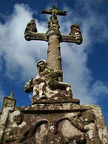
The calvary
This article is issued from Wikipedia - version of the 1/3/2016. The text is available under the Creative Commons Attribution/Share Alike but additional terms may apply for the media files.