Guengat
| Guengat Gwengad | ||
|---|---|---|
|
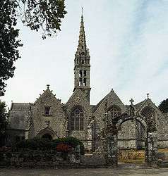
The church in Guengat | ||
| ||
 Guengat | ||
|
Location within Brittany region  Guengat | ||
| Coordinates: 48°02′33″N 4°12′15″W / 48.0425°N 4.2042°WCoordinates: 48°02′33″N 4°12′15″W / 48.0425°N 4.2042°W | ||
| Country | France | |
| Region | Brittany | |
| Department | Finistère | |
| Arrondissement | Quimper | |
| Canton | Douarnenez | |
| Intercommunality | Quimper-Communauté | |
| Government | ||
| • Mayor (2014–2020) | Youenn Le Guélaff | |
| Area1 | 22.72 km2 (8.77 sq mi) | |
| Population (2008)2 | 1,651 | |
| • Density | 73/km2 (190/sq mi) | |
| Time zone | CET (UTC+1) | |
| • Summer (DST) | CEST (UTC+2) | |
| INSEE/Postal code | 29066 / 29180 | |
| Elevation | 7–162 m (23–531 ft) | |
|
1 French Land Register data, which excludes lakes, ponds, glaciers > 1 km² (0.386 sq mi or 247 acres) and river estuaries. 2 Population without double counting: residents of multiple communes (e.g., students and military personnel) only counted once. | ||
.svg.png)
Guengat (Breton: Gwengad) is a commune in the Finistère department of Brittany in northwestern France.
Population
Inhabitants of Guengat are called in French Guengatais.
See also
References
- Mayors of Finistère Association (French);
External links
| Wikimedia Commons has media related to Guengat. |
This article is issued from Wikipedia - version of the 3/15/2016. The text is available under the Creative Commons Attribution/Share Alike but additional terms may apply for the media files.