Plouguin
| Plouguin Plougin | ||
|---|---|---|
|
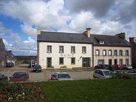
The town hall in Plouguin | ||
| ||
 Plouguin | ||
|
Location within Brittany region  Plouguin | ||
| Coordinates: 48°31′31″N 4°36′00″W / 48.5253°N 4.6000°WCoordinates: 48°31′31″N 4°36′00″W / 48.5253°N 4.6000°W | ||
| Country | France | |
| Region | Brittany | |
| Department | Finistère | |
| Arrondissement | Brest | |
| Canton | Ploudalmézeau | |
| Intercommunality | Plabennec et des Abers | |
| Government | ||
| • Mayor (2014–2020) | Roger Talarmain | |
| Area1 | 31.02 km2 (11.98 sq mi) | |
| Population (2008)2 | 2,074 | |
| • Density | 67/km2 (170/sq mi) | |
| Time zone | CET (UTC+1) | |
| • Summer (DST) | CEST (UTC+2) | |
| INSEE/Postal code | 29196 / 29830 | |
| Elevation | 0–82 m (0–269 ft) | |
|
1 French Land Register data, which excludes lakes, ponds, glaciers > 1 km² (0.386 sq mi or 247 acres) and river estuaries. 2 Population without double counting: residents of multiple communes (e.g., students and military personnel) only counted once. | ||

Plouguin (Plougin in Breton) is a commune in the Finistère department of Brittany in north-western France.
It lies 20 km (12 mi) northwest of Brest, about 7 km (4.3 mi) from the English Channel in the far west of the Leon peninsula.
Population
Inhabitants of Plouguin are called in French Plouguinois.
Saint Winwaloe
Plouguin is considered to have been (about 460) the birthplace of Saint Winwaloe, and his supposed place of birth, a feudal hillock, is still pointed out.
International relations
Plouguin is twinned with the town of Newport in Pembrokeshire, Wales.
See also
References
- INSEE
- Mayors of Finistère Association (French)
External links
| Wikimedia Commons has media related to Plouguin. |
- Official website
- French Ministry of Culture list for Plouguin (French)
- Plouguin Website (French)
This article is issued from Wikipedia - version of the 2/12/2016. The text is available under the Creative Commons Attribution/Share Alike but additional terms may apply for the media files.