Lopérec
| Lopérec Lopereg | |
|---|---|
|
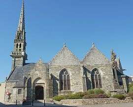
The parish church in Lopérec | |
 Lopérec | |
|
Location within Brittany region  Lopérec | |
| Coordinates: 48°16′41″N 4°02′46″W / 48.2781°N 4.0461°WCoordinates: 48°16′41″N 4°02′46″W / 48.2781°N 4.0461°W | |
| Country | France |
| Region | Brittany |
| Department | Finistère |
| Arrondissement | Châteaulin |
| Canton | Carhaix-Plouguer |
| Intercommunality | Yeun Elez |
| Government | |
| • Mayor (2014–2020) | Jean-Yves Crenn |
| Area1 | 39.49 km2 (15.25 sq mi) |
| Population (2008)2 | 804 |
| • Density | 20/km2 (53/sq mi) |
| Time zone | CET (UTC+1) |
| • Summer (DST) | CEST (UTC+2) |
| INSEE/Postal code | 29139 / 29590 |
| Elevation | 11–316 m (36–1,037 ft) |
|
1 French Land Register data, which excludes lakes, ponds, glaciers > 1 km² (0.386 sq mi or 247 acres) and river estuaries. 2 Population without double counting: residents of multiple communes (e.g., students and military personnel) only counted once. | |
Lopérec (Breton: Lopereg) is a commune in the Finistère department of Brittany in north-western France. It is in the canton of Carhaix-Plouguer in the arrondissement of Châteaulin.[1] Lopérec is located within the Parc naturel régional d'Armorique.
Population
Inhabitants of Lopérec are called Lopérécois in French.
| Historical population | ||
|---|---|---|
| Year | Pop. | ±% |
| 1793 | 2,118 | — |
| 1800 | 1,588 | −25.0% |
| 1821 | 1,826 | +15.0% |
| 1831 | 1,897 | +3.9% |
| 1836 | 2,030 | +7.0% |
| 1841 | 2,056 | +1.3% |
| 1846 | 2,101 | +2.2% |
| 1851 | 2,062 | −1.9% |
| 1856 | 1,938 | −6.0% |
| 1861 | 1,893 | −2.3% |
| 1866 | 2,016 | +6.5% |
| 1872 | 1,902 | −5.7% |
| 1876 | 1,899 | −0.2% |
| 1881 | 1,885 | −0.7% |
| 1886 | 1,875 | −0.5% |
| 1891 | 1,892 | +0.9% |
| 1896 | 1,757 | −7.1% |
| 1901 | 1,803 | +2.6% |
| 1906 | 1,845 | +2.3% |
| 1911 | 1,778 | −3.6% |
| 1921 | 1,661 | −6.6% |
| 1926 | 1,640 | −1.3% |
| 1931 | 1,522 | −7.2% |
| 1936 | 1,411 | −7.3% |
| 1946 | 1,337 | −5.2% |
| 1954 | 1,210 | −9.5% |
| 1962 | 1,082 | −10.6% |
| 1968 | 943 | −12.8% |
| 1975 | 769 | −18.5% |
| 1982 | 674 | −12.4% |
| 1990 | 723 | +7.3% |
| 1999 | 714 | −1.2% |
| 2008 | 804 | +12.6% |
See also
References
- ↑ "Commune de Lopérec". INSEE. Retrieved 10 April 2016.
- Mayors of Finistère Association (French);
External links
- Official website (French)
- French Ministry of Culture list for Lopérec (French)
| Wikimedia Commons has media related to Lopérec. |
This article is issued from Wikipedia - version of the 4/10/2016. The text is available under the Creative Commons Attribution/Share Alike but additional terms may apply for the media files.