Sơn Động District
| Son Dong District Huyện Sơn Động | |
|---|---|
| Rural district | |
| Country |
|
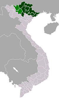
| Province | Bắc Giang |
| Capital | An Châu |
| Area | |
| • Total | 326 sq mi (844 km2) |
| Population | |
| • Total | 70,629 |
| Time zone | UTC + 7 (UTC+7) |
Sơn Động District is a rural district of Bắc Giang Province in the northeast region of Vietnam. As of 2003 the district had a population of 70,629.[1] The district covers an area of 844 km². The district capital lies at An Châu.[1] There are some cultural sites here such as: Chẽ pagoda, Female King temple, Lục Liễu temple, Đặng temple and Chẽ temple.
Administrative divisions
The district is divided administratively into two townships, An Châu (the capital) and Thanh Sơn and the communes of Hữu Sản, An Lạc, Vân Sơn, Lệ Viễn, Vĩnh Khương, An Lập, Dương Hưu, Long Sơn, An Châu, An Bá, Yên Định, Tuấn Đạo, Bồng Am, Thanh Luận, Cẩm Đàn, Giáo Liêm, Chiên Sơn, Quế Sơn, Phúc Thắng, Thạch Sơn, Tuấn Mậu.
References
- 1 2 "Districts of Vietnam". Statoids. Retrieved March 13, 2009.
Coordinates: 21°20′00″N 106°51′00″E / 21.3333°N 106.8500°E
This article is issued from Wikipedia - version of the 9/24/2016. The text is available under the Creative Commons Attribution/Share Alike but additional terms may apply for the media files.