Sa Pa District
| Sa Pa District Huyện Sa Pa | |
|---|---|
| Rural district | |
|
Sa Pa Mountains | |
| Country |
|
| Region | Northeast |
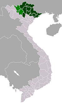
| Province | Lào Cai |
| Capital | Sa Pa |
| Area | |
| • Total | 261 sq mi (677 km2) |
| Population (2003) | |
| • Total | 42,095 |
| Time zone | UTC + 7 (UTC+7) |

Sa Pa (![]() listen) is a rural district of Lào Cai Province in the Northeast region of Vietnam. As of 2003, the district had a population of 42,095.[1] The district covers an area of 677 km². The district capital lies at Sa Pa.[1]
listen) is a rural district of Lào Cai Province in the Northeast region of Vietnam. As of 2003, the district had a population of 42,095.[1] The district covers an area of 677 km². The district capital lies at Sa Pa.[1]
Administrative divisions
Sa Pa contains the city (thị trấn) of Sa Pa and the communes of Hầu Thào, Bản Phùng, Tả Phìn, Nậm Sài, Thanh Phú, Sa Pả, Lao Chải, Trung Chải, San Sả Hồ, Thanh Kim, Bản Hồ, Sử Pán, Suối Thầu, Tả Van, Bản Khoang, Tả Giàng Phình and Nậm Cang.
References
- 1 2 "Districts of Vietnam". Statoids. Retrieved March 23, 2009.
Coordinates: 22°20′26″N 103°49′51″E / 22.34056°N 103.83083°E
This article is issued from Wikipedia - version of the 10/8/2015. The text is available under the Creative Commons Attribution/Share Alike but additional terms may apply for the media files.