Mường Khương District
| Mường Khương District Huyện Mường Khương | |
|---|---|
| Rural district | |
| Country |
|
| Region | Northeast |
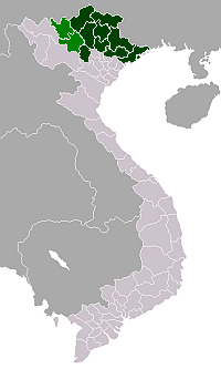
| Province | Lào Cai |
| Capital | Mường Khương |
| Area | |
| • Total | 213 sq mi (552 km2) |
| Population (2003) | |
| • Total | 48,242 |
| Time zone | UTC + 7 (UTC+7) |
Mường Khương is a rural district of Lào Cai Province in the Northeast region of Vietnam. Mường is as variation of Mueang. As of 2003, the district had a population of 48,242.[1] The district covers an area of 552 km². The district capital lies at Mường Khương.[1]
Administrative divisions
Mường Khương, Lào Ca, Cao Sơn, Bản Lầu, Nậm Chảy, Tung Chung Phố, Tả Gia Khâu, Pha Long, Dìn Chin, Tả Ngải Chồ, Thanh Bình, Bản Sen, Lùng Khấu Nhin, La Pan Tẩn, Nấm Lư, Tả Thàng, Lùng Vai. Mường is a variation of Mueang.
References
- 1 2 "Districts of Vietnam". Statoids. Retrieved March 23, 2009.
Coordinates: 22°40′01″N 104°04′59″E / 22.667°N 104.083°E
This article is issued from Wikipedia - version of the 10/24/2015. The text is available under the Creative Commons Attribution/Share Alike but additional terms may apply for the media files.