Nghĩa Lộ
| Nghĩa Lộ Thị xã Nghĩa Lộ | |
|---|---|
| Town | |
 | |
 Nghĩa Lộ | |
| Coordinates: 21°34′33″N 104°31′9″E / 21.57583°N 104.51917°ECoordinates: 21°34′33″N 104°31′9″E / 21.57583°N 104.51917°E | |
| Country |
|
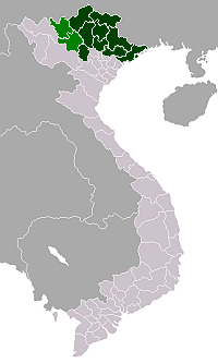
| Region | north-east |
| Province | Yên Bái |
| Area | |
| • Town | 11.4 sq mi (29.6 km2) |
| Population (2009) | |
| • Town | 27,336 |
| • Density | 2,390/sq mi (921/km2) |
| • Urban | 19,111 |
| Time zone | UTC + 7 (UTC+7) |
Nghĩa Lộ is a town in Yên Bái Province, in the north-east region of Vietnam.
In 1951, the Viet Minh 312 Division fought French forces in the area as part of the First Indochina War.
As of 2003 the district had a population of 25,256.[1] The district covers an area of 29 km².[1]
References
![]() Media related to Nghĩa Lộ at Wikimedia Commons
Media related to Nghĩa Lộ at Wikimedia Commons
- 1 2 "Districts of Vietnam". Statoids. Retrieved March 23, 2009.
This article is issued from Wikipedia - version of the 9/24/2016. The text is available under the Creative Commons Attribution/Share Alike but additional terms may apply for the media files.