Newport, Pembrokeshire
| Newport | |
| Welsh: Trefdraeth | |
 Newport and Nevern estuary |
|
 Newport |
|
| Population | 1,161 (2011 census[1] |
|---|---|
| OS grid reference | SN055395 |
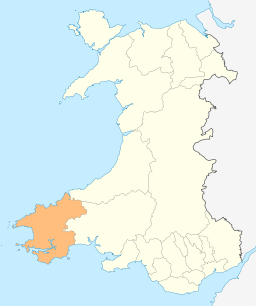
| Principal area | Pembrokeshire |
| Ceremonial county | Dyfed |
| Country | Wales |
| Sovereign state | United Kingdom |
| Post town | NEWPORT |
| Postcode district | SA42 |
| Dialling code | 01239 |
| Police | Dyfed-Powys |
| Fire | Mid and West Wales |
| Ambulance | Welsh |
| EU Parliament | Wales |
| UK Parliament | Preseli Pembrokeshire |
|
|
Coordinates: 52°01′11″N 4°50′10″W / 52.01975°N 4.83607°W
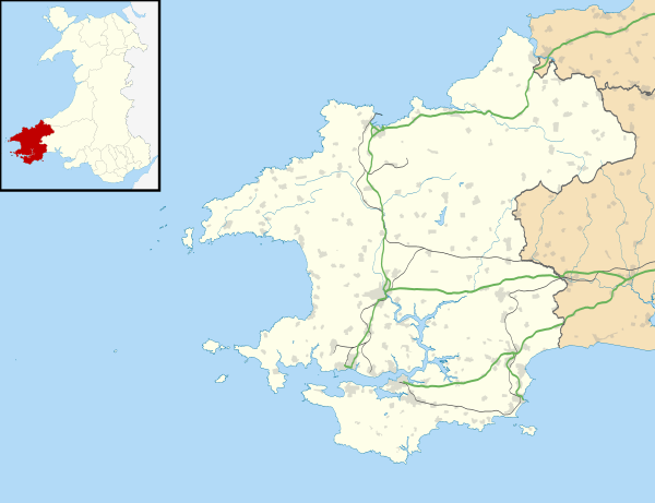
Newport (Welsh: Trefdraeth, meaning: "town by the beach") is a community, town and ancient port (Parrog) on the Pembrokeshire coast in south-west Wales, at the mouth of the River Nevern (Welsh: Afon Nyfer) in the Pembrokeshire Coast National Park.
A popular tourist destination, Newport town straddles the A487 Fishguard to Cardigan road, while the old port area hosts many beach, water and other activities.
Newport is twinned with the village of Plouguin in Finistère, Brittany and Annapolis, Maryland, USA.
History
The town was founded by the Norman William FitzMartin (c.1155-1209) in about 1197. He was a son-in-law of the Lord Rhys, who nevertheless expelled him from his former base at nearby Nevern, which had been established by his father Robert fitz Martin. William founded Newport as the new capital of the Marcher Lordship of Cemais and it was a busy port founded primarily on the growing medieval wool trade. Despite seizure from the native Welsh, it remained within the FitzMartin family until the death of William, the 2nd Lord Martin, who died without male heir in 1326.
Newport is a marcher borough. George Owen of Henllys, in 1603, described it as one of five Pembrokeshire boroughs overseen by a portreeve.[2] It retains some of the borough customs such as electing a mayor, who beats the bounds on horseback every August.
.jpg)
The castle built by FitzMartin is situated on a spur of Carn Ingli which overlooks Newport and much of the surrounding countryside. Though in ruins since at least the 17th century, it is impressive due to its site, and a converted house incorporating the castle walls which faces west over the town, the bay and the Irish Sea is still inhabited.
In the 1880s the castle was associated with John Brett, who rented it for his large family while he spent summers cruising the south and west coasts of Wales painting, sketching and photographing. He moored his 210-ton schooner, Viking (which had a crew of twelve) at Parrog. A lifeboat station (now a private residence) was operated from a beach known as The Cwm to the west of Parrog in the early 20th century.[3]
Amenities
Town
Newport town has a compact but varied shopping centre with most facilities including bank, post office, a wide range of retail premises and ancient buildings including the castle, not presently (2014) open to the public, which is undergoing restoration work.
Parrog

The old port area contains much of historic interest, including some of the old quay walls and two former lime kilns. As well as other activities there are moorings for small craft and a number of holiday lets and eating places. It is possible, with caution, to cross the river on foot at low tide.[4][5]
Parrog has two beaches, a golf course, a windsurfing and dinghy sailing club, pubs, hotels and camping grounds.
Worship
.jpg)
The church of St Mary's, situated below the castle though within the town, dates from the FitzMartin era, and the outside east apse bears their arms ("Argent, two bars gules"). The church was the subject of a 1860 photograph by notable early Welsh photographer John Thomas (1838–1905).[6]
Other religious buildings include Bethlehem Chapel and the Tabernacle Chapel.
Hostelries
.jpg)
The town's hostelries include Llwyngwair Arms in the centre of town and Cnapan Hotel, a Georgian hotel and restaurant.
Sailing
Newport Sailing Club is housed in an old warehouse. As well as facilities for members, it has a non-members' bar.
Walking
Newport is situated on the Pembrokeshire Coast Path, part of the Wales Coast Path, has a youth hostel and is popular for walks in the Preseli Hills. Carn Ingli hill, an Iron Age hillfort with Bronze Age hut circles, lies just outside the town. Nearby are the Carreg Coetan Arthur burial chamber and the West Wales Eco Centre.
A little to the north of Newport lie Newport Cliffs, a Site of Special Scientific Interest managed by Natural Resources Wales.
Notable people

- James Bevan Bowen (MP), of Llwyngwair, Newport, was High Sheriff of Pembrokeshire in 1862
- William Edward Cheverton, Saloon Steward on the Titanic.
- John Grono, (c.1767- 4 May 1847), settler, sailor, ship builder, ship captain, sealer, whaler and farmer, born in Newport, died in Australia.
- Robert FitzMartin, (c. 10??-c. 1159), Norman knight and first Lord of Cemais, founded the Newport Castle.
- Dillwyn Miles (1915-2007), writer and teacher, was born in Newport.
- John Seymour, (12 June 1914 – 14 September 2004), author, lived at a farm near Newport between 1963 and 1980.
- The Incredible String Band, psychedelic folk band, formed in 1966, lived communally at a farmhouse near Newport 1969 - 1970.
See also
References
- ↑ "Community and Ward population 2011". Retrieved 20 April 2015.
- ↑ Owen, George (1892). The Description of Pembrokeshire by George Owen of Henllys Lord of Kemes (Henry Owen, Ed.). London.
- ↑ "The Cwm". Retrieved 16 June 2014.
- ↑ "Visit Pembrokeshire: Newport Parrog Beach". Retrieved 5 Apr 2014.
- ↑ "Newport Parrog". Retrieved 5 Apr 2014.
- ↑
Other sources
- The Lords of Cemais, Dillwyn Miles, Haverfordwest, 1996.
- Cemais, Dillwyn Miles, Haverfordwest, 1998.
- Echoes and Shadows: tales and traditions of Newport and Nevern, Brian John, Newport, 2008.
- Carningli: land and people, Brian John, Newport, 2008.

External links
| Wikimedia Commons has media related to Newport, Pembrokeshire. |
| Wikivoyage has a travel guide for Trefdraeth. |
| Wikivoyage has a travel guide for Newport (Pembrokeshire). |
- Local and Tourists Guide to Newport Pembrokeshire
- Newport Pembrokeshire Official Council website latest access date 18 Jan 2014
- www.geograph.co.uk : photos of Newport, Pembs and surrounding area
- Historical information and sources on GENUKI
- Old photographs of Newport (People's Collection Wales)
- Newport: Visit Wales