Pennyroyal, Victoria
| Pennyroyal Victoria | |||||||||||||
|---|---|---|---|---|---|---|---|---|---|---|---|---|---|
 Pennyroyal | |||||||||||||
| Coordinates | 38°26′35″S 143°52′34″E / 38.44306°S 143.87611°ECoordinates: 38°26′35″S 143°52′34″E / 38.44306°S 143.87611°E | ||||||||||||
| Postcode(s) | 3235 | ||||||||||||
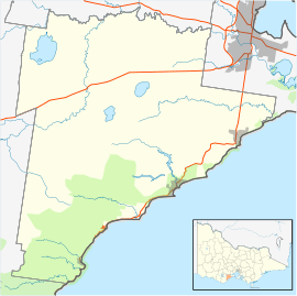
| Location | |||||||||||||
| LGA(s) | |||||||||||||
| State electorate(s) | Polwarth | ||||||||||||
| Federal Division(s) | Corangamite | ||||||||||||
| |||||||||||||
Pennyroyal is a rural locality in Victoria, Australia. Most of the locality is situated in the Surf Coast Shire; a small section is situated in the Shire of Colac Otway.[1][2] In the 2011 census, the population of Pennyroyal was too low to separately report; however in June 2014 the Victorian Electoral Commission recorded 72 enrolled voters in Pennyroyal, living in 44 properties.[3][4] It was probably named in 1841 by Simeon Madden, after the plant that grew by Pennyroyal Creek.[5]
Pennyroyal is a small rural locality; while it once had a post office, church, school, and railway station for carting local produce, these have long since closed. Pennyroyal Creek Post Office opened on 15 August 1887 and closed on 14 January 1955.[6] St Michael's Church of England opened in 1885 and closed in 1950. Penny Royal Creek State School (No. 1204) opened in 1873, moved to a new site in 1916, and closed in 1982. The Birregurra-Forrest railway line opened in 1891; a station called "Arlett's Corner" opened with the line and was renamed Pennyroyal in September that year.[7][8] The line closed in 1957.[9] The Pennyroyal Public Hall opened in 1912, and survives to the present day.[10][11]
Pennyroyal is located in a lush valley, and is now known for tourism and dairy and berry farming. It has two berry farms which are open to the public,each has a seasonal cafe,one also provides B&B accommodation and there are a number of holiday cottages, conference centres and camps in the area. The Penny Royal Creek Bushland Reserve is located in Pennyroyal, and the locality also adjoins the Otway Forest Park and Great Otway National Park.[12][13]
References
- ↑ "Pennyroyal (entry 102465)". VICNAMES. Government of Victoria. Retrieved 19 June 2014.
- ↑ "Pennyroyal (entry 102464)". VICNAMES. Government of Victoria. Retrieved 19 June 2014.
- ↑ "2011 Census QuickStats: Deans Marsh". Australian Bureau of Statistics. Retrieved 10 July 2014.
- ↑ "Locality Finder" (PDF). Victorian Electoral Commission. 16 June 2014. Retrieved 10 July 2014.
- ↑ "Pennyroyal". Prahran Mechanics' Institute. Retrieved 19 June 2014.
- ↑ Premier Postal History. "Post Office List". Premier Postal Auctions. Retrieved 19 June 2014.
- ↑ "The Otway Forest Railway Line". The Colac Herald. 9 June 1891. Retrieved 19 June 2014.
- ↑ "Notes and events". The Colac Herald. 15 September 1891. Retrieved 19 June 2014.
- ↑ "Birregurra - Forrest 'Tiger' Rail Trail". railtrails.org.au. Retrieved 19 June 2014.
- ↑ "Pennyroyal - Parish of Bambra". Rootsweb. Retrieved 19 June 2014.
- ↑ "Community Funding Program distributes $117,500". Shire of Colac Otway. Retrieved 19 June 2014.
- ↑ "Pennyroyal Valley". Victoria For Everyone. Retrieved 19 June 2014.
- ↑ "Penny Royal Creek Bushland Reserve". Parks Victoria. Retrieved 19 June 2014.