Shire of Colac Otway
| Shire of Colac Otway Victoria | |||||||||||||
|---|---|---|---|---|---|---|---|---|---|---|---|---|---|
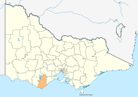 Location in Victoria | |||||||||||||
| Population | 20,255 (2015 est)[1] | ||||||||||||
| • Density | 5.9001/km2 (15.2812/sq mi) | ||||||||||||
| Established | 1994 | ||||||||||||
| Gazetted | 23 September 1994[2] | ||||||||||||
| Area | 3,433 km2 (1,325.5 sq mi) | ||||||||||||
| Mayor | Cr Lyn Russell | ||||||||||||
| Council seat | Colac | ||||||||||||
| Region | Barwon South West | ||||||||||||
| State electorate(s) | Polwarth | ||||||||||||
| Federal Division(s) | Corangamite | ||||||||||||
|
| |||||||||||||
| Website | Shire of Colac Otway | ||||||||||||
| |||||||||||||
The Shire of Colac Otway is a local government area in the Barwon South West region of Victoria, Australia, located in the south-western part of the state. It covers an area of 3,433 square kilometres (1,325 sq mi) and, at the 2011 Census, had a population of 20,345.[3] It includes the towns of Apollo Bay, Beeac, Beech Forest, Birregurra, Colac, Cressy, Forrest, Johanna, Kennett River, Lavers Hill, Warrion and Wye River. It was formed in 1994 from the amalgamation of the City of Colac, Shire of Colac, Shire of Otway and part of the Shire of Heytesbury.[2]
The Shire is governed and administered by the Colac Otway Shire Council; its seat of local government and administrative centre is located at the council headquarters in Colac, it also has a service centre located in Apollo Bay. The Shire is named after the combination of the names for the former City of Colac, and Shires of Colac and Otway, of which the majority of the LGA was formed from. The name Colac is used for both the main urban settlement and the lake, Lake Colac, which are located in the north-centre of the LGA. Colac is also the most populous urban centre in the LGA with a population of 11,415.[4] The name Otways is used for the major geographical features located in the south of the LGA, which are The Otways and Cape Otway.
Council
Current composition
The council is composed of seven councillors elected to represent an unsubdivided municipality.[5]
| Ward | Councillor | Notes | |
|---|---|---|---|
| Unsubdivided | Brian Crook | ||
| Michael Delahunty | |||
| Stephen Hart[6] | |||
| Frank Buchanan | |||
| Lyn Russell | Mayor (2013–14) | ||
| Chris Smith | |||
| Terry Woodcroft | |||
Former Wards (1996–2008)
- Colac – had three councillors
- Murray – had one councillor
- Otway – had one councillor
- Warrion – had one councillor
Administration and governance
The council meets in the council chambers at the council headquarters in the Colac Municipal Offices, which is also the location of the council's administrative activities. It also provides customer services at both its administrative centre in Colac, and its service centre in Apollo Bay.
Localities
Localities which encompass the Shire of Colac Otway include:
|
|
|
|
References
- ↑ "3218.0 – Regional Population Growth, Australia, 2014–15". Australian Bureau of Statistics. Retrieved 29 September 2016.
- 1 2 Victoria Government Gazette – Online Archive (1837–1997). "S63 of 1994". State Library of Victoria. State Government of Victoria (published 23 September 1994). p. 3. Retrieved 10 January 2014.
|article=ignored (help) - ↑ Census QuickStats (2011). "Colac-Otway (S) – LGA21750". Australian Bureau of Statistics. Government of Australia. Retrieved 10 January 2014.
- ↑ Census QuickStats (2011). "Colac (UCL) – UCL213003". Australian Bureau of Statistics. Government of Australia. Retrieved 10 January 2014.
- ↑ Local Government in Victoria. "Colac Otway Shire Council". Department of Transport, Planning and Local Infrastructure. State Government of Victoria. Retrieved 10 January 2014.
- ↑ http://greens.org.au/vic/representatives
External links
![]() Media related to Shire of Colac Otway at Wikimedia Commons
Media related to Shire of Colac Otway at Wikimedia Commons
- Colac Otway Shire Council official website
- Colac Otway Web – Regional Web Site
- Metlink local public transport map
- Link to Land Victoria interactive maps
Coordinates: 38°20′00″S 143°35′00″E / 38.33333°S 143.58333°E