Ombersley, Victoria
| Ombersley Victoria | |||||||||||||
|---|---|---|---|---|---|---|---|---|---|---|---|---|---|
 Ombersley | |||||||||||||
| Coordinates | 38°11′14″S 143°52′08″E / 38.18722°S 143.86889°ECoordinates: 38°11′14″S 143°52′08″E / 38.18722°S 143.86889°E | ||||||||||||
| Postcode(s) | 3241 | ||||||||||||
| Location | |||||||||||||
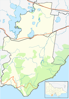
| LGA(s) | |||||||||||||
| State electorate(s) | Polwarth | ||||||||||||
| Federal Division(s) | Corangamite | ||||||||||||
| |||||||||||||
Ombersley is a rural locality in Victoria, Australia. Most of the locality is in Colac Otway Shire, with a portion being in adjacent Surf Coast Shire.[1][2] In the 2011 census, the population of Ombersley was too low to separately report; however in June 2014 the Victorian Electoral Commission recorded 64 enrolled voters in Ombersley, living in 35 properties.[3][4]
Ombersley Post Office opened on 1 May 1884 and closed on 30 March 1963.[5]
Mount Hesse Station, a historic homestead listed on the Victorian Heritage Register and classified by the National Trust of Australia, is located within Ombersley. It was developed as a pastoral property around 1837, and the first homestead was built in the early 1840s. A succession of still surviving outbuildings followed thereafter, including a store (1843), shepherd's hut (1849), stables (1849, extended in 1873), woolshed (1852) and gate lodge (1873).
The main Mount Hesse homestead was built in 1856, and extended in 1873. It was severely damaged by fire in 1941 and rebuilt in 1947. The property has historical associations with a number of prominent 19th century pastoralists and businessmen, and the stables and woolshed are amongst the oldest surviving examples of their kind in the state.[6][7]
A second historic homestead, Mountside Homestead, is also located within Ombersley. It was built in 1876 after the original Mount Hesse estate was divided into three properties, and is also classified by the National Trust of Australia.[6][8]
The locality includes Mount Gellibrand, an extinct scoria volcano and the future site of a wind farm.
References
- ↑ "Ombersley (entry 102411)". VICNAMES. Government of Victoria. Retrieved 17 June 2014.
- ↑ "Ombersley (entry 102412)". VICNAMES. Government of Victoria. Retrieved 17 June 2014.
- ↑ "2011 Census QuickStats: Birregurra". Australian Bureau of Statistics. Retrieved 10 July 2014.
- ↑ "Locality Finder" (PDF). Victorian Electoral Commission. 16 June 2014. Retrieved 10 July 2014.
- ↑ Premier Postal History. "Post Office List". Premier Postal Auctions. Retrieved 17 June 2014.
- 1 2 "Mount Hesse Station". Victorian Heritage Register. Retrieved 17 June 2014.
- ↑ "Mount Hesse Homestead and Outbuildings". Victorian Heritage Database. National Trust of Australia. Retrieved 17 June 2014.
- ↑ "Mountside Homestead". Victorian Heritage Database. National Trust of Australia. Retrieved 17 June 2014.