Mount Moriac, Victoria
| Mount Moriac Victoria | |||||||||||||
|---|---|---|---|---|---|---|---|---|---|---|---|---|---|
 Mount Moriac | |||||||||||||
| Coordinates | 38°12′38″S 144°11′23″E / 38.21056°S 144.18972°ECoordinates: 38°12′38″S 144°11′23″E / 38.21056°S 144.18972°E | ||||||||||||
| Population | 252 (2011 census)[1] | ||||||||||||
| Postcode(s) | 3240 | ||||||||||||
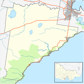
| Location | |||||||||||||
| LGA(s) | Surf Coast Shire | ||||||||||||
| State electorate(s) | South Barwon | ||||||||||||
| Federal Division(s) | Corangamite | ||||||||||||
| |||||||||||||
Mount Moriac is a rural locality in the Surf Coast Shire, Victoria, Australia.[2] In the 2011 census, Mount Moriac had a population of 252 people.[1]
A farming community developed at Mount Moriac as early as the 1840s, with a hotel opening in 1844.[3] A Catholic school was opened by 1853, and a Catholic church (St Patrick's) built in 1863. It became the administrative centre of the district, with a police station, court, and the offices of the Barrabool Hills Road Board. By 1865, it also had a flour mill, several shops, the offices for the Shire of Barrabool, a hotel, and Presbyterian and Bible Christian churches. Mount Moriac State School opened in 1875.[4]
A separate hamlet named Clifford, located within the modern Mount Moriac locality, developed around the intersection of Cape Otway and Devon Roads and the Princes Highway in the early 1850s, and had a hotel, school, church, store and blacksmith. This area took its name from Clifford Farm, the property of Lawrence Trewin. The church closed in 1875 and the hotel burnt down in 1877, and the hamlet had reportedly ceased to exist by 1890.[5][6]
The railway line was extended from Geelong to Colac in 1877, and a station was opened at nearby Moriac. A new township developed around the railway station, and over time took prominence over the older Mount Moriac settlement. The shire offices shifted to Geelong in 1949, and ceased holding meetings in the shire hall at Mount Moriac in 1976.[4] Mount Moriac Primary School was merged into nearby Moriac Primary School in the 1990s.[7]
Mount Moriac Railway Station PO opened on 16 October 1882, was renamed Mount Moriac PO in 1909, and closed on 31 July 1978. An earlier post office was opened at "Duneed" in 1854, renamed Mount Moriac PO in 1864, and renamed Moriac PO in 1909.[8]
Today, the town has a hotel (Mount Moriac Hotel), a cemetery, and a Catholic church (St Patrick's).[3][9][10] It also has a sporting reserve (Mount Moriac Reserve), with two ovals, a pavilion and club rooms, netball courts, tennis courts, and a pony club.[11] It also has a memorial to the artist Arthur Streeton, who was born at Mount Moriac (in the area once known as Clifford)[12] which is in the Parish of Duneed.[13]
References
- 1 2 Australian Bureau of Statistics (31 October 2012). "Mount Moriac (SSC)". 2011 Census QuickStats. Retrieved 12 June 2014.
- ↑ "Mount Moriac (entry 102180)". VICNAMES. Government of Victoria. Retrieved 11 June 2014.
- 1 2 "Mount Moriac Hotel". Mount Moriac Hotel. Retrieved 13 June 2014.
- 1 2 "Moriac 3240". Only Melbourne. Retrieved 13 June 2014.
- ↑ Barrabool Land of the Magpie by Ian Wynd page 83
- ↑ "Former Clifford Township". Victorian Heritage Database. Retrieved 13 June 2014.
- ↑ "History". Moriac Primary School. Retrieved 13 June 2014.
- ↑ Premier Postal History. "Post Office List". Premier Postal Auctions. Retrieved 13 June 2014.
- ↑ "Mt Moriac Cemetery". Geelong Cemeteries Trust. Retrieved 13 June 2014.
- ↑ "St Patrick's Catholic Church". Australian Catholic Church Histories. Retrieved 13 June 2014.
- ↑ "Sport and Recreation Reserves". Surf Coast Shire. Retrieved 13 June 2014.
- ↑ http://mdpa.weebly.com/blog/where-was-arthur-streeton-born
- ↑ Cornish, Richard (29 December 2012). "Six reasons to visit Moriac". The Age. Retrieved 13 June 2014.