Cape Otway
| Cape Otway Victoria | |||||||||||||
|---|---|---|---|---|---|---|---|---|---|---|---|---|---|
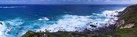 Cape Otway coast | |||||||||||||
 Cape Otway | |||||||||||||
| Coordinates | 38°51′0″S 143°31′0″E / 38.85000°S 143.51667°ECoordinates: 38°51′0″S 143°31′0″E / 38.85000°S 143.51667°E | ||||||||||||
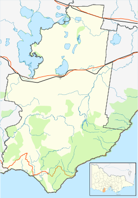
| Location | |||||||||||||
| LGA(s) | Colac Otway Shire | ||||||||||||
| State electorate(s) | Polwarth | ||||||||||||
| Federal Division(s) | Corangamite | ||||||||||||
| |||||||||||||
Cape Otway is a cape and a bounded locality of the Colac Otway Shire in southern Victoria, Australia on the Great Ocean Road; much of the area is enclosed in the Great Otway National Park.
History
Cape Otway was originally inhabited by the Gadubanud people; evidence of their campsites is contained in the middens throughout the region. The Cape was discovered by Europeans when Lieutenant James Grant made the first west-to-east passage through Bass Strait in the Lady Nelson in December 1800. Grant named it Cape Albany Otway after Captain William Albany Otway.[1] This was later shortened to Cape Otway.
Cape Otway Lighthouse was built on the point of the cape in 1848. The lighthouse is listed on the Victorian Heritage Register.[2]
A telegraph office opened in 1859. The post office opened on 1 September 1880 and closed in 1972.[3]
Eight ships were wrecked along the coast of Cape Otway.[4] These included the Marie (1851), Sacramento (1853), Schomberg (1855), Loch Ard (1878), Joseph H. Scammell (May 1891), Fiji (September 1891) and the Casino in 1932. The first American vessel sunk during World War II, the SS City of Rayville, was also sunk off the Cape by a German mine. Following this, the Americans built a radar bunker on the cape in 1942; it is now open to the public.
Commercial fisheries
The hostile seas, where the Southern Ocean meets with Bass Strait, that surround Cape Otway are home to some of the worlds most prized marine species including crayfish and abalone. It is common on calm days for there to be as many as 20 abalone dive boats operating along the shoreline beneath the light house. Commercial cray fishers use baited pots or traps throughout the reef system, with white floats on the surface marking their locations.
Other uses
- The mv Cape Otway was a handy-sized bulk carrier owned by Lyle Shipping of Glasgow and operated on the Christmas Island, Indian Ocean phosphate trade[5]
See also
References
- ↑ Grant, James (1803). The narrative of a voyage of discovery, performed in His Majesty's vessel the Lady Nelson, of sixty tons burthen: with sliding keels, in the years 1800, 1801, and 1802, to New South Wales. Printed by C. Roworth for T. Egerton. p. 72. ISBN 978-0-7243-0036-5. Retrieved 24 January 2012.
- ↑ "Cape Otway Lightstation (H1222)". Victorian Heritage Register. Heritage Victoria. Retrieved 4 July 2014.
- ↑ Premier Postal History, Post Office List, retrieved 20 February 2013
- ↑ Australia's Great Ocean Road. Shipwrecks
- ↑ "Cape Otway". Scottish Ship Management. Retrieved 22 June 2014.