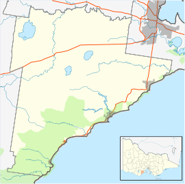
Wensleydale, Victoria
| Wensleydale Victoria | |||||||||||||
|---|---|---|---|---|---|---|---|---|---|---|---|---|---|
 Wensleydale | |||||||||||||
| Coordinates | 38°22′08″S 144°03′11″E / 38.36889°S 144.05306°ECoordinates: 38°22′08″S 144°03′11″E / 38.36889°S 144.05306°E | ||||||||||||
| Postcode(s) | 3240 | ||||||||||||
| Elevation | 200 m (656 ft) | ||||||||||||
| Time zone | AEST (UTC) | ||||||||||||
| Location | |||||||||||||
| LGA(s) | Surf Coast Shire | ||||||||||||
| State electorate(s) | Polwarth | ||||||||||||
| Federal Division(s) | Corangamite | ||||||||||||
| |||||||||||||
Wensleydale is a small rural community in Victoria, Australia.
History
Wordieboluc Post Office opened on 15 March 1866 and was replaced by the Wensleydale office in 1872. It closed in 1955.[1] Wensleydale was the terminus of a railway line which branched from the Port Fairy line near Moriac. The line opened in 1890 and was used to transport firewood, gravel and brown coal out of the area. It was closed in 1948.[2]
References
- ↑ Premier Postal History. "Post Office List". Premier Postal Auctions. Retrieved 2011-05-26.
- ↑ Harrigan, Leo J. "Victorian Railways to ‘62", Victorian Railways Public Relations and Betterment Board, 1962, p. 284.
Further reading
- Houghton, Norm (1982). The Saddle Line: A History of the Moriac to Wensleydale Railway. Geelong: self published. ISBN 0 9593013 0 5.
This article is issued from Wikipedia - version of the 7/1/2016. The text is available under the Creative Commons Attribution/Share Alike but additional terms may apply for the media files.