Connewarre, Victoria
| Connewarre Victoria | |||||||||||||
|---|---|---|---|---|---|---|---|---|---|---|---|---|---|
 Connewarre | |||||||||||||
| Coordinates | 38°16′S 144°24′E / 38.267°S 144.400°ECoordinates: 38°16′S 144°24′E / 38.267°S 144.400°E | ||||||||||||
| Population | 350 (2011 census)[1] | ||||||||||||
| Postcode(s) | 3227 | ||||||||||||
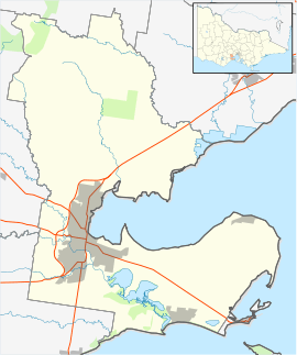
| Location | |||||||||||||
| LGA(s) | |||||||||||||
| State electorate(s) | |||||||||||||
| Federal Division(s) | Corangamite | ||||||||||||
| |||||||||||||
Connewarre, Victoria, Australia, is located in south-east of Geelong, and is named after Lake Connewarre which is situated immediately to its north-east. At the 2011 census, Connewarre and the surrounding area had a population of 350.[1]
Part of the Eastern Precinct of the large Armstrong Creek Growth Area was within Connewarre when urban development began in 2010, but in 2012, when the new suburb Armstrong Creek was gazetted, Connewarre's boundary was adjusted to exclude the area north of Lower Duneed Road and the west of Baenschs Lane, meaning that all of the Growth Area then lay outside Connewarre.[2][3][4]
Settlements near Connewarre include Breamlea to the south, Torquay to the west and Barwon Heads to the east.
History
The Post Office opened on 9 September 1860 and closed in 1967. An earlier Connewarre office was renamed Mount Duneed.[5]
The former Connewarre Primary School has been closed and merged with Mount Duneed Primary School.[6]
References
- 1 2 Australian Bureau of Statistics (31 October 2012). "Connewarre (State Suburb)". 2011 Census QuickStats. Retrieved 11 December 2014.
- ↑ "General Gazette Number G8" (PDF). Victoria Government Gazette. Government of Victoria. 23 February 2012. p. 36. Archived from the original (PDF) on 4 March 2016. Retrieved 4 July 2014.
- ↑ Woods, Eleanor (9 August 2011). "Charlemont 3217". Surf Coast Times. Archived from the original on 14 July 2014. Retrieved 5 July 2014.
- ↑ "Charlemont" (PDF). Department of Energy and Primary Industries. Archived from the original (PDF) on April 1, 2012. Retrieved 5 July 2014.
- ↑ Premier Postal History, Post Office List, retrieved 2008-04-11
- ↑ "Minutes: Tuesday, 13 December 2011" (PDF). City of Greater Geelong. Retrieved 18 June 2014.