National Register of Historic Places listings in Phoenix
This is a list of the National Register of Historic Places listings in Phoenix, Arizona.
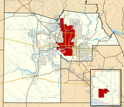
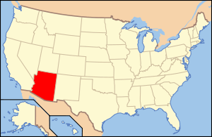
This is intended to be a complete list of the properties and districts on the National Register of Historic Places in Phoenix, the largest city in Maricopa County, Arizona, United States. The locations of National Register properties and districts for which the latitude and longitude coordinates are included below, may be seen in an online map.[1]
There are 386 properties and districts listed on the National Register in Maricopa County, including 3 that are also National Historic Landmarks. The city of Phoenix is the location of 207 of these properties and districts, including 1 National Historic Landmark; they are listed here, while the remaining properties and districts and 2 National Historic Landmarks are located elsewhere in the county and are listed separately. Seventeen properties in Phoenix were once listed, but have since been removed. One property, the George E. Cisney House, has been delisted and relisted.
- This National Park Service list is complete through NPS recent listings posted December 16, 2016.[2]
Current listings
| [3] | Name on the Register[4] | Image | Date listed[5] | Location | Neighborhood | Description |
|---|---|---|---|---|---|---|
| 1 | 6th Avenue Hotel-Windsor Hotel | 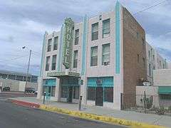 |
(#85002041) |
546 W. Adams 33°26′57″N 112°04′50″W / 33.449167°N 112.080556°W |
||
| 2 | 915 E. Pierce Street/Grand Pyramid House | .JPG) |
(#02000800) |
915 E. Pierce St. 33°26′47″N 112°03′37″W / 33.446389°N 112.060278°W |
||
| 3 | Salim Ackel House | 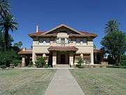 |
(#94000574) |
94 E. Monte Vista Rd. 33°28′12″N 112°04′09″W / 33.47°N 112.069167°W |
||
| 4 | Adams School | 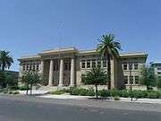 |
(#79000418) |
800 W. Adams St. 33°26′58″N 112°04′58″W / 33.449444°N 112.082778°W |
||
| 5 | W. E. Adams House | .JPG) |
(#94001524) |
1014 S. 1st Ave. 33°26′15″N 112°04′28″W / 33.4375°N 112.074444°W |
||
| 6 | Alvarado Historic District |  |
(#94001481) |
Roughly bounded by Central Ave., Oak St., 3rd St., and Palm Ln. 33°28′15″N 112°04′12″W / 33.470833°N 112.07°W |
||
| 7 | Anchor Manufacturing Co. |  |
(#85002042) |
525-551 S. Central 33°26′32″N 112°04′22″W / 33.442222°N 112.072778°W |
||
| 8 | Helen Anderson House |  |
(#83003449) |
149 W. McDowell Rd. 33°27′56″N 112°04′37″W / 33.465556°N 112.076944°W |
||
| 9 | Anderson-Johannes House |  |
(#94001525) |
127 N. 10th Ave. 33°27′00″N 112°05′05″W / 33.45°N 112.084722°W |
||
| 10 | Arizona Academy-North Hall and South Hall | .JPG) |
(#93000813) |
1325 N. 14th St. 33°27′49″N 112°03′03″W / 33.463611°N 112.050833°W |
The former academy is now known as the "Stepping Stone Place". The North Hall is now addressed as 1307 and the South Hall as 1305. | |
| 11 | Arizona Army National Guard Arsenal |  |
(#10000108) |
5636 E. McDowell Rd., M5320 33°27′56″N 111°57′46″W / 33.465578°N 111.962775°W |
During WWII the Arizona Army National Guard Arsenal building served as a maintenance shop for German prisoners of War. The building now is houses the Arizona Military Museum. | |
| 12 | Arizona Compress & Warehouse Co. Warehouse | .JPG) |
(#85002044) |
215 S. 13th St. 33°26′45″N 112°03′11″W / 33.445833°N 112.053056°W |
||
| 13 | Arizona State Capitol Building | 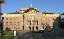 |
(#74000455) |
1700 W. Washington St. 33°26′53″N 112°05′47″W / 33.448056°N 112.096389°W |
||
| 14 | Arizona State Hospital Building | 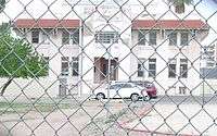 |
(#09000510) |
2500 E. Van Buren St. 33°27′08″N 112°01′38″W / 33.452103°N 112.02735°W |
The Arizona State Hospital Building, also known as Mahoney Administration Building, was built in 1900. It is where Winnie Ruth Judd, known as the infamous "Trunk Murderess", was committed on April 24, 1933. | |
| 15 | Arvizu's El Fresnal Grocery Store | 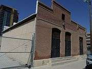 |
(#85002046) |
310 E. Buchanan 33°26′36″N 112°04′06″W / 33.443333°N 112.068333°W |
||
| 16 | Cline R. Asbury/Riney B. Salmon House | 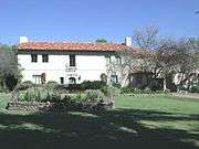 |
(#10000154) |
7801 N. Central Ave. 33°33′02″N 112°04′24″W / 33.550642°N 112.073358°W |
||
| 17 | Ashland Place Historic District | .JPG) |
(#94001486) |
Roughly bounded by Central Ave., Vernon Ave., 3rd St., and Oak St. 33°28′26″N 112°04′14″W / 33.473889°N 112.070556°W |
||
| 18 | F.S. Baird Machine Shop | .JPG) |
(#85002047) |
623 E. Adams 33°26′57″N 112°03′54″W / 33.449167°N 112.065°W |
||
| 19 | Samuel L. Bartlett House |  |
(#96001057) |
325 W. Northern Ave. 33°33′11″N 112°04′48″W / 33.553056°N 112.08°W |
||
| 20 | J. B. Bayless Store No. 7 | .JPG) |
(#85002048) |
825 N. 7th St. 33°27′26″N 112°03′50″W / 33.457222°N 112.063889°W |
||
| 21 | Bennitt Mansion | .JPG) |
(#09000609) |
126 E. County Club Dr. 33°28′52″N 112°03′29″W / 33.480994°N 112.058186°W |
||
| 22 | Bethlehem Baptist Church | .JPG) |
(#93000744) |
1402 E. Adams St. 33°26′59″N 112°01′46″W / 33.449722°N 112.029444°W |
||
| 23 | Blount Addition Historic District |  |
(#86000265) |
Northern side of W. Culver St. between Central and 3rd Aves. 33°27′48″N 112°04′31″W / 33.463333°N 112.075278°W |
||
| 24 | Boardwalk Apartments Historic District |  |
(#15000342) |
N. 36th Street 33°29′52″N 112°00′11″W / 33.4977°N 112.0031°W |
||
| 25 | Louis J. Bohn and Gertrude Lee House |  |
(#10001165) |
Corner of 8001 N. 7th Street/E. Northern Ave. 33°33′11″N 112°03′53″W / 33.553056°N 112.064722°W |
The house is actually located on the corner of 7th Ave. and Northern. Its address is 8001 N. 7th Street. | |
| 26 | Jorgine Boomer House | 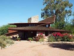 |
(#16000071) |
5808 N. 30th St. 33°31′21″N 112°01′00″W / 33.522512°N 112.016643°W |
The house was designed by architect Frank Lloyd Wright | |
| 27 | Bragg's Pies Building |  |
(#08001313) |
1301 Grand Ave. 33°27′26″N 112°05′23″W / 33.457142°N 112.089833°W |
||
| 28 | Brentwood Historic District | .JPG) |
(#10000320) |
Roughly bounded by Brill St. to the north, 20th St. to the east, Culver St. to the south, 16th St. to the west 33°27′50″N 112°02′36″W / 33.463756°N 112.043328°W |
||
| 29 | Brophy College Chapel | .JPG) |
(#93000747) |
4701 N. Central Ave. 33°30′18″N 112°04′19″W / 33.505°N 112.071944°W |
||
| 30 | Brown's Pharmacy | .JPG) |
(#85002049) |
1000 E. Pierce 33°27′21″N 112°03′35″W / 33.455833°N 112.059722°W |
||
| 31 | Burgess Lateral Historic District |  |
(#09000221) |
Adjacent to Arcadia Dr. between the Arizona Canal and Lafayette Boulevard, between 47th Pl. and 47th St. 33°29′57″N 111°58′32″W / 33.499042°N 111.975633°W |
||
| 32 | Campus Vista Historic District | .JPG) |
(#10000321) |
Roughly bounded by Thomas Rd. and Flower St., 7th and 11th Aves. and Flower St., and Osborn Rd. and 10th and 15th Aves. 33°29′02″N 112°05′13″W / 33.484011°N 112.087064°W |
Residential neighborhood of primarily ranch-style homes adjacent to Phoenix College and Encanto Park; developed between 1939 and 1956[6] | |
| 33 | Cartwright School |  |
(#93000739) |
5833 W. Thomas Rd. 33°28′48″N 112°11′07″W / 33.48°N 112.185278°W |
||
| 34 | William Edward Cavness House | .JPG) |
(#01001191) |
606 N. 4th Ave. 33°27′16″N 112°04′06″W / 33.454444°N 112.068333°W |
||
| 35 | Celora Stoddard/Lon Harmon House | .JPG) |
(#83003451) |
801 N. 1st Ave. 33°27′24″N 112°04′26″W / 33.456667°N 112.073889°W |
||
| 36 | Chambers Transfer & Storage Co. |  |
(#85002052) |
301 S. 4th Ave. 33°26′41″N 112°04′41″W / 33.444722°N 112.078056°W |
||
| 37 | Chambers Transfer & Storage Co.-Central Warehouse |  |
(#85002051) |
15-39 E. Jackson 33°26′41″N 112°04′20″W / 33.444722°N 112.072222°W |
||
| 38 | Cheery Lynn Historic District | Upload image | (#94001485) |
16th St. to Randolph Rd. and Earll Dr. to Flower St. 33°29′04″N 112°02′57″W / 33.484444°N 112.049167°W |
||
| 39 | Chelsea Place Historic District | Upload image | (#83003452) |
Roughly bounded by W. Lynwood and W. Willetta Sts. between Central and 3rd Aves. 33°27′51″N 112°04′31″W / 33.464167°N 112.075278°W |
||
| 40 | George E. Cisney House | .JPG) |
(#94001528) |
916 E. McKinley St. 33°27′25″N 112°03′39″W / 33.456944°N 112.060833°W |
Property first listed January 12, 1995; delisted April 6, 2015; relisted September 8, 2015 | |
| 41 | H. M. Coe House | .JPG) |
(#94001529) |
365 N. 4th Ave. 33°27′13″N 112°04′41″W / 33.453611°N 112.078056°W |
||
| 42 | Coffelt-Lamoreaux Homes Historic District |  |
(#14001081) |
19th Ave to I-17; Buckeye Rd to Durango Curve 33°26′04″N 112°05′59″W / 33.4345°N 112.0997°W |
The city's oldest active public housing development, begun in 1953. | |
| 43 | Concrete Block House | .JPG) |
(#83003457) |
618-620 N. 4th Ave. 33°27′19″N 112°04′42″W / 33.455278°N 112.078333°W |
Demolished | |
| 44 | Concrete Block House |  |
(#83003456) |
640 N. 6th Ave. 33°27′22″N 112°04′51″W / 33.456111°N 112.080833°W |
||
| 45 | Ralph Converse House | .JPG) |
(#10000153) |
6617 N. Central Ave. 33°32′01″N 112°04′23″W / 33.533478°N 112.072986°W |
||
| 46 | Colonel Edward Power Conway House | 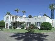 |
(#10001164) |
7625 N. 10th St. 33°32′51″N 112°03′38″W / 33.5475°N 112.060556°W |
||
| 47 | Neil and Louise Cook House | Upload image | (#16000782) |
5725 North 20th Pl. 33°31′15″N 112°02′16″W / 33.520802°N 112.037665°W |
||
| 48 | Copeland & Tracht Service Station | 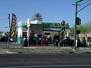 |
(#85002054) |
1702 W. Van Buren 33°27′06″N 112°05′43″W / 33.451667°N 112.095278°W |
Historic Copeland & Trachet Service Station, now Granpa Sal's Tires, built in 1925 | |
| 49 | Coronado Neighborhood Historic District | 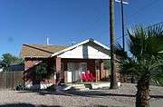 |
(#86000206) |
Roughly bounded by Virginia Ave., 14th St., McDowell Rd., and 7th St.; also roughly bounded by 13th St., Coronado Rd., 14th St., and Monte Vista Rd., and the western side of 13th St. between Monte Vista and Oak 33°28′17″N 112°03′28″W / 33.471389°N 112.057778°W |
This is the Albert and Mary Garcia House located at 2201 N Dayton St. Albert Garcia became Arizona’s first Hispanic Assistant Attorney General, from 1937 until 1942. The house is in the Historic Coronado District. | |
| 50 | Country Club Park Historic Subdivision | Upload image | (#94001484) |
Thomas Rd. to Virginia Ave. and 7th St. to Dayton St. 33°28′41″N 112°03′41″W / 33.478056°N 112.061389°W |
||
| 51 | Craig Mansion | .JPG) |
(#92001013) |
131 E. Country Club Dr. 33°28′48″N 112°03′25″W / 33.48°N 112.056944°W |
||
| 52 | Del Norte Place Historic District | 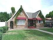 |
(#94001482) |
Virginia Ave. to Encanto Boulevard and 15th to 17th Aves. 33°28′30″N 112°05′34″W / 33.475°N 112.092778°W |
This Tudor Revival Residence is located at 1614 W. Vernon Ave. and was built in 1936. It is in the historic "Del Norte Place Historic District". | |
| 53 | Lester D. DeMund House | .JPG) |
(#94001520) |
363 E. Monte Vista 33°28′17″N 112°03′57″W / 33.471389°N 112.065833°W |
||
| 54 | Adam Diller House |  |
(#10001163) |
8702 N. 7th Ave. 33°33′51″N 112°04′59″W / 33.564167°N 112.083056°W |
The house is also known as the "Lightning Z Ranch House" | |
| 55 | J. B. Doughterty and C. W. Peterson House | .JPG) |
(#94001540) |
2141-2143 W. Washington St. 33°26′53″N 112°06′13″W / 33.448056°N 112.103611°W |
||
| 56 | Lewis Douglas House |  |
(#85000188) |
815 E. Orangewood Ave. 33°32′57″N 112°04′02″W / 33.549167°N 112.067222°W |
||
| 57 | Dunbar School |  |
(#93000740) |
707 W. Grant 33°26′31″N 112°05′04″W / 33.441944°N 112.084444°W |
Dunbar School built in 1925 | |
| 58 | Charles H. Dunlap House | .JPG) |
(#83003466) |
650 N. 1st Ave. 33°27′23″N 112°04′28″W / 33.456389°N 112.074444°W |
||
| 59 | Durand Grocery | .JPG) |
(#85002891) |
901 Grand Ave. 33°27′12″N 112°05′05″W / 33.453333°N 112.084722°W |
||
| 60 | Earll Place Historic District | Upload image | (#06000468) |
1620-1722 E. Pinchot Ave. and 1617-1731 and 1736 E. Earll Dr. 33°29′01″N 112°02′42″W / 33.483611°N 112.045°W |
||
| 61 | East Alvarado Historic District | .JPG) |
(#00000102) |
E. Alvarado Rd. between 3rd and 7th Sts. 33°28′20″N 112°04′00″W / 33.472222°N 112.066667°W |
||
| 62 | East Evergreen Historic District | Upload image | (#10000322) |
Roughly bounded by McDowell Rd., 3rd St., 7th St., and Wiletta St. 33°27′53″N 112°04′03″W / 33.464764°N 112.067453°W |
||
| 63 | El Chaparral |  |
(#11000631) |
4935 E. Lafayette Blvd. 33°29′51″N 111°58′28″W / 33.4975°N 111.974444°W |
||
| 64 | El Zaribah Shrine Auditorium | 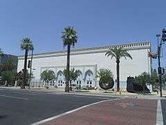 |
(#89000168) |
1502 W. Washington St. 33°26′55″N 112°05′27″W / 33.448611°N 112.090833°W |
El Zaribah Shrine Auditorium (now the Polly Rosenbaum Building) built in 1921 | |
| 65 | Elder-Moffitt House | .JPG) |
(#94001605) |
1336 W. Taylor St. 33°27′36″N 112°05′21″W / 33.46°N 112.089167°W |
||
| 66 | Elizabeth Seargeant-Emery Oldaker House | .JPG) |
(#83003472) |
649 N. 3rd Ave. 33°27′24″N 112°04′36″W / 33.456667°N 112.076667°W |
||
| 67 | Ellis-Shackelford House |  |
(#83003475) |
1242 N. Central Ave. 33°27′44″N 112°05′02″W / 33.462222°N 112.083889°W |
The Ellis-Shackelford House was built in 1917 | |
| 68 | Encanto Manor Historic District |  |
(#10000323) |
Roughly bounded by 7th and 15th Aves. and Thomas Rd. and Edgemont Ave. 33°28′48″N 112°05′13″W / 33.479897°N 112.087025°W |
Primarily post-World War II (1945–1959) upscale residential neighborhood development which also includes Dorris House (Casa de Rosas), built in 1911[6][7] | |
| 69 | Encanto-Palmcroft Historic District | 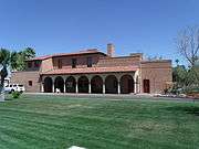 |
(#84000696) |
Roughly bounded by N. 7th and 15th Aves., McDowell and Thomas Rds.; also Holly St. from 15th Ave. to 12th Ave. and 12th from Holly to Encanto Boulevard; also roughly bounded by Encanto Blvd., Coronado Rd., 7th Ave. and 15th Ave. The historic Encanto Park Clubhouse is located in this district. 33°28′21″N 112°05′10″W / 33.4725°N 112.086111°W |
Second and third sets of addresses represent boundary increases | |
| 70 | Encanto Vista Historic District | 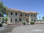 |
(#10000324) |
Roughly bounded by 7th Ave, Encanto Blvd, Windsor Ave, and Encanto Park Municipal Golf Course 33°28′33″N 112°05′01″W / 33.475833°N 112.083667°W |
The Dr. Norton House built in 1912, located in the Encanto Vista Historic District | |
| 71 | Abner Elliot England-Guy Hidden Lawrence House | 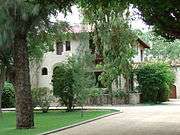 |
(#10001162) |
6234 N. Central Ave. 33°31′43″N 112°04′28″W / 33.528611°N 112.074444°W |
The Abner Elliot England-Guy Hidden Lawrence House was built in 1929 | |
| 72 | Evans House | 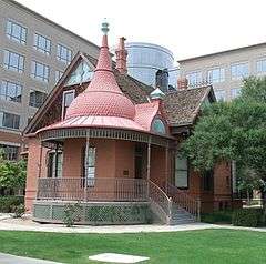 |
(#76000375) |
1108 W. Washington St. 33°26′54″N 112°05′11″W / 33.448333°N 112.086389°W |
Dr. Evans' House was built in 1893 | |
| 73 | Eyrich-Kohl House | .JPG) |
(#94001530) |
1015 Woodland Ave. 33°27′03″N 112°05′08″W / 33.450833°N 112.085556°W |
||
| 74 | Fairview Place Historic District | 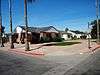 |
(#94001483) |
Encanto Boulevard to McDowell Rd., 15th Ave. to the alley west of 17th Ave. 33°28′10″N 112°05′34″W / 33.469444°N 112.092778°W |
||
| 75 | Firestone | 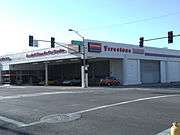 |
(#85002892) |
302 W. Van Buren 33°27′06″N 112°04′38″W / 33.451667°N 112.077222°W |
Historic Firestone building built in 1925 | |
| 76 | First Baptist Church | 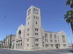 |
(#82002081) |
302 W. Monroe St. 33°27′02″N 112°04′39″W / 33.450556°N 112.0775°W |
First Baptist Church built in 1923 | |
| 77 | First Church of Christ, Scientist | .JPG) |
(#93000745) |
924 N. 1st St. 33°27′30″N 112°04′20″W / 33.458333°N 112.072222°W |
||
| 78 | First Presbyterian Church | 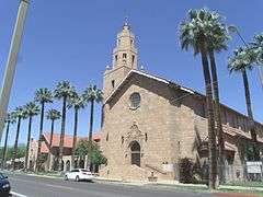 |
(#93000746) |
402 W. Monroe St. 33°27′02″N 112°04′43″W / 33.450556°N 112.078611°W |
First Presbyterian Church built in 1892 | |
| 79 | Franklin School | 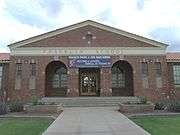 |
(#93000814) |
1625 W. McDowell Rd. 33°27′55″N 112°05′39″W / 33.465278°N 112.094167°W |
||
| 80 | Fry Building-Baxter Block | 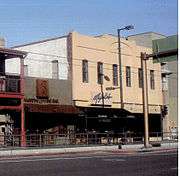 |
(#85002056) |
146 E. Washington 33°26′54″N 112°04′15″W / 33.448333°N 112.070833°W |
Fry building built in 1891 | |
| 81 | Garfield Historic District | 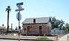 |
(#10000325) |
Roughly bounded by 7th St. on the west, 16th St. on the east, Roosevelt St. on the north, and Van Buren St. on the south 33°27′18″N 112°03′23″W / 33.455111°N 112.056444°W |
||
| 82 | Garfield Methodist Church | .JPG) |
(#93000743) |
1302 E. Roosevelt St. 33°27′33″N 112°03′11″W / 33.459167°N 112.053056°W |
||
| 83 | Neil H. Gates House | 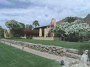 |
(#86002646) |
4602 N. Elsie Ave. 33°30′15″N 111°57′11″W / 33.504167°N 111.953056°W |
||
| 84 | General Sales Company Warehouse | Upload image | (#16000681) |
515 E. Grant St. 33°26′27″N 112°04′01″W / 33.440928°N 112.067075°W |
||
| 85 | Gerardo's Building | .JPG) |
(#85002057) |
421 S. 3rd St. 33°26′36″N 112°04′08″W / 33.443333°N 112.068889°W |
||
| 86 | Carter W. Gibbes House | .JPG) |
(#83002992) |
2233 N. Alvarado 33°28′19″N 112°04′11″W / 33.471944°N 112.069722°W |
||
| 87 | Grace Lutheran Church | .JPG) |
(#93000835) |
1124 N. 3rd St. 33°27′39″N 112°04′09″W / 33.460833°N 112.069167°W |
||
| 88 | Lois Grunow Memorial Clinic | 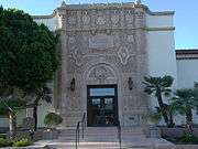 |
(#85002065) |
926 E. McDowell 33°27′58″N 112°03′38″W / 33.466111°N 112.060556°W |
Entrance of the Lois Grunow Memorial Clinic built in 1931 | |
| 89 | Burgess A. Hadsell House |  |
(#94001531) |
1001 E. Fillmore St. 33°27′17″N 112°03′34″W / 33.454722°N 112.059444°W |
||
| 90 | Fred G. Hilvert House | Upload image | (#16000700) |
106 E. Country Club Dr. 33°28′52″N 112°03′33″W / 33.481006°N 112.059221°W |
||
| 91 | George M. Halm and Mary Alverda Howard House | .JPG) |
(#10001161) |
6850 North Central Ave. 33°32′16″N 112°04′28″W / 33.537778°N 112.074444°W |
||
| 92 | Hanny's |  |
(#85002058) |
44 N. 1st St. 33°26′57″N 112°04′19″W / 33.449167°N 112.071944°W |
||
| 93 | Sarah and Jack Harelson House |  |
(#10000152) |
4437 E. Arlington Rd. 33°31′01″N 111°59′06″W / 33.517058°N 111.984903°W |
||
| 94 | Heard Building |  |
(#85002059) |
112 N. Central 33°26′59″N 112°04′24″W / 33.449722°N 112.073333°W |
The Heard Building, built in 1920, was Phoenix's first skyscraper. The building was featured in Alfred Hitchcocks 1960 film "Psycho"[8] | |
| 95 | Hedgpeth Hills Petroglyph Site | 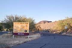 |
(#84000718) |
3711 West Deer Valley Road 33°41′01″N 112°08′30″W / 33.68361°N 112.141722°W |
North/Northwest Phoenix | |
| 96 | George Hidden House | .JPG) |
(#94001532) |
763 E. Moreland St. 33°27′40″N 112°03′48″W / 33.461111°N 112.063333°W |
||
| 97 | Hohokam-Pima Irrigation Sites | 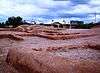 |
(#66000184) |
Address Restricted |
||
| 98 | Hotel Westward Ho | 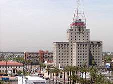 |
(#82002082) |
618 N. Central Ave. 33°27′18″N 112°04′26″W / 33.455°N 112.073889°W |
||
| 99 | House at 818 South 1st Avenue | .JPG) |
(#94001538) |
818 S. 1st Ave. 33°26′22″N 112°04′28″W / 33.439444°N 112.074444°W |
||
| 100 | L. Ron Hubbard House | 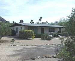 |
(#09000953) |
5501 N. 44th St. 33°31′02″N 111°59′10″W / 33.517125°N 111.986103°W |
||
| 101 | William K. Humbert House | .JPG) |
(#83003476) |
2238 N. Alvarado Rd. 33°28′21″N 112°04′14″W / 33.4725°N 112.070556°W |
||
| 102 | Hunt Bass Hatchery Caretaker's House |  |
(#02001723) |
Phoenix Zoo grounds, 455 N. Galvin Parkway 33°27′06″N 111°56′49″W / 33.451667°N 111.946944°W |
||
| 103 | Hunt's Tomb |  |
(#08000526) |
625 N. Galvin Pkwy, Papago Park 33°27′07″N 111°56′40″W / 33.451898°N 111.944339°W |
||
| 104 | Hurley Building |  |
(#85002062) |
536 and 544-548 W. McDowell and 1601 N. 7th Ave. 33°27′57″N 112°04′54″W / 33.465833°N 112.081667°W |
||
| 105 | Idylwilde Park Historic District | Upload image | (#98000054) |
Roughly bounded by 11th and 12th Sts., Weldon, and Fairmont Aves. 33°29′27″N 112°03′23″W / 33.490833°N 112.056389°W |
||
| 106 | Immaculate Heart of Mary | .JPG) |
(#93000742) |
909 E. Washington St. 33°26′53″N 112°03′40″W / 33.448056°N 112.061111°W |
||
| 107 | Judge Fred C. Jacobs House |  |
(#10001169) |
6224 N. Central Ave. 33°31′41″N 112°04′28″W / 33.528056°N 112.074444°W |
Judge Fred C. Jacobs' House was built in 1928 | |
| 108 | Kaler House | .JPG) |
(#92001686) |
301 W. Frier Dr. 33°32′56″N 112°04′40″W / 33.548889°N 112.077778°W |
||
| 109 | Kenilworth Elementary School | .JPG) |
(#82002083) |
1210 N. 5th Ave. 33°27′44″N 112°04′49″W / 33.462222°N 112.080278°W |
||
| 110 | Kenilworth Historic District | Upload image | (#83003478) |
Roughly bounded by W. Lynwood and W. Willetta Sts. between 3rd and 7th Aves., and W. Culver St. between 5th and 7th Aves.; also 312 W. Culver St. 33°27′49″N 112°04′48″W / 33.463611°N 112.08°W |
Culver St. address represents a boundary increase | |
| 111 | King's Rest Hotel Motor Court |  |
(#87001882) |
801 S. 17th Ave. 33°26′21″N 112°05′41″W / 33.439167°N 112.094722°W |
||
| 112 | Denison Kitchel House |  |
(#94000448) |
2912 E. Sherran Lane 33°29′24″N 112°01′04″W / 33.49°N 112.017778°W |
Phoenix, Arizona | |
| 113 | Knights of Pythias Building | .JPG) |
(#85002063) |
829 N. 1st Ave. 33°27′27″N 112°04′27″W / 33.4575°N 112.074167°W |
||
| 114 | Kinter K. Koontz House | .JPG) |
(#11000463) |
7620 N. 7th St. 33°32′52″N 112°03′57″W / 33.547778°N 112.065833°W |
||
| 115 | La Hacienda Historic District |  |
(#09000002) |
Bounded by N. 3rd St. to the west, N. 7th St. to the east, E. Catalina Dr. to the north, and E. Thomas Rd. to the south 33°28′52″N 112°04′02″W / 33.481156°N 112.067295°W |
||
| 116 | C. A. Larson House | .JPG) |
(#94001533) |
710 S. 1st Ave. 33°26′27″N 112°04′28″W / 33.440833°N 112.074444°W |
||
| 117 | Los Olivos Historic District | Upload image | (#10000326) |
The 300 block of E Monte Vista Rd. 33°28′16″N 112°04′02″W / 33.471175°N 112.067267°W |
||
| 118 | Margarita Place Historic District |  |
(#07000279) |
Bounded by Thomas Rd., Windsor Ave., 15th And 16th Ave. 33°28′47″N 112°05′33″W / 33.479592°N 112.092556°W |
The Vlassis Ruzow and Associates Building is located at 1545 W. Thomas Road. The building is considered historical by the Phoenix Historic Preservation Office.[9] | |
| 119 | Maricopa County Courthouse | 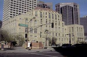 |
(#88003237) |
125 W. Washington St. 33°26′53″N 112°04′29″W / 33.448056°N 112.074722°W |
The historical “Miranda rights” was established in this court after the arrest of Ernesto Miranda | |
| 120 | James H. McClintock House | .JPG) |
(#90001525) |
323 E. Willetta St. 33°27′49″N 112°03′56″W / 33.463611°N 112.065556°W |
||
| 121 | Medlock Place Historic District | .JPG) |
(#06000434) |
Roughly bounded by Missouri Ave., Camelback Rd., 7th Ave., and Central Ave. 33°29′42″N 112°04′39″W / 33.495°N 112.0775°W |
||
| 122 | Monroe School | 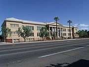 |
(#77000237) |
215 N. 7th St. 33°27′00″N 112°03′50″W / 33.45°N 112.063889°W |
Monroe High School built in 1914 | |
| 123 | David Morgan-Earl A. Bronson House | 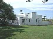 |
(#10001168) |
8030 N. Central Ave. 33°33′15″N 112°04′28″W / 33.554167°N 112.074444°W |
The David Morgan-Earl A. Bronson House, built 1927. | |
| 124 | North Central Avenue Streetscape Historic District | 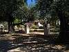 |
(#05001346) |
Central Ave. between Bethany Home Rd. and the Arizona Canal 33°31′26″N 112°04′25″W / 33.523806°N 112.073686°W |
||
| 125 | North Encanto Historic District |  |
(#06001262) |
Roughly bounded by 15th and 18th Aves., Thomas to Osborn Rds. 33°29′03″N 112°05′41″W / 33.484117°N 112.094661°W |
||
| 126 | North Garfield Historic District | .JPG) |
(#10000327) |
Roughly bounded by 7th St. on the west, 16th St. on the east, Roosevelt St. on the south, and Interstate 10 on the north 33°27′36″N 112°03′23″W / 33.459942°N 112.056447°W |
||
| 127 | Oakland Historic District | 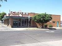 |
(#92000847) |
Roughly bounded by Fillmore St., 19th Ave., Van Buren St., and Grand Ave. 33°27′12″N 112°05′31″W / 33.453333°N 112.091944°W |
The Crown Filter Queen Building is located at 1800 W. Van Buren Ave. The building is considered historical by the Phoenix Historic Preservation Office.[9] | |
| 128 | George A. Olney/Everett E. Ellinwood House | .JPG) |
(#10000155) |
6810 N. Central Ave. 33°32′13″N 112°04′28″W / 33.537006°N 112.0745°W |
||
| 129 | Ong Yut Geong Wholesale Market | .JPG) |
(#85002066) |
502 S. 2nd St. 33°26′35″N 112°04′10″W / 33.443056°N 112.069444°W |
||
| 130 | Jim Ong's Market | .JPG) |
(#82002084) |
1110 E. Washington St. 33°26′55″N 112°03′28″W / 33.448611°N 112.057778°W |
||
| 131 | Orpheum Theater | |
(#85002067) |
209 W. Adams 33°26′57″N 112°04′33″W / 33.449167°N 112.075833°W |
||
| 132 | William Lewis Osborn House | .JPG) |
(#91000544) |
1266 W. Pierce Ave. 33°27′23″N 112°05′23″W / 33.456389°N 112.089722°W |
||
| 133 | Palm Lane Gardens | .JPG) |
(#09001112) |
101-115 E. Palm La. 33°28′10″N 112°04′16″W / 33.469361°N 112.07115°W |
||
| 134 | E. Payne Palmer House |  |
(#02000420) |
6012 N. Central Ave. 33°31′28″N 112°04′27″W / 33.524444°N 112.074167°W |
||
| 135 | Pay'n Takit No. 5 | .JPG) |
(#85002069) |
1012 N. 7th Ave. 33°27′32″N 112°04′55″W / 33.458889°N 112.081944°W |
||
| 136 | Pay'n Takit No. 13 | .JPG) |
(#85002068) |
1402 E. Van Buren 33°27′06″N 112°03′04″W / 33.451667°N 112.051111°W |
||
| 137 | Pay'n Takit No. 25 | 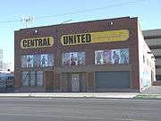 |
(#85002070) |
1753-1755 W. Van Buren 33°27′04″N 112°05′50″W / 33.451111°N 112.097222°W |
Pay'n Takit No. 25, built in 1926, now (2012) houses Central United "A boxing club" | |
| 138 | Phoenix Building and Loan House | .JPG) |
(#94001534) |
1138-1140 E. Taylor St. 33°27′14″N 112°03′24″W / 33.453889°N 112.056667°W |
||
| 139 | Phoenix Carnegie Library and Library Park | 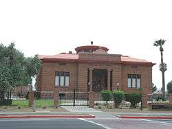 |
(#74000456) |
1101 W. Washington St. 33°26′51″N 112°05′10″W / 33.4475°N 112.086111°W |
The Phoenix Carnegie Library was built in 1907 | |
| 140 | Phoenix Elementary School District No. 1 Administration Building | .JPG) |
(#95001076) |
331 N. 1st Ave. 33°27′08″N 112°04′25″W / 33.452222°N 112.073611°W |
||
| 141 | Phoenix Homesteads Historic District |  |
(#87001430) |
Roughly bounded by Flower and 28th Sts., Pinchot Ave., and 26th St.; boundary increase (listed October 15, 2010): Roughly bounded by Pinchot and Flower Sts., 26th to 28th Sts. 33°29′01″N 112°01′21″W / 33.483611°N 112.0225°W |
||
| 142 | Phoenix Indian School Historic District |  |
(#01000521) |
300 E. Indian School Rd. 33°29′51″N 112°04′10″W / 33.4975°N 112.069444°W |
Image is of the main building of the historic Phoenix Indian School built in 1891 | |
| 143 | Phoenix LDS Second Ward Church |  |
(#83003492) |
1120 N. 3rd Ave. 33°27′56″N 112°04′37″W / 33.465556°N 112.076944°W |
||
| 144 | Phoenix Seed & Feed Company | .JPG) |
(#85002071) |
411 S. 2nd St. 33°26′38″N 112°04′11″W / 33.443889°N 112.069722°W |
||
| 145 | Phoenix Towers | .JPG) |
(#07001334) |
2201 N. Central Ave. 33°28′17″N 112°04′21″W / 33.471389°N 112.0725°W |
||
| 146 | Phoenix Townsite | 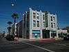 |
(#78000550) |
Bounded by 6th, 7th, Monroe, and Adams Sts. 33°26′59″N 112°03′54″W / 33.449722°N 112.065°W |
||
| 147 | Phoenix Union Colored High School | 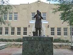 |
(#91000543) |
415 E. Grant St. 33°26′22″N 112°04′00″W / 33.439328°N 112.066581°W |
Phoenix Union Colored High School built in 1926. The school was renamed the George Washington Carver High School | |
| 148 | Phoenix Union High School Historic District |  |
(#82002085) |
512 E. Van Buren 33°27′10″N 112°03′51″W / 33.452778°N 112.064167°W |
Phoenix Union High School built in 1912 | |
| 149 | Harry E. Pierce House | .JPG) |
(#83003493) |
632 N. 3rd Ave. 33°27′22″N 112°04′37″W / 33.456111°N 112.076944°W |
||
| 150 | N. Clyde Pierce House | 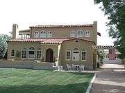 |
(#97001602) |
4505 E. Osborn Rd. 33°29′13″N 111°58′59″W / 33.486944°N 111.983056°W |
||
| 151 | Pieri-Elliot House | .JPG) |
(#83003500) |
767 E. Moreland St. 33°27′40″N 112°03′41″W / 33.461111°N 112.061389°W |
||
| 152 | Pioneer Military and Memorial Park | 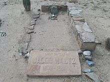 |
(#06001317) |
13th to 15th Aves., Jefferson to Harrison Aves. 33°26′44″N 112°05′25″W / 33.445647°N 112.090253°W |
Grave site of Jacob "Dutchman" Waltz located in the "City/Loosley Cemetery" section. | |
| 153 | Portland Street Historic District |  |
(#83003491) |
W. Portland St. between 3rd and 7th Aves. 33°27′35″N 112°04′46″W / 33.459722°N 112.079444°W |
||
| 154 | Charles H. Pratt House |  |
(#96001274) |
4979 E. Camelback Rd. 33°30′20″N 111°58′20″W / 33.505556°N 111.972222°W |
||
| 155 | Professional Building |  |
(#85003563) |
137 N. Central 33°27′00″N 112°04′22″W / 33.45°N 112.072778°W |
||
| 156 | Pueblo Grande Ruin | 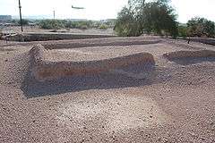 |
(#66000185) |
4619 E. Washington Ave. 33°26′32″N 111°59′00″W / 33.442222°N 111.983333°W |
||
| 157 | Rancho Arroyo |  |
(#03000901) |
6737 N. 20th St. 33°32′10″N 112°02′15″W / 33.536111°N 112.0375°W |
||
| 158 | Rancho Joaquina House |  |
(#84000786) |
4630 E. Cheery Lynn Rd. 33°29′07″N 111°58′08″W / 33.485278°N 111.968889°W |
||
| 159 | Regency House | Upload image | (#16000630) |
2323 N. Central Ave. 33°28′25″N 112°04′25″W / 33.473716°N 112.073711°W |
||
| 160 | Rehbein Grocery | .JPG) |
(#85002895) |
1231 Grand Ave. 33°27′24″N 112°05′19″W / 33.456667°N 112.088611°W |
||
| 161 | Roosevelt Historic District |  |
(#83003490) |
Roughly bounded by Portland and Fillmore Sts., Central and 7th Aves. 33°27′29″N 112°04′40″W / 33.458056°N 112.077778°W |
The historic Harry J. Felch House was built in 1927 and is located in 525 W. Lynwood Street in Phoenix, Az. The Dutch Colonial Home is located in Phoenix’s historic Roosevelt District. | |
| 162 | John M. Ross House | .JPG) |
(#00000145) |
6722 N. Central Ave. 33°31′36″N 112°04′27″W / 33.526667°N 112.074167°W |
||
| 163 | Dr. Roland Lee Rosson House |  |
(#71000112) |
139 N. 6th St. 33°27′00″N 112°03′58″W / 33.45009°N 112.06623°W |
||
| 164 | Sacred Heart Church |  |
(#12000124) |
920 S. 17th St. 33°26′04″N 112°03′22″W / 33.43436°N 112.056203°W |
||
| 165 | Sacred Heart Home for the Aged |  |
(#05001548) |
1110 N. 16th St. 33°27′39″N 112°02′56″W / 33.460972°N 112.048772°W |
||
| 166 | St. Mary's Church | 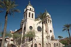 |
(#78000551) |
231 N. 3rd St. 33°27′02″N 112°04′06″W / 33.450556°N 112.068333°W |
||
| 167 | San Carlos Hotel | 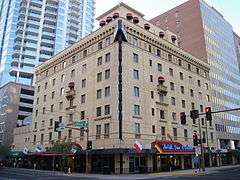 |
(#83003498) |
202 N. Central Ave. 33°27′02″N 112°04′23″W / 33.450556°N 112.073056°W |
||
| 168 | Security Building | 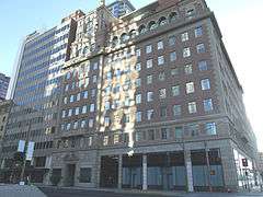 |
(#85002081) |
234 N. Central 33°27′04″N 112°04′24″W / 33.451111°N 112.073333°W |
Security Building built in 1925 | |
| 169 | M. J. Sharp House | .JPG) |
(#94001535) |
1012 S. 1st Ave. 33°26′15″N 112°04′28″W / 33.4375°N 112.074444°W |
||
| 170 | Shell Oil Co. | .JPG) |
(#85002073) |
425 S. 16th Ave. 33°26′34″N 112°05′31″W / 33.442778°N 112.091944°W |
||
| 171 | E. W. Skinner House | .JPG) |
(#94001536) |
917 E. Roosevelt St. 33°27′31″N 112°03′38″W / 33.458611°N 112.060556°W |
||
| 172 | Walter Lee Smith House | .JPG) |
(#10001167) |
7202 N. 7th Ave. 33°32′30″N 112°05′08″W / 33.541667°N 112.085556°W |
||
| 173 | Smurthwaite House | 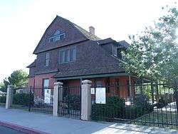 |
(#01000479) |
1317 W. Jefferson St. 33°26′48″N 112°05′21″W / 33.446667°N 112.089167°W |
Built in 1897, the house was formerly located at 602 N. 7th St., Phoenix[10] | |
| 174 | Squaw Peak Inn |  |
(#96000760) |
4425 E. Horseshoe Rd. 33°33′56″N 111°59′02″W / 33.565556°N 111.983889°W |
||
| 175 | Steinegger Lodging House |  |
(#86001369) |
27 E. Monroe 33°27′00″N 112°04′20″W / 33.45°N 112.072222°W |
||
| 176 | C.P. Stephens DeSoto Six Motorcars |  |
(#13000019) |
915 N. Central Ave. 33°27′30″N 112°04′26″W / 33.458424°N 112.073768°W |
||
| 177 | Storage Warehouse |  |
(#85002074) |
429 W. Jackson 33°26′41″N 112°04′44″W / 33.444722°N 112.078889°W |
Built in 1920, refrigeration ice was stored in this building, thus the name Storage Warehouse. It was known as the Constable Ice and Fuel Co. | |
| 178 | F. Q. Story Neighborhood Historic District | .JPG) |
(#88000212) |
McDowell Rd., 7th Ave., Roosevelt St., and 16th Ave.; also roughly bounded by 17th Ave., Culver St., 15th Ave. and Lynwood St., plus lots on Roosevelt St. and McDowell Rd. 33°27′41″N 112°05′15″W / 33.461389°N 112.0875°W |
Second set of addresses represents a boundary increase | |
| 179 | Ralph H. Stoughton Estate | Upload image | (#85001475) |
805 W. South Mountain Ave. 33°22′12″N 112°05′09″W / 33.37°N 112.085833°W |
||
| 180 | Courtney and Hilda Stubbs House | 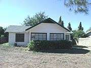 |
(#10001166) |
1245 E. Ocotillo Rd. 33°32′04″N 112°03′16″W / 33.534444°N 112.054444°W |
||
| 181 | Sun Mercantile Building | 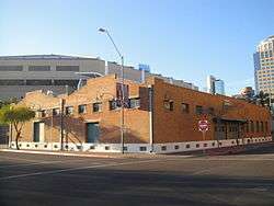 |
(#85002075) |
232 S. 3rd St. 33°26′43″N 112°04′13″W / 33.445278°N 112.070278°W |
||
| 182 | Swindall Tourist Inn | .JPG) |
(#95001081) |
1021 E. Washington St. 33°26′53″N 112°03′31″W / 33.448056°N 112.058611°W |
||
| 183 | Temple Beth Israel | .JPG) |
(#11000043) |
122 E Culver St. 33°27′46″N 112°04′18″W / 33.462778°N 112.071667°W |
||
| 184 | Title and Trust Building | .jpg) |
(#85002076) |
112 N. 1st Ave. 33°26′58″N 112°04′29″W / 33.449444°N 112.074722°W |
"U" shaped towers were built in 1931 | |
| 185 | Tovrea Castle | 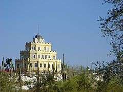 |
(#96000309) |
5041 E. Van Buren 33°26′55″N 111°58′16″W / 33.448611°N 111.971111°W |
||
| 186 | Judge Charles Austin Tweed House | .JPG) |
(#87000775) |
1611 W. Fillmore Ave. 33°27′17″N 112°05′37″W / 33.454722°N 112.093611°W |
||
| 187 | U.S. Post Office | 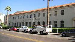 |
(#83002993) |
522 N. Central Ave. 33°27′15″N 112°04′25″W / 33.454167°N 112.073611°W |
||
| 188 | Union Station | 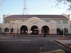 |
(#85003056) |
4th Ave. and Southern Pacific railroad tracks 33°26′39″N 112°04′42″W / 33.444167°N 112.078333°W |
||
| 189 | Valley Plumbing & Sheet Metal |  |
(#85002894) |
530 W. Adams 33°26′58″N 112°04′48″W / 33.449444°N 112.08°W |
||
| 190 | Verde Park Pumphouse |  |
(#95001078) |
Junction of 9th St. and Van Buren Ave. 33°27′09″N 112°03′37″W / 33.4525°N 112.060278°W |
||
| 191 | Victoria Place Historic District | Upload image | (#88000384) |
700 block of E. McKinley St. 33°27′24″N 112°03′46″W / 33.456667°N 112.062778°W |
||
| 192 | Villa del Coronado | Upload image | (#09001113) |
100-190 E. Coronado Rd. 33°28′03″N 112°04′14″W / 33.467536°N 112.070558°W |
||
| 193 | Villa Verde Plat A and Villa Verde Plat B Historic District |  |
(#10000328) |
Roughly bounded by Monte Vista Rd., Granada Rd., 19th Ave., and 20th Ave. 33°28′11″N 112°06′04″W / 33.4697°N 112.101211°W |
||
| 194 | George H. Vradenburg House | .JPG) |
(#10000156) |
1600 W. Colter St. 33°30′49″N 112°05′38″W / 33.5136°N 112.093775°W |
||
| 195 | J. W. Walker Building-Central Arizona Light & Power |  |
(#85002077) |
10 N. 3rd Ave. and 300 W. Washington 33°26′54″N 112°04′38″W / 33.448333°N 112.077222°W |
||
| 196 | Webster Auditorium |  |
(#90000823) |
1201 N. Galvin Parkway 33°27′35″N 111°56′30″W / 33.459722°N 111.941667°W |
||
| 197 | Welnick Arcade Market and Liefgreen Seed Company Building | Upload image | (#16000490) |
341-345 W. Van Buren St. 33°27′05″N 112°04′43″W / 33.451410°N 112.078507°W |
||
| 198 | Western Wholesale Drug Co. Warehouse | .JPG) |
(#85002078) |
101 E. Jackson 33°26′41″N 112°04′16″W / 33.444722°N 112.071111°W |
||
| 199 | J. T. Whitney Funeral Home | .JPG) |
(#85002079) |
330 N. 2nd Ave. 33°27′09″N 112°04′33″W / 33.4525°N 112.075833°W |
||
| 200 | John G. Whittier School | 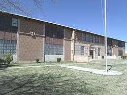 |
(#93000741) |
2004 N. 16th St. 33°28′12″N 112°02′50″W / 33.47°N 112.047222°W |
||
| 201 | Willo Historic District |  |
(#90002099) |
Roughly bounded by Central Ave., McDowell Rd., 7th Ave., and Thomas Rd.; also roughly bounded by Edgemont and Cambridge Rds. and 7th and 3rd Aves. 33°28′23″N 112°04′42″W / 33.473056°N 112.078333°W |
The Conn and Candlin CPA Office is located at 2701 N. 7th Ave. The building is considered historical by the Phoenix Historic Preservation Office. Second set of addresses represents a boundary increase.[9] | |
| 202 | Windsor Square Historic District |  |
(#00001499) |
Roughly bounded by 7th St., Camelback Rd., Central St., and Oregon Ave. 33°30′44″N 112°04′05″W / 33.512222°N 112.068056°W |
||
| 203 | Woodland Historic District | .JPG) |
(#92000839) |
Roughly bounded by Van Buren St., 7th Ave., Adams St., and 15th Ave. 33°27′01″N 112°05′11″W / 33.450278°N 112.086389°W |
||
| 204 | Woodlea Historic District | .JPG) |
(#10000329) |
Roughly bounded by Glenrosa Ave. and Mackenzie Dr. on the north and south, and 9th Ave. on the east and west 33°29′51″N 112°05′05″W / 33.497606°N 112.084706°W |
Residential neighborhood developed between 1928 and 1949 including a range of architectural styles from bungalow to ranch[6] | |
| 205 | William Wrigley, Jr., Winter Cottage |  |
(#89001045) |
2501 E. Telawa Trail 33°31′22″N 112°01′34″W / 33.522778°N 112.026111°W |
||
| 206 | Yaple Park Historic District | .JPG) |
(#10000330) |
Roughly bounded by 3rd and 7th Aves. and Turney and Minnezona Aves. 33°30′06″N 112°04′49″W / 33.501594°N 112.080289°W |
||
| 207 | Yaun Ah Gim Groceries |  |
(#86001553) |
1002 S. 4th Ave. 33°26′16″N 112°04′44″W / 33.437778°N 112.078889°W |
The building is in a state of abandonment. |
Former listings
| [3] | Name on the Register | Image | Date listed | Date removed | Location | City or town | Summary |
|---|---|---|---|---|---|---|---|
| 1 | Arizona Citrus Growers Association Warehouse | Upload image | (#85002043) | 601 E. Jackson 33°26′41″N 112°03′54″W / 33.444722°N 112.065°W |
Demolished | ||
| 2 | Arizona Orange Association Packing House | Upload image | (#85002045) | 520 W. Jackson 41°31′29″N 88°05′41″W / 41.524834°N 88.094587°W |
|||
| 3 | Clinton Campbell House | .JPG) |
(#94001526) | 361 N. 4th Ave. 33°27′12″N 112°04′41″W / 33.453333°N 112.078056°W |
|||
| 4 | Central Wholesale Terminal | Upload image | (#85002050) | 315 E. Madison & 227 S. 3rd St. |
|||
| 5 | C. W. Cisney House |  |
(#94001527) | 2011 W. Madison St. 33°26′41″N 112°06′07″W / 33.444722°N 112.101944°W |
|||
| 6 | Coca Cola Bottling Works | Upload image | (#85002053) | 547 W. Jefferson 41°31′29″N 88°05′41″W / 41.524834°N 88.094587°W |
|||
| 7 | Concrete Block House |  |
(#83003455) | 614 N. 4th Ave. 33°27′20″N 112°04′42″W / 33.455556°N 112.078333°W |
|||
| 8 | Ellingson Building | Upload image | (#85002055) | 19 E. Washington 41°31′29″N 88°05′41″W / 41.524834°N 88.094587°W |
|||
| 9 | High Class Food Company | Upload image | (#85002060) | 1410 E. Washington 41°31′29″N 88°05′41″W / 41.524834°N 88.094587°W |
|||
| 10 | Higuera Grocery | Upload image | (#85002893) | 923 S. 2nd Ave. 33°26′17″N 112°04′30″W / 33.438056°N 112.075°W |
Demolished | ||
| 11 | Hotel St. James |  |
(#85002061) | 21 E. Madison 33°26′45″N 112°04′21″W / 33.445833°N 112.0725°W |
|||
| 12 | Lightning Delivery Co. Warehouse | Upload image | (#85002064) | 425 E. Jackson 33°26′41″N 112°04′01″W / 33.444722°N 112.066944°W |
Demolished | ||
| 13 | Overland Arizona Co. | Upload image | (#85002896) | 12 N. 4th Ave. 33°26′54″N 112°04′43″W / 33.448333°N 112.078611°W |
Demolished | ||
| 14 | Rose Tourist Camp | Upload image | (#85002072) | 1555 W. Van Buren 41°31′29″N 88°05′41″W / 41.524834°N 88.094587°W |
|||
| 15 | Judge W. H. Stillwell House | Upload image | (#94001537) | 2039 W. Monroe St. 33°27′00″N 112°06′09″W / 33.45°N 112.1025°W |
Demolished | ||
| 16 | West End Hotel | Upload image | (#85002897) | 701 W. Washington 33°26′52″N 112°04′59″W / 33.447886°N 112.082937°W |
|||
| 17 | Winters Building-Craig Building | Upload image | (#85002080) | 39 W. Adams 41°31′29″N 88°05′41″W / 41.524834°N 88.094587°W |
See also
| Wikimedia Commons has media related to National Register of Historic Places in Phoenix, Arizona. |
- National Register of Historic Places listings in Maricopa County, Arizona
- List of National Historic Landmarks in Arizona
- National Register of Historic Places listings in Arizona
References
- ↑ The latitude and longitude information provided in this table was derived originally from the National Register Information System, which has been found to be fairly accurate for about 99% of listings. For about 1% of NRIS original coordinates, experience has shown that one or both coordinates are typos or otherwise extremely far off; some corrections may have been made. A more subtle problem causes many locations to be off by up to 150 yards, depending on location in the country: most NRIS coordinates were derived from tracing out latitude and longitudes off of USGS topographical quadrant maps created under the North American Datum of 1927, which differs from the current, highly accurate WGS84 GPS system used by most on-line maps. Chicago is about right, but NRIS longitudes in Washington are higher by about 4.5 seconds, and are lower by about 2.0 seconds in Maine. Latitudes differ by about 1.0 second in Florida. Some locations in this table may have been corrected to current GPS standards.
- ↑ "National Register of Historic Places: Weekly List Actions". National Park Service, United States Department of the Interior. Retrieved on December 16, 2016.
- 1 2 Numbers represent an ordering by significant words. Various colorings, defined here, differentiate National Historic Landmarks and historic districts from other NRHP buildings, structures, sites or objects.
- ↑ National Park Service (2008-04-24). "National Register Information System". National Register of Historic Places. National Park Service.
- ↑ The eight-digit number below each date is the number assigned to each location in the National Register Information System database, which can be viewed by clicking the number.
- 1 2 3 Steckner, Susie (January 21, 2011). "11 Phoenix neighborhoods get coveted historic status". The Arizona Republic. Phoenix, Arizona. Retrieved January 27, 2011.
- ↑ "The History of Encanto Manor Historic District (excerpted from National Register of Historic Places nomination form)". historicphoenix.com. Phoenix, Arizona. June 19, 2009. Retrieved January 27, 2011.
- ↑ "Phoenix Then and Now"; Authors: Paul Scharbach, John H. Akers; ISBN 978-1-59223-302-1
- 1 2 3 "Midcentury Marvels: Commercial Architecture of Phoenix, 1945 - 1975"; by: City of Phoenix Historic Preservation and Ryden Architects; Publisher: City of Phoenix; ISBN 978-0615409894
- ↑
 |  | ||
Municipalities and communities of Maricopa County, Arizona, United States | ||
|---|---|---|
| Cities | 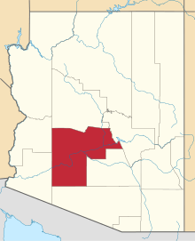 | |
| Towns | ||
| CDPs | ||
| Unincorporated communities |
| |
| Indian reservations | ||
| Ghost towns | ||
| Footnotes | ‡This populated place also has portions in an adjacent county or counties | |