Cave Creek is a town in Maricopa County, Arizona, United States. It is twenty-seven miles northeast of Phoenix. According to the 2010 census, the population of the town was 5,015.
There are 2 Cave Creeks in Arizona. The other one is on the eastern face of the Chiricahua Mountains and is a small mountain town. Nearby Maple Grove is known for autumn color of the Canyon Maple tree.
Geography
Cave Creek is a town located at 33°49′43″N 111°57′17″W / 33.82861°N 111.95472°W / 33.82861; -111.95472 (33.828657, -111.954855).[3] in the Sonoran Desert of Arizona, and the elevation is 2129 feet above sea level.
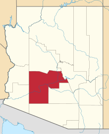
According to the United States Census Bureau, the town has a total area of 28.2 square miles (73 km2), all land. It is adjacent to the town of Carefree, and shares local landmark Black Mountain with Carefree.
There are two notable streams known as Cave Creek in Arizona. One flows through the Town of Cave Creek and into Phoenix. This may be the origin of the Town's name. The other Cave Creek (Cave Creek Canyon) is in the Chiricahua Mountains, 200 miles to the southeast.
In 2000, the state of Arizona, Maricopa County, and the town of Cave Creek bought Spur Cross Ranch, owned by Tyler Covell, a 2,154-acre (8.72 km2) tract of Sonoran desert just north of Phoenix, for $21 million. It had unusual cacti, stone formations, and hundreds of Hopi Indian tribal artifacts, and is now a Maricopa County park.[4]

Cave Creek Recreational Park
Education
The portion of Cave Creek west of longitude 111°59'44.21"W is served by Deer Valley Unified School District and the remainder of the town by Cave Creek Unified School District.
Demographics
| Historical population |
| Census | Pop. | | %± |
| 1980 | 1,712 | | — |
| 1990 | 2,925 | | 70.9% |
| 2000 | 3,728 | | 27.5% |
| 2010 | 5,015 | | 34.5% |
| Est. 2015 | 5,341 | [5] | 6.5% |
U.S. Decennial Census[6]
2014 Estimate[2] |
As of the census of 2000, there were 3,728 people, 1,571 households, and 1,101 families residing in the town. The population density was 132.0 people per square mile (51.0/km²). There were 1,753 housing units at an average density of 62.1 per square mile (24.0/km²). The racial makeup of the town was 94.98% White, 0.30% Black or African American, 0.19% Native American, 0.43% Asian, 0.05% Pacific Islander, 2.60% from other races, and 1.45% from two or more races. Hispanic or Latino of any race were 7.05% of the population.
Out of the 1,571 households some 27.1% had children under the age of 18 living with them, 59.0% were married couples living together, 7.4% had a female householder with no husband present, and 29.9% were non-families. 24.3% of all households were made up of individuals and 6.2% had someone living alone who was 65 years of age or older. The average household size was 2.37 and the average family size was 2.80.
In the town the population was spread out with 20.9% under the age of 18, 5.5% from 18 to 24, 24.2% from 25 to 44, 36.1% from 45 to 64, and 13.3% who were 65 years of age or older. The median age was 45 years. For every 100 females there were 100.1 males. For every 100 females age 18 and over, there were 97.5 males.
The median income for a household in the town was $59,938, and the median income for a family was $76,549. Males had a median income of $50,399 versus $31,607 for females. The per capita income for the town was $38,070. About 6.0% of families and 7.7% of the population were below the poverty line, including 12.9% of those under age 18 and 7.3% of those age 65 or over.
Politics

Trail markers at Spur Cross Park, north of Cave Creek
In June 2009, Cave Creek attracted media attention when a game of chance was used to break a tie in a vote for Town Council. The drawing of playing cards led to the victory of 25-year-old law student Adam Trenk over incumbent Town Council member Thomas McGuire. The Arizona State Constitution allows a game of chance to be used to break ties.[7]
"Where the Wild West Lives" was adopted as the town motto by the Cave Creek Town Council during a November 2013 meeting.[8]
Transportation
Cave Creek residents use Phoenix Sky Harbor International Airport or Mesa Gateway Airport to fly on commercial airlines. Deer Valley Airport, the closest airport to Cave Creek, is a very active general aviation airport.
Notable people
- Brazzabelle, DJ/Producer[9]
- Kiowa Gordon, actor
- Stephenie Meyer, author[10]
- David Henrie, actor
- Brian Dales, singer of The Summer Set
- Sonny Barger, founder of the Oakland chapter of the Hells Angels
- Earl Simmons, rapper, actor, popularly known as DMX
- Taylor Lewan, NFL player for Tennessee Titans, drafted in 2014
- Dick Van Dyke, actor[11]
- Shane Doan, NHL player for the Arizona Coyotes[12]
Historic properties and artifacts
There are various historic properties and artifacts in the town of Cave Creek. Located on the grounds of the Cave Creek Museum are the Tubercular Cabin, which is listed in the National Register of Historic Places, the First Church of Cave Creek and Golden Reef Stamp Mill. Two of the historic properties have been converted into restaurants. They are the Cave Creek Service Station, which is listed in the National Register of Historic Places and the Cave Creek Inn. Frontier Town which has some of Cave Creeks original structures is also pictured.[13][14][15]
Historic properties and artifacts of Cave Creek, Arizona
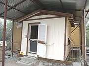
 Cave Creek Town Hall located at 37622 N. Cave Creek Rd.
(National Register of Historic Places) |
|---|
| Cave Creek Museum Entrance Marker |
| The Cave Creek Museum located at 6140 E. Skyline Dr. in Cave Creek Arizona. The museum opened its doors in 1970 by the historical society. The society itself was established in 1968. Among its outside exhibits are Tubercular Cabin , listed in the National Register of Historic Places, the First Church of Cave Creek and the Golden Reef Stamp Mill . |
| The Cave Creek Museum Lizard Bench. |
| The Tubercular Cabin was one of the cabins belonging to the Desmount Sanitarium built in 1920. It was originally located where the Cave Creek Road curve. The cabin was donated to the Cave Creek Museum. The cabin was listed in the National Register of Historic Places in October 28, 2001, reference #01001172. |
| Inside the Tubercular Cabin . |
| The First Church of Cave Creek , also known as the First Episcopal Church of Cave Creek, was built in 1948 and is located on the grounds of the Cave Creek Museum. The church continues to be active for weddings and memorial services. |
| Inside the First Church of Cave Creek . |
| The original bell of the First Church of Cave Creek . |
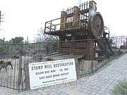
| The Golden Reef Stamp Mill was built in 1880 in California for the Golden Reef Mine in Cave Creek, Arizona. The Mine folded in 1913 and the stamp mill was donated to the Cave Creek Museum. |
| Another view of the Golden Reef Stamp Mill . |
| The Cave Creek Bandshell was originally located in downtown Cave Creek, Arizona. It is now located on the grounds of the Cave Creek Museum. |
| A pre-1913 Golden Reef Mine Tramway Car . It is located on the grounds of the Cave Creek Museum. |
| A Miner’s Arrastre. The arrastre, which in Spanish means “to drag, was built in 1900. It was a crude crushing mill run by burro or oxen. |
| The Cave Creek Service Station was built in 1925 and is located at 6141 Cave Creek Rd. in Cave Creek Rd. The service station was converted into a restaurant. It was listed in the National Register of Historic Places in September 22, 2000, reference #00001126. |
| A Cave Creek Service Station 1967 gas pump. |
| Location where the Cave Creek Inn was built in 1920. The structure is located at 37645 N. Cave Creek Rd. It is Cave Creek’s longest running commercial building and is now occupied by a restaurant. |
| Frontier Town is mostly replicas from Cave Creek’s old west days of cowboys and gold miners. It is located in 6245 E. Cave Creek Rd. |
| The former Leather Mill building is located in Frontier Town. It was built in the late 1880s and is one of the original buildings still standing in Cave Creek. |
| Harold’s Cave Creek Corral was built in 1935 and is located at 6895 E. Cave Creek Road. It originally started as the Corral Bar. |
| The Cave Buttes Dam is an earthen dam located near Cave Creek, Arizona. Built in 1979, by the U.S. Army Corps of Engineers, the dry dam was built to replace the nearby Cave Creek Dam. |
| Road leading to the Cave Buttes Dam. |
|
See also
References
- ↑ "American FactFinder". United States Census Bureau. Retrieved 2012-06-18.
- 1 2 "Population Estimates". United States Census Bureau. Retrieved July 11, 2015.
- ↑ "US Gazetteer files: 2010, 2000, and 1990". United States Census Bureau. 2011-02-12. Retrieved 2011-04-23.
- ↑ Greg Gordon (October 27, 2008). "McCain pushed regulators for land swap, despite pledge". McClatchy Newspapers.
- ↑ "Annual Estimates of the Resident Population for Incorporated Places: April 1, 2010 to July 1, 2015". Retrieved July 2, 2016.
- ↑ "U.S. Decennial Census". Census.gov. Archived from the original on May 11, 2015. Retrieved May 10, 2014.
- ↑ Archibold, Randal C. Election at a Draw, Arizona Town Cuts a Deck, The New York Times, 2009-06-16. Accessed 2009-08-25.
- ↑ Carcamo, Cindy. (2013, November 7). A showdown between Arizona towns over motto. The Los Angeles Times.
- ↑
- ↑ Arizona Republic
- ↑
- ↑ McLellan, Sarah (2016-10-12). "Hockey, horses constants for Arizona Coyotes' Shane Doan". azcentral. The Arizona Republic. Retrieved 2016-10-13.
- ↑ Cave Creek Out Door Exhibits
- ↑ National Register of Historic Places
- ↑ Arizona Republic
External links
|
|---|
|
| Core city | |
|---|
|
Largest suburbs
(over 100,000 inhabitants) | |
|---|
|
Other suburbs and towns
(over 10,000 inhabitants) | |
|---|
|
Smaller suburbs and towns
(over 5,000 inhabitants) | |
|---|
|
| Counties | |
|---|
|
| Native American reservations | |
|---|
|
| Subregions | |
|---|