National Register of Historic Places listings in Cochise County, Arizona
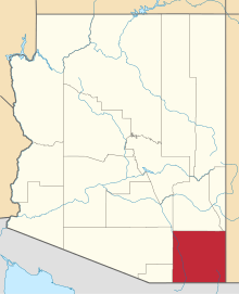
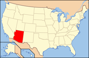
Location of Cochise County in Arizona
This is a list of the National Register of Historic Places listings in Cochise County, Arizona. It is intended to be a complete list of the properties and districts on the National Register of Historic Places in Cochise County, Arizona, United States. The locations of National Register properties and districts for which the latitude and longitude coordinates are included below, may be seen in a map.[1]
There are 85 properties and districts listed on the National Register in the county, including 8 that are also National Historic Landmarks.
- This National Park Service list is complete through NPS recent listings posted December 16, 2016.[2]
Listings county-wide
| [3] | Name on the Register | Image | Date listed[4] | Location | City or town | Description |
|---|---|---|---|---|---|---|
| 1 | Apache Powder Historic Residential District |  |
(#94000078) |
100 and 200 blocks of W. 6th St. 31°58′01″N 110°17′59″W / 31.966944°N 110.299722°W |
Benson | |
| 2 | Barfoot Lookout Complex |  |
(#87002463) |
Buena Vista Peak 31°54′59″N 109°16′23″W / 31.916389°N 109.273056°W |
Portal | Constructed by the CCC in 1935, Barfoot Lookout on the Coronado National Forest in Arizona was active for more than 65 years. It was a 14’x 14’ L-4 ground house with a roof-catch cistern once common in the dry Southwestern forests.
This lookout was destroyed in the Horseshoe II fire in June 2011.[5] Only the foundation remains.[6] |
| 3 | Bear Spring House, Guardhouse, and Spring |  |
(#83002985) |
South of Bowie off Apache Pass Rd. 32°08′22″N 109°25′34″W / 32.139444°N 109.426111°W |
Bowie | |
| 4 | Benson Railroad Historic District |  |
(#94000079) |
200 and 300 blocks of E. 3rd St. 31°58′10″N 110°17′41″W / 31.969444°N 110.294722°W |
Benson | |
| 5 | Benson Historic Barrio | |
(#11000174) |
307-572 E. Fifth St., between San Pedro St. and Route 80 31°57′59″N 110°17′33″W / 31.966389°N 110.2925°W |
Benson | |
| 6 | Bisbee Historic District |  |
(#80004487) |
off U.S. Route 80 31°26′34″N 109°54′50″W / 31.4427°N 109.9138°W |
Bisbee | |
| 7 | Bisbee Residential Historic District |  |
(#10000233) |
Roughly bounded by the City of Bisbee city limits north of Lavender Put Mine, excluding existing Bisbee Historic District 31°26′38″N 109°55′26″W / 31.4439°N 109.9238°W |
Bisbee | |
| 8 | Bisbee Woman's Club Clubhouse |  |
(#85000145) |
74 Quality Hill 31°26′32″N 109°55′12″W / 31.442354°N 109.919876°W |
Bisbee | |
| 9 | Benjamin E. Briscoe House | |
(#87000737) |
358 N. Bowie 32°15′28″N 109°50′21″W / 32.25781°N 109.83917°W |
Willcox | |
| 10 | Bowie School District No. 14 | |
(#15000168) |
315 W. 5th St. 32°19′33″N 109°29′26″W / 32.3258°N 109.4905°W |
Bowie | |
| 11 | Camp Naco Historic District |  |
(#12000853) |
Junction of Willson Rd. & Newell St. 31°20′24″N 109°57′10″W / 31.340077°N 109.952857°W |
Naco | |
| 12 | Chiricahua National Monument Historic Designed Landscape |  |
(#08001020) |
12856 E. Rhyolite Canyon Rd. 32°00′20″N 109°21′24″W / 32.00569°N 109.35672°W |
Encompasses improved portions of the National Monument. | |
| 13 | Cima Park Fire Guard Station | Upload image | (#93000514) |
In the Chiricahua Wilderness northeast of Douglas in Coronado National Forest 31°51′41″N 109°16′55″W / 31.861389°N 109.281944°W |
Douglas | |
| 14 | Cochise Hotel |  |
(#76000370) |
Off U.S. Route 666 32°06′17″N 109°55′20″W / 32.104722°N 109.922222°W |
Cochise | |
| 15 | Coronado National Memorial | 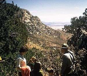 |
(#66000168) |
30 miles (48 km) southwest of Bisbee 31°20′48″N 110°15′12″W / 31.346667°N 110.253333°W |
Bisbee | |
| 16 | Council Rocks Archaeological District |  |
(#86003666) |
Address Restricted |
St. David | |
| 17 | Crowley House | _from_NW_1.JPG) |
(#87000748) |
175 S. Railroad Ave. 32°15′02″N 109°49′51″W / 32.25047°N 109.83083°W |
Willcox | |
| 18 | Double Adobe Site | 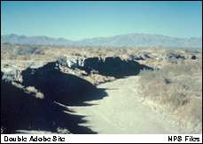 |
(#66000169) |
Address Restricted |
Douglas | |
| 19 | Douglas Historic District |  |
(#85000146) |
Roughly bounded by Pan American, H, and F Aves. along 8th, 10th, 11th, 12th, and 13th Sts. and G Ave. 31°20′43″N 109°33′13″W / 31.345278°N 109.553611°W |
Douglas | |
| 20 | Douglas Municipal Airport | 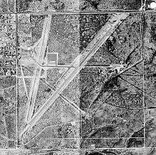 |
(#75000336) |
Eastern end of 10th Ave. 31°20′32″N 109°30′19″W / 31.342222°N 109.505278°W |
Douglas | |
| 21 | Douglas Residential Historic District | 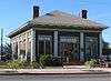 |
(#86002095) |
Roughly bounded by 12th St., Carmelita Ave., 7th St., and East Ave. 31°20′40″N 109°32′49″W / 31.344444°N 109.546944°W |
Douglas | |
| 22 | Douglas Sonoran Historic District | |
(#87001793) |
Roughly bounded by the western side of H Ave. between 6th and 9th Sts. 31°20′47″N 109°32′30″W / 31.346389°N 109.541667°W |
Douglas | |
| 23 | Douglas Underpass | 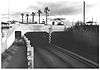 |
(#88001609) |
U.S. Route 80 under Southern Pacific railroad tracks at milepost 366.1 31°21′01″N 109°33′17″W / 31.350278°N 109.554722°W |
Douglas | Built in 1936 as a part of the Works Projects Administration for historic U.S. 80 under the tracks of the Southern Pacific Railroad; demolished in 1999.[7] It became a national historic site on September 30, 1988.[8] |
| 24 | Walter Douglas House | 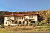 |
(#00001125) |
201 Cole Ave. 31°25′05″N 109°52′37″W / 31.418056°N 109.876944°W |
Bisbee | Also known as Loma Linda. |
| 25 | Dragoon Springs Stage Station Site | 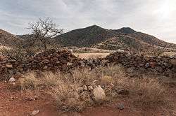 |
(#79000415) |
Address Restricted |
Dragoon | |
| 26 | El Paso and Southwestern Railroad Passenger Depot-Douglas | 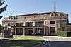 |
(#86000792) |
14th St. and H Ave. 31°20′58″N 109°33′21″W / 31.349444°N 109.555833°W |
Douglas | |
| 27 | El Paso and Southwestern Railroad YMCA | 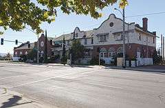 |
(#84000647) |
1000 Pan American Ave. 31°20′40″N 109°33′24″W / 31.344444°N 109.556667°W |
Douglas | |
| 28 | Evergreen Cemetery | 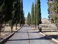 |
(#04001071) |
Old Douglas Rd. 31°25′54″N 109°53′26″W / 31.431667°N 109.890556°W |
Bisbee | |
| 29 | Faraway Ranch Historic District | 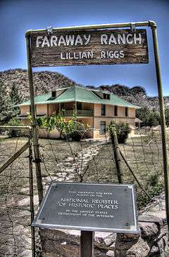 |
(#80000368) |
State Route 181 32°00′38″N 109°22′23″W / 32.010556°N 109.373056°W |
Dos Cabezas | |
| 30 | Fort Bowie National Historic Site | 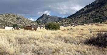 |
(#72000194) |
12 miles (19 km) south of Bowie 32°09′24″N 109°27′11″W / 32.156708°N 109.452928°W |
Bowie | |
| 31 | Fort Huachuca | 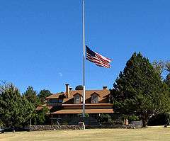 |
(#74000443) |
3.6 miles (5.8 km) west of Sierra Vista 31°32′59″N 110°21′50″W / 31.549722°N 110.363889°W |
Sierra Vista | |
| 32 | Fry Pioneer Cemetery |  |
(#08001312) |
Between 6th and 7th Sts., ½ block north of Fry Boulevard 31°33′22″N 110°17′30″W / 31.556111°N 110.291692°W |
Sierra Vista | |
| 33 | Gadsden Hotel | 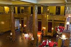 |
(#76000371) |
1046 G. Ave. 31°20′43″N 109°33′15″W / 31.345278°N 109.554167°W |
Douglas | |
| 34 | Garden Canyon Archeological Site | Upload image | (#75000338) |
Address Restricted |
Sierra Vista | |
| 35 | Garden Canyon Petroglyphs | |
(#74000444) |
Address Restricted |
Sierra Vista | |
| 36 | Geronimo Surrender Site |  |
(#98000170) |
Bluff overlooking Skeleton Canyon, 45 miles (72 km) northeast of Douglas 31°35′59″N 109°04′24″W / 31.599722°N 109.073333°W |
Douglas | |
| 37 | Grand Theatre | 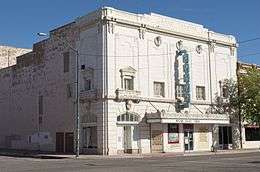 |
(#76000372) |
1139-1149 G. Ave. 31°20′43″N 109°33′35″W / 31.345278°N 109.559722°W |
Douglas | |
| 38 | John Gung'l House | |
(#87000749) |
210 S. Austin Blvd.[9] 32°15′10″N 109°50′13″W / 32.25289°N 109.83683°W |
Willcox | |
| 39 | Hereford Bridge | 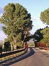 |
(#88001659) |
Hereford Rd. over the San Pedro River 31°26′18″N 110°06′26″W / 31.438333°N 110.107222°W |
Hereford | |
| 40 | Hi Wo Company Grocery | 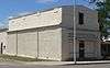 |
(#94000074) |
398 E. 4th St. 31°58′03″N 110°17′35″W / 31.967428°N 110.293186°W |
Benson | |
| 41 | Hooker Town House | |
(#87000736) |
235 E. Stewart 32°15′10″N 109°49′45″W / 32.252821°N 109.829207°W |
Willcox | |
| 42 | Johnson-Tillotson House | _from_SE_1.JPG) |
(#87000743) |
124 N. Curtis 32°15′13″N 109°50′01″W / 32.25364°N 109.83361°W |
Willcox | |
| 43 | Kinjockity Ranch | 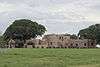 |
(#96000759) |
10047 E. State Route 92 31°23′12″N 110°13′17″W / 31.38667°N 110.22139°W |
Hereford | |
| 44 | Lehner Mammoth-Kill Site |  |
(#67000002) |
Address Restricted 31°25′18″N 110°06′53″W / 31.421685°N 110.114830°W |
Hereford | |
| 45 | W.D. Martinez General Merchadise Store | |
(#94000073) |
180 San Pedro St. 31°58′01″N 110°17′42″W / 31.966986°N 110.294974°W |
Benson | |
| 46 | Joe Mee House | |
(#87000739) |
265 W. Stewart 32°15′18″N 109°50′02″W / 32.25503°N 109.83375°W |
Willcox | |
| 47 | Monte Vista Lookout Cabin | Upload image | (#87002468) |
Monte Vista Peak 31°49′30″N 109°18′53″W / 31.825°N 109.314722°W |
Elfrida | |
| 48 | Morgan House | _from_NE_1.JPG) |
(#87000746) |
242 E. Maley [10] 32°15′04″N 109°49′47″W / 32.251013°N 109.829818°W |
Willcox | |
| 49 | Muheim House | 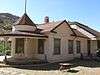 |
(#79000414) |
207 Youngblood Ave. 31°26′47″N 109°54′45″W / 31.446389°N 109.9125°W |
Bisbee | |
| 50 | Murray Springs Clovis Site |  |
(#12001019) |
T.21 S., R.21 E.; Sec. 26 (portion) East of Moson Rd., San Pedro Riparian National Conservation Area 31°34′16″N 110°10′53″W / 31.5712°N 110.1813°W |
Sierra Vista vicinity | |
| 51 | Naco Border Station | 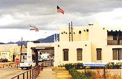 |
(#91000026) |
106 D St. 31°20′05″N 109°56′52″W / 31.334722°N 109.947778°W |
Naco | |
| 52 | Naco-Mammoth Kill Site | 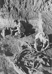 |
(#76002285) |
Address Restricted |
Naco | First Clovis culture mammoth-kill site found |
| 53 | John H. Norton and Company Store | |
(#83002987) |
180 N. Railroad Ave. 32°15′11″N 109°49′51″W / 32.253056°N 109.83083°W |
Willcox | |
| 54 | Oasis Court | |
(#94000072) |
363 W. 4th St. 31°58′09″N 110°18′08″W / 31.969129°N 110.302284°W |
Benson | |
| 55 | Our Lady of Victory Catholic Church | 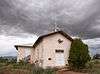 |
(#04000718) |
Fronting 4th St., between Cedar and Spruce Sts. 31°54′15″N 109°49′19″W / 31.904167°N 109.821944°W |
Pearce | |
| 56 | Pearce General Store | 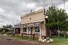 |
(#78000541) |
Ghost Town and Pearce Rd. 31°54′16″N 109°49′16″W / 31.904444°N 109.821111°W |
Pearce | |
| 57 | Phelps Dodge General Office Building | 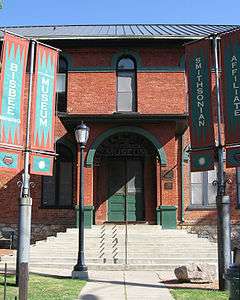 |
(#71000109) |
Copper Queen Plaza, intersection of Main St. and Brewery Gulch 31°26′31″N 109°54′41″W / 31.441944°N 109.911389°W |
Bisbee | |
| 58 | Portal Ranger Station |  |
(#93000517) |
Forest Rd. 42A southwest of Portal, Coronado National Forest 31°53′56″N 109°09′41″W / 31.898889°N 109.161389°W |
Portal | |
| 59 | Quiburi | Upload image | (#71000110) |
Address Restricted |
Fairbank | |
| 60 | Railroad Avenue Historic District | 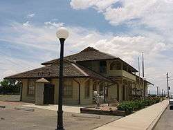 |
(#87000751) |
Roughly bounded by Curtis Ave., Stewart St., Southern Pacific railroad tracks, and Grant St. 32°15′08″N 109°49′52″W / 32.252222°N 109.831111°W |
Willcox | |
| 61 | Redfield-Romine House | 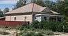 |
(#94000076) |
146 E. 6th St. 31°57′58″N 110°17′50″W / 31.965997°N 110.29735°W |
Benson | |
| 62 | Rucker Canyon Archeological District | Upload image | (#95000157) |
Address Restricted |
Douglas | |
| 63 | Rustler Park Fire Guard Station | Upload image | (#93000518) |
Southeast of Chiricahua National Monument in Coronado National Forest 31°54′10″N 109°16′41″W / 31.902778°N 109.278056°W |
Douglas | |
| 64 | Sacred Heart Church | _interior_2.JPG) |
(#02000032) |
516 Safford St. 31°42′51″N 110°03′51″W / 31.714112°N 110.064153°W |
Tombstone | |
| 65 | St. Patrick's Roman Catholic Church |  |
(#95001080) |
Oak Ave., on Higgins Hill 31°26′40″N 109°55′19″W / 31.444444°N 109.921944°W |
Bisbee | |
| 66 | St. Paul's Episcopal Church |  |
(#71000111) |
Safford and 3rd Sts. 31°42′54″N 110°04′01″W / 31.715°N 110.066944°W |
Tombstone | |
| 67 | San Bernardino Ranch | |
(#66000170) |
17 miles (27 km) east of Douglas on the international boundary 31°20′12″N 109°16′47″W / 31.336667°N 109.279722°W |
Douglas | National Historic Landmark site associated with early cattle ranching in southern Arizona and northern Mexico |
| 68 | Harry Saxon House | |
(#87000750) |
308 S. Haskell 32°15′00″N 109°50′04″W / 32.25011°N 109.83444°W |
Willcox | |
| 69 | Schilling Ranch Historic District | Upload image | (#09000608) |
6396 N. Schilling Ranch Rd. 32°19′55″N 110°07′19″W / 32.331944°N 110.121944°W |
Corral | |
| 70 | Schwertner House | _from_E_1.JPG) |
(#83002986) |
124 E. Stewart St. 32°15′12″N 109°49′53″W / 32.25338°N 109.83139°W |
Willcox | |
| 71 | Sierra Bonita Ranch | 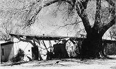 |
(#66000181) |
Southwest of Bonita 32°30′36″N 110°02′15″W / 32.51°N 110.0375°W |
Bonita | Extends into Graham County |
| 72 | Silver Peak Lookout Complex |  |
(#87002469) |
Coronado National Forest 31°54′20″N 109°11′56″W / 31.905556°N 109.198889°W |
Portal | An L-4 type lookout house measuring 14 feet square.[11] Built in 1938 by a CCC crew.[12] Part of National Forest Fire Lookouts in the Southwestern Region TR. Listed on National Register on January 28, 1988.[13] Burned down in an October, 1992, thunder and snow storm. Only a foundation remains.[14] |
| 73 | J.H. Smith Grocery Store and Filling Station | |
(#04000720) |
1835 Old Ranch Rd. 32°01′39″N 110°02′16″W / 32.027461°N 110.037818°W |
Dragoon | |
| 74 | Smith-Beck House | _from_NW_1.JPG) |
(#94000077) |
425 Huachuca St. 31°57′53″N 110°17′48″W / 31.96481°N 110.29663°W |
Benson | |
| 75 | Pablo Soto House | _from_E_1.JPG) |
(#87000744) |
108 E. Stewart 32°15′12″N 109°49′54″W / 32.25344°N 109.83158°W |
Willcox | |
| 76 | Stafford Cabin |  |
(#75000171) |
30 miles (48 km) southeast of Willcox in Chiricahua National Monument 32°00′32″N 109°22′07″W / 32.008889°N 109.368611°W |
Willcox | |
| 77 | Tombstone City Hall | 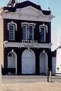 |
(#72000195) |
315 E. Fremont St. 31°42′48″N 110°04′00″W / 31.713333°N 110.066667°W |
Tombstone | |
| 78 | Tombstone Courthouse | 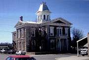 |
(#72000196) |
219 E. Toughnut 31°42′39″N 110°04′10″W / 31.710833°N 110.069444°W |
Tombstone | |
| 79 | Tombstone Historic District | 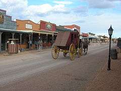 |
(#66000171) |
U.S. Route 80 31°42′49″N 110°04′05″W / 31.713611°N 110.068056°W |
Tombstone | |
| 80 | John Treu House |  |
(#95001077) |
205 W. Vista, Warren Townsite 31°24′46″N 109°52′45″W / 31.412778°N 109.879167°W |
Bisbee | |
| 81 | Max Treu Territorial Meat Company | .JPG) |
(#94000075) |
305 E. 4th St. 31°58′04″N 110°17′39″W / 31.967682°N 110.294271°W |
Benson | |
| 82 | U.S. Inspection Station--Douglas, Arizona |  |
(#14000242) |
Pan American Hwy. & 1st St. 31°20′04″N 109°33′36″W / 31.334525°N 109.560061°W |
Douglas | Part of the U.S. Border Inspection Stations |
| 83 | US Post Office and Customs House-Douglas Main | |
(#85003104) |
601 10th St. 31°20′41″N 109°33′10″W / 31.344722°N 109.552778°W |
Douglas | |
| 84 | Willcox Women's Club | |
(#87000740) |
312 W. Stewart 32°15′17″N 109°50′04″W / 32.25469°N 109.83458°W |
Willcox | |
| 85 | J.C. Wilson House | _from_E_1.JPG) |
(#87000747) |
258 E. Maley 32°15′03″N 109°49′47″W / 32.25092°N 109.82961°W |
Willcox |
See also
| Wikimedia Commons has media related to National Register of Historic Places in Cochise County, Arizona. |
- List of National Historic Landmarks in Arizona
- National Register of Historic Places listings in Arizona
References
- ↑ The latitude and longitude information provided in this table was derived originally from the National Register Information System, which has been found to be fairly accurate for about 99% of listings. For about 1% of NRIS original coordinates, experience has shown that one or both coordinates are typos or otherwise extremely far off; some corrections may have been made. A more subtle problem causes many locations to be off by up to 150 yards, depending on location in the country: most NRIS coordinates were derived from tracing out latitude and longitudes off of USGS topographical quadrant maps created under the North American Datum of 1927, which differs from the current, highly accurate WGS84 GPS system used by most on-line maps. Chicago is about right, but NRIS longitudes in Washington are higher by about 4.5 seconds, and are lower by about 2.0 seconds in Maine. Latitudes differ by about 1.0 second in Florida. Some locations in this table may have been corrected to current GPS standards.
- ↑ "National Register of Historic Places: Weekly List Actions". National Park Service, United States Department of the Interior. Retrieved on December 16, 2016.
- ↑ Numbers represent an ordering by significant words. Various colorings, defined here, differentiate National Historic Landmarks and historic districts from other NRHP buildings, structures, sites or objects.
- ↑ The eight-digit number below each date is the number assigned to each location in the National Register Information System database, which can be viewed by clicking the number.
- ↑ "Barfoot Lookout", nhlr.org 2013. Retrieved on 14 October 2014.
- ↑ Patt, Jonathan. "Barfoot Lookout Trail", Chiricahuatrails.com, 31 December 2013. Cached copy retrieved on 14 October 2014.
- ↑ Hartman, Pamela. "‘Magic tunnel’ or ‘crooked road’? Underpass debate revs up Douglas", Tucson Citizen, Tucson, 23 October 1999. Retrieved on 6 October 2014.
- ↑ "National Register of Historic Places Program: Weekly Register List 1988", National Park Service, Retrieved on 6 October 2014.
- ↑ When listed in NRHP in 1987, address was 210 S. El Paso Ave.; see National Register Focus site. Street's name changed to Austin Boulevard in 1989: see "George Austin", Arizona Range News, 2010-04-28, retrieved 2012-02-26.
- ↑ "Arizona State Historic Property Inventory: Morgan Home". Retrieved 2015-03-05.
- ↑ "Lookouts in the Southwestern Region. Cultural Resources Management Report no. 8. USDA Forest Service Southwester Region. Sept. 1989.", USDA Forest Service, Southwestern Region, Retrieved on 9 July 2015.
- ↑ "National Register of Historic Places Inventory - Nomination Form 12/14/87", National Park Service, Retrieved on 9 July 2015.
- ↑ "National Regsiter of Historic Places, 1966-1994", National Park Service, Retrieved on 9 July 2015.
- ↑ "Silver Peak Trail #280, AZ", hikearizona.com, Retrieved on 9 July 2015.
| Topics | |
|---|---|
| Lists by states |
|
| Lists by insular areas | |
| Lists by associated states | |
| Other areas | |
| |
 |  | ||
Municipalities and communities of Cochise County, Arizona, United States | ||
|---|---|---|
| Cities | | |
| Towns | ||
| CDPs | ||
| Unincorporated communities |
| |
| Ghost towns |
| |
This article is issued from Wikipedia - version of the 9/27/2016. The text is available under the Creative Commons Attribution/Share Alike but additional terms may apply for the media files.