Sun Lakes, Arizona
| Sun Lakes, Arizona | |
|---|---|
| CDP | |
 Location in Maricopa County and the state of Arizona | |
 Sun Lakes, Arizona Location in the United States | |
| Coordinates: 33°12′53″N 111°52′12″W / 33.21472°N 111.87000°WCoordinates: 33°12′53″N 111°52′12″W / 33.21472°N 111.87000°W | |
| Country | United States |
| State | Arizona |
| County | Maricopa |
| Area | |
| • Total | 5.2 sq mi (13.6 km2) |
| • Land | 5.2 sq mi (13.6 km2) |
| • Water | 0 sq mi (0 km2) |
| Elevation | 1,194 ft (364 m) |
| Population (2010) | |
| • Total | 13,975 |
| • Density | 2,278.7/sq mi (879.8/km2) |
| Time zone | MST (no DST) (UTC-7) |
| ZIP code | 85248 |
| Area code(s) | 480 |
| FIPS code | 04-70530 |
| GNIS feature ID | 0025113 |
| Website | http://www.robson.com |
Sun Lakes is a census-designated place (CDP) in Maricopa County, Arizona, United States. The population was 13,975 at the 2010 census. Sun Lakes is an active adult community comprising five active adult country club communities in three homeowner associations. These include the gated communities of Oakwood and IronWood (IronOaks), and the gated and non-gated communities of Palo Verde and Cottonwood (Cottonwood Palo Verde), and the non-gated community of Sun Lakes 1. Sun Lakes is a master-planned community developed by a single builder, Robson Communities. Robson Communities was founded by Ed Robson.
Geography
Sun Lakes is located at 33°12′53″N 111°52′12″W / 33.21472°N 111.87000°W (33.214686, -111.869966).[1]
According to the United States Census Bureau, the CDP has a total area of 5.2 square miles (13.6 km²), all of it land.
Demographics
| Historical population | |||
|---|---|---|---|
| Census | Pop. | %± | |
| 1980 | 1,925 | — | |
| 1990 | 6,578 | 241.7% | |
| 2000 | 11,936 | 81.5% | |
| 2010 | 13,975 | 17.1% | |
| source:[2] | |||
As of the census[3] of 2000, there were 11,936 people, 6,683 households, and 4,798 families residing in the CDP. The population density was 2,278.7 people per square mile (879.5/km²). There were 7,746 housing units at an average density of 1,478.8 per square mile (570.8/km²). The racial makeup of the CDP was 98.37% White, 0.78% Black or African American, 0.13% Native American, 0.32% Asian, 0.01% Pacific Islander, 0.10% from other races, and 0.29% from two or more races. 0.94% of the population were Hispanic or Latino of any race.
There were 6,683 households out of which 0.1% had children under the age of 18 living with them, 69.5% were married couples living together, 1.8% had a female householder with no husband present, and 28.2% were non-families. 25.8% of all households were made up of individuals and 20.6% had someone living alone who was 65 years of age or older. The average household size was 1.79 and the average family size was 2.06.
In the CDP the population was spread out with 0.2% under the age of 18, 0.3% from 18 to 24, 2.1% from 25 to 44, 31.3% from 45 to 64, and 66.2% who were 65 years of age or older. The median age was 69 years. For every 100 females there were 82.6 males. For every 100 females age 18 and over, there were 82.6 males.
The median income for a household in the CDP was $43,634, and the median income for a family was $50,333. Males had a median income of $46,250 versus $35,350 for females. The per capita income for the CDP was $33,394. About 2.0% of families and 2.8% of the population were below the poverty line, including none of those under age 18 and 3.0% of those age 65 or over.
References
- ↑ "US Gazetteer files: 2010, 2000, and 1990". United States Census Bureau. 2011-02-12. Retrieved 2011-04-23.
- ↑ "CENSUS OF POPULATION AND HOUSING (1790-2000)". U.S. Census Bureau. Retrieved 2010-08-07.
- ↑ "American FactFinder". United States Census Bureau. Retrieved 2008-01-31.
External links
- Sun Lakes of Arizona community resources site for residents and visitors.
Municipalities and communities of Maricopa County, Arizona, United States | ||
|---|---|---|
| Cities | 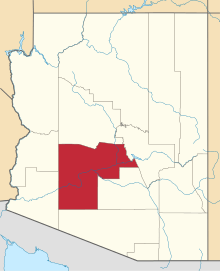 | |
| Towns | ||
| CDPs | ||
| Unincorporated communities |
| |
| Indian reservations | ||
| Ghost towns | ||
| Footnotes | ‡This populated place also has portions in an adjacent county or counties | |