Theba, Arizona
| Theba, Arizona | |
|---|---|
| Census-designated place | |
 Theba, Arizona Location within the state of Arizona | |
| Coordinates: 32°55′10″N 112°53′41″W / 32.91944°N 112.89472°WCoordinates: 32°55′10″N 112°53′41″W / 32.91944°N 112.89472°W | |
| Country | United States |
| State | Arizona |
| County | Maricopa |
| Elevation | 728 ft (222 m) |
| Population (2010) | |
| • Total | 158 |
| Time zone | Mountain (MST) (UTC-7) |
| ZIP codes | 85337 |
| GNIS feature ID | 12385[1] |
Theba is a census-designated place in Maricopa County, Arizona, United States. Its elevation is 728 feet (222 m).[1] Theba is located along Interstate 8 and is served by Exit 106.
The Rowley Mine, a private copper mine known as a source of the mineral Wulfenite, is located near the settlement.[2] The large Paloma Ranch is located near Theba; many residents are employed on the ranch, and the area is frequently marked as Paloma on maps.
History
The area, which is in the Sonoran desert, was a farming area into the 1960s, and once had significant crops of melons, jojoba,[3][4] and guar in the 1970s, which is used in the oil industry.[5] The Southern Pacific Company once had a railroad station there, served by Wells Fargo.[6] The population was estimated at 200 in 1960.[7]
Theba is listed by the U.S. National Register of Historic Places as the nearest community to the Painted Rocks, a site of ancient petroglyphs that was listed on the National Register in 1977.[8]
Demographics
As of the census[9] of 2010, there were 158 people residing in the CDP. The population density was 254.2 people per square mile. The racial makeup of the CDP was 36.71% White, 0.63% Black or African American and 62.66% from other races. 95.57% of the population were Hispanic or Latino of any race.
Education
The Theba/Paloma area is served by the Paloma Elementary School District.
Theba Elementary School made headlines across the state of Arizona in 1977, when school administrators refused to sign a federal pledge agreeing not to discriminate against women. The school was one of the few in the country which refused to sign the agreement, disqualifying them from receiving federal funding. According to school administrators, the school refused to sign because they had never received federal funding anyway.[10][11][12]
References
- 1 2 "Theba, Arizona". Geographic Names Information System. United States Geological Survey.
- ↑ "Rowley Mine". mindat.org. Retrieved 2009-06-11.
- ↑ Roger Dunbier, "The Sonoran Desert: its geography, economy, and people," (University of Arizona Press, 1968), p. 298, found at Google books. Accessed June 10, 2009.
- ↑ Gary A. Ritchie, "New agricultural crops," (Westview Press for the American Association for the Advancement of Science, Washington, D.C., 1979), ISBN 978-0-89158-473-5, found at Google books. Accessed June 10, 2009.
- ↑ McGowan, Dan (17 December 1982). "Arizona farmers making big money with guar". Kingman Daily Miner. Retrieved 2009-06-11.
- ↑ "A B C pathfinder shipping and mailing guide", p. 734 (New England Railway Publishing Co., 1903), found at Google Books. Accessed June 11, 2009.
- ↑ "Arizona". World Book Encyclopedia. 1. Field Enterprises Educational Corporation. 1961. p. 557.
- ↑ National Park Service (2010-07-09). "National Register Information System". National Register of Historic Places. National Park Service.
- ↑ http://factfinder2.census.gov/faces/tableservices/jsf/pages/productview.xhtml?pid=DEC_10_PL_GCTPL2.ST13&prodType=table
- ↑ "School near Gila Bend faces cutoff of funds because forms unfiled". Casa Grande Dispatch. Casa Grande, AZ. 1977-12-09. p. 1.
- ↑ "HEW to stop funds to Theba School". Arizona Daily Sun. Flagstaff, AZ. 1977-12-09. p. 16.
- ↑ "Theba won't pledge to treat women equally". Yuma Daily Sun. Yuma, AZ. 1977-12-09. p. 2.
Municipalities and communities of Maricopa County, Arizona, United States | ||
|---|---|---|
| Cities | 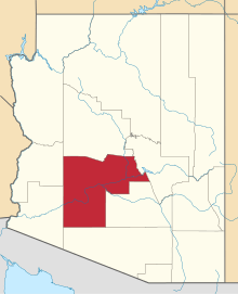 | |
| Towns | ||
| CDPs | ||
| Unincorporated communities |
| |
| Indian reservations | ||
| Ghost towns | ||
| Footnotes | ‡This populated place also has portions in an adjacent county or counties | |